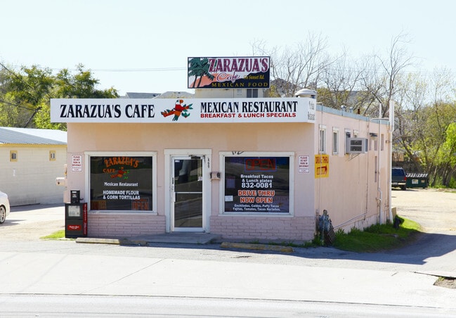
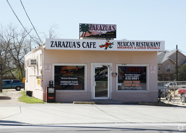
Property Record
414 W Sunset Rd, San Antonio, TX 78209
Property Detail
414 W Sunset Rd
San Antonio-New Braunfels, TX
NCB 11883 BLDG 414 UNIT 101 (414 SUNSET OFFICE CONDOMINIUMS) 2016 - % CHANGE PER CONDO DECL 17266/570 FILED 6-1-15; 2013 - NEW ACCT PER CONDO DECLARATION 15527/1156 EXE 04/04/12 FILED 06/06/12
11883-414-1010
BEXAR
Medicalbuilding
Texas
B and X Area of moderate flood hazard, usually the area between the limits of the 100-year and 500-year floods.
691
2025
0.12 AC
2025
North Central
120702
San Antonio
2,054 SF
NEARBY LISTINGS FOR SALE OR LEASE
DEMOGRAPHICS near 414 W Sunset Rd
1 mile
3 mile
5 mile
2025 Total Population
13,389
99,077
294,325
2030 Population
14,146
104,402
309,756
Pop Growth 2025-2030
+ 5.65%
+ 5.37%
+ 5.24%
Average Age
43
41
39
2025 Total Households
6,365
41,912
123,729
HH Growth 2025-2030
+ 6.06%
+ 5.66%
+ 5.48%
Median Household Inc
$73,096
$70,301
$62,030
Avg Household Size
2.00
2.30
2.30
2025 Avg HH Vehicles
2.00
2.00
2.00
Median Home Value
$352,558
$376,988
$303,350
Median Year Built
1977
1967
1972
Nearby Places
Map Layers
Map Styles
 Street
 Aerial
Layers
 Traffic
 Biking
Places
Listings with unknown addresses are not visible on the map
- Restaurants
- Banks
- Shops
- Fitness
- Groceries
PUBLIC TRANSPORTATION
COMMUTER RAIL
San Antonio Amtrak Station (Sunset Limited - Amtrak, Texas Eagle - Amtrak)
Drive
Walk
Distance
San Antonio Amtrak Station (Sunset Limited - Amtrak, Texas Eagle - Amtrak)
11 min
7.4 mi
AIRPORT
San Antonio International
Drive
Walk
Distance
San Antonio International
4 min
2.1 mi
Freight Ports
Calhoun Port
Drive
Walk
Distance
Calhoun Port
188 min
153.6 mi
Nearby Properties
Address
Land Use
TOTAL SIZE
Lot Size
Zoning
Address
Land Use
TOTAL SIZE
Lot Size
Zoning
557,078 SF
10.73 AC
Address
Land Use
TOTAL SIZE
Lot Size
Zoning
632,091 SF
27.82 AC
Address
Land Use
TOTAL SIZE
Lot Size
Zoning
324,360 SF
15.05 AC
Address
Land Use
TOTAL SIZE
Lot Size
Zoning
246,000 SF
22.54 AC
Address
Land Use
TOTAL SIZE
Lot Size
Zoning
25,513 SF
18.14 AC
Address
Land Use
TOTAL SIZE
Lot Size
Zoning
46,451 SF
7.03 AC
Address
Land Use
TOTAL SIZE
Lot Size
Zoning
Address
Land Use
TOTAL SIZE
Lot Size
Zoning
317,537 SF
25.06 AC
Address
Land Use
TOTAL SIZE
Lot Size
Zoning
56,042 SF
14.60 AC
Address
Land Use
TOTAL SIZE
Lot Size
Zoning
239,264 SF
9.02 AC
Address
Land Use
TOTAL SIZE
Lot Size
Zoning
316,556 SF
6.56 AC
Address
Land Use
TOTAL SIZE
Lot Size
Zoning
262,515 SF
6.38 AC
Address
Land Use
TOTAL SIZE
Lot Size
Zoning
10,342 SF
1.41 AC
Address
Land Use
TOTAL SIZE
Lot Size
Zoning
506,058 SF
25.23 AC
Address
Land Use
TOTAL SIZE
Lot Size
Zoning
250,990 SF
4.89 AC
Address
Land Use
TOTAL SIZE
Lot Size
Zoning
23,738 SF
4.84 AC
Address
Land Use
TOTAL SIZE
Lot Size
Zoning
268,495 SF
13.04 AC
Address
Land Use
TOTAL SIZE
Lot Size
Zoning
314,264 SF
4.27 AC
Address
Land Use
TOTAL SIZE
Lot Size
Zoning
219,400 SF
6.16 AC
Address
Land Use
TOTAL SIZE
Lot Size
Zoning
307,193 SF
7.18 AC
Address
Land Use
TOTAL SIZE
Lot Size
Zoning
8,671 SF
2.71 AC
Address
Land Use
TOTAL SIZE
Lot Size
Zoning
157,762 SF
9.26 AC
Address
Land Use
TOTAL SIZE
Lot Size
Zoning
245,160 SF
15.10 AC
Address
Land Use
TOTAL SIZE
Lot Size
Zoning
392,678 SF
21.04 AC
Address
Land Use
TOTAL SIZE
Lot Size
Zoning
248,547 SF
3.30 AC
Address
Land Use
TOTAL SIZE
Lot Size
Zoning
74,510 SF
6.58 AC
Address
Land Use
TOTAL SIZE
Lot Size
Zoning
Address
Land Use
TOTAL SIZE
Lot Size
Zoning
248,413 SF
3.23 AC
Address
Land Use
TOTAL SIZE
Lot Size
Zoning
279,012 SF
12.17 AC
Address
Land Use
TOTAL SIZE
Lot Size
Zoning
192,175 SF
5.08 AC
The World's #1 Commercial Real Estate Marketplace
Connect with us
© 2026 CoStar Group
The information above has been obtained from sources believed reliable. While we do not doubt its accuracy we have not verified it and make no guarantee, warranty or representation about it. It is your responsibility to independently confirm its accuracy and completeness. Any projections, opinions, assumptions, or estimates used are for example only and do not represent the current or future performance of the property. The value of this transaction to you depends on tax and other factors which should be evaluated by your tax, financial, and legal advisors. You and your advisors should conduct a careful, independent investigation of the property to determine to your satisfaction the suitability of the property for your needs.