Property Record
4140 Whidden Blvd, Punta Gorda, FL 33980


NEARBY LISTINGS FOR SALE OR LEASE
Property Detail
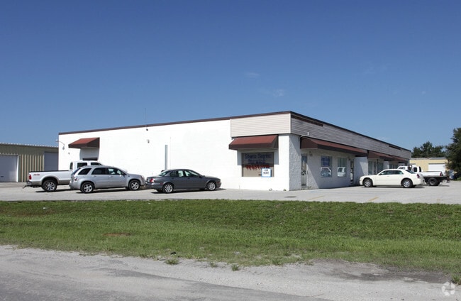
4140 Whidden Blvd
Punta Gorda, FL
Whidden Industrial Pk
402225252001
WHIDDEN INDUSTRIAL PK LT 12 574/1691 634/711 660/49 876/1323 876/1324 PR96-233 1464/654 2993/1100
Warehouse
Charlotte
AE
Florida
12015C0227G
12
2024
0.54 AC
2025
Charlotte County
021003
Southwest Florida
10,500 SF
DEMOGRAPHICS near 4140 Whidden Blvd
1 Mile
3 Mile
5 Mile
2024 Total Population
4,730
37,822
102,946
2029 Population
5,698
45,286
123,003
Pop Growth 2024-2029
+ 20.47%
+ 19.73%
+ 19.48%
Average Age
52
51
52
2024 Total Households
2,298
17,349
47,484
HH Growth 2024-2029
+ 21.02%
+ 20.18%
+ 19.83%
Median Household Inc
$47,879
$48,909
$56,885
Avg Household Size
2.00
2.10
2.10
2024 Avg HH Vehicles
1.00
2.00
2.00
Median Home Value
$177,788
$189,533
$242,974
Median Year Built
1984
1980
1986
Nearby Places
Map Layers
Map Styles
 Street
 Aerial
- Restaurants
- Banks
- Shops
- Fitness
- Groceries
PUBLIC TRANSPORTATION
AIRPORT
Punta Gorda
DRIVE
WALK
Distance
Punta Gorda
15 min
7.4 mi
Freight Ports
Port Manatee
DRIVE
WALK
Distance
Port Manatee
84 min
69.0 mi
Nearby Properties
Address
Land Use
TOTAL SIZE
Lot Size
Zoning
Address
Land Use
TOTAL SIZE
Lot Size
Zoning
333,027 SF
9.79 AC
CHRW
Address
Land Use
TOTAL SIZE
Lot Size
Zoning
156,350 SF
12.49 AC
OMI
Address
Land Use
TOTAL SIZE
Lot Size
Zoning
129,475 SF
16.04 AC
OMI
Address
Land Use
TOTAL SIZE
Lot Size
Zoning
77,154 SF
10.30 AC
CC
Address
Land Use
TOTAL SIZE
Lot Size
Zoning
121,585 SF
696.03 AC
RE1
Address
Land Use
TOTAL SIZE
Lot Size
Zoning
249,777 SF
48 AC
RMF10
Address
Land Use
TOTAL SIZE
Lot Size
Zoning
172,298 SF
37.42 AC
OMI
Address
Land Use
TOTAL SIZE
Lot Size
Zoning
789,392 SF
31.39 AC
RMF15
Address
Land Use
TOTAL SIZE
Lot Size
Zoning
139,109 SF
23.44 AC
CG
Address
Land Use
TOTAL SIZE
Lot Size
Zoning
47,443 SF
7.94 AC
CC
Address
Land Use
TOTAL SIZE
Lot Size
Zoning
238,852 SF
26.63 AC
CG
Address
Land Use
TOTAL SIZE
Lot Size
Zoning
40,430 SF
5.63 AC
RMF12
Address
Land Use
TOTAL SIZE
Lot Size
Zoning
6,313 SF
15.49 AC
P
Address
Land Use
TOTAL SIZE
Lot Size
Zoning
73,095 SF
5 AC
NC
Address
Land Use
TOTAL SIZE
Lot Size
Zoning
44,185 SF
1.22 AC
CC
Address
Land Use
TOTAL SIZE
Lot Size
Zoning
128,594 SF
25.54 AC
PD
Address
Land Use
TOTAL SIZE
Lot Size
Zoning
25,356 SF
1.40 AC
CC
Address
Land Use
TOTAL SIZE
Lot Size
Zoning
70,518 SF
2.08 AC
PD
Address
Land Use
TOTAL SIZE
Lot Size
Zoning
102,337 SF
10.43 AC
RSF3.5
Address
Land Use
TOTAL SIZE
Lot Size
Zoning
50,970 SF
9.74 AC
RSF3.5
Address
Land Use
TOTAL SIZE
Lot Size
Zoning
125.54 AC
PD
Address
Land Use
TOTAL SIZE
Lot Size
Zoning
82,379 SF
0.88 AC
CC
Address
Land Use
TOTAL SIZE
Lot Size
Zoning
12,159 SF
0.56 AC
CC
Address
Land Use
TOTAL SIZE
Lot Size
Zoning
24,880 SF
84.50 AC
PKR
Address
Land Use
TOTAL SIZE
Lot Size
Zoning
1,296 SF
14.46 AC
CG
Address
Land Use
TOTAL SIZE
Lot Size
Zoning
34,975 SF
2.90 AC
RMF15
Address
Land Use
TOTAL SIZE
Lot Size
Zoning
35,587 SF
6.27 AC
RMF15
Address
Land Use
TOTAL SIZE
Lot Size
Zoning
43,755 SF
8.19 AC
CC
Address
Land Use
TOTAL SIZE
Lot Size
Zoning
84,500 SF
5.59 AC
CG
Address
Land Use
TOTAL SIZE
Lot Size
Zoning
30,472 SF
3.19 AC
NR-10
The World's #1 Commercial Real Estate Marketplace
Connect with us
© 2026 CoStar Group
The information above has been obtained from sources believed reliable. While we do not doubt its accuracy we have not verified it and make no guarantee, warranty or representation about it. It is your responsibility to independently confirm its accuracy and completeness. Any projections, opinions, assumptions, or estimates used are for example only and do not represent the current or future performance of the property. The value of this transaction to you depends on tax and other factors which should be evaluated by your tax, financial, and legal advisors. You and your advisors should conduct a careful, independent investigation of the property to determine to your satisfaction the suitability of the property for your needs.