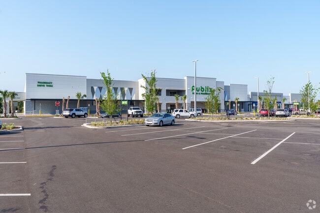
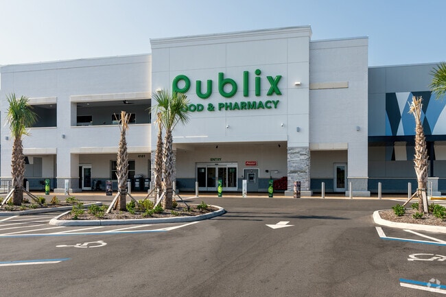
Property Record
4169 W State Road 46, Sanford, FL 32771


Current Lease Availabilities
Property Detail
4169 W State Road 46
Orlando-Kissimmee-Sanford, FL
TRACT B KINGS CROSSING PLAT BOOK 89 PAGES 34-38
03-20-31-504-0B00-0000
SEMINOLE
Storebuilding
Florida
2025
8.39 AC
2025
E Seminole Outlying
020601
Orlando
NEARBY LISTINGS FOR SALE OR LEASE
-
-
View all Sanford listings for lease on LoopNet.com
DEMOGRAPHICS near 4169 W State Road 46
1 mile
3 mile
5 mile
2025 Total Population
2,431
14,935
54,718
2030 Population
2,740
16,415
59,183
Pop Growth 2025-2030
+ 12.71%
+ 9.91%
+ 8.16%
Average Age
37
39
40
2025 Total Households
785
5,058
20,141
HH Growth 2025-2030
+ 12.74%
+ 9.91%
+ 8.07%
Median Household Inc
$85,648
$83,256
$65,883
Avg Household Size
3.10
2.90
2.60
2025 Avg HH Vehicles
2.00
2.00
2.00
Median Home Value
$365,773
$362,527
$315,692
Median Year Built
2010
2003
1988
Nearby Places
Map Layers
Map Styles
 Street
 Aerial
Transit
 Traffic
 Biking
Places
Listings with unknown addresses are not visible on the map
- Restaurants
- Banks
- Shops
- Fitness
- Groceries
PUBLIC TRANSPORTATION
COMMUTER RAIL
Sanford Amtrak Auto Train Station (Auto Train - Amtrak)
Drive
Walk
Distance
Sanford Amtrak Auto Train Station (Auto Train - Amtrak)
12 min
6.4 mi
Sanford (SunRail - Florida Department of Transportation)
Drive
Walk
Distance
Sanford (SunRail - Florida Department of Transportation)
14 min
7.3 mi
AIRPORT
Orlando Sanford International
Drive
Walk
Distance
Orlando Sanford International
10 min
5.2 mi
Daytona Beach International
Drive
Walk
Distance
Daytona Beach International
50 min
31.6 mi
Orlando International
Drive
Walk
Distance
Orlando International
45 min
35.5 mi
Freight Ports
Port Canaveral
Drive
Walk
Distance
Port Canaveral
80 min
56.2 mi
Nearby Properties
Address
Land Use
TOTAL SIZE
Lot Size
Zoning
Address
Land Use
TOTAL SIZE
Lot Size
Zoning
413,982 SF
0.05 AC
RI1
Address
Land Use
TOTAL SIZE
Lot Size
Zoning
615.80 AC
RI1
Address
Land Use
TOTAL SIZE
Lot Size
Zoning
376.01 AC
C2
Address
Land Use
TOTAL SIZE
Lot Size
Zoning
10,900 SF
38.31 AC
RI1
Address
Land Use
TOTAL SIZE
Lot Size
Zoning
115,946 SF
47.65 AC
PD
Address
Land Use
TOTAL SIZE
Lot Size
Zoning
19.06 AC
A1
Address
Land Use
TOTAL SIZE
Lot Size
Zoning
115,431 SF
61 AC
PLI
Address
Land Use
TOTAL SIZE
Lot Size
Zoning
177.86 AC
A1
Address
Land Use
TOTAL SIZE
Lot Size
Zoning
Address
Land Use
TOTAL SIZE
Lot Size
Zoning
4,648 SF
161.90 AC
A1
Address
Land Use
TOTAL SIZE
Lot Size
Zoning
97.58 AC
AG
Address
Land Use
TOTAL SIZE
Lot Size
Zoning
1,664 SF
40.25 AC
A1
Address
Land Use
TOTAL SIZE
Lot Size
Zoning
28,155 SF
8 AC
A1
Address
Land Use
TOTAL SIZE
Lot Size
Zoning
12,864 SF
14.70 AC
RI1
Address
Land Use
TOTAL SIZE
Lot Size
Zoning
45,173 SF
11.22 AC
PD
Address
Land Use
TOTAL SIZE
Lot Size
Zoning
102,431 SF
13.20 AC
MR2
Address
Land Use
TOTAL SIZE
Lot Size
Zoning
8,046 SF
269.35 AC
A1
Address
Land Use
TOTAL SIZE
Lot Size
Zoning
1,152 SF
9.30 AC
A1
Address
Land Use
TOTAL SIZE
Lot Size
Zoning
48,195 SF
39.20 AC
A1
Address
Land Use
TOTAL SIZE
Lot Size
Zoning
61,429 SF
10.21 AC
Address
Land Use
TOTAL SIZE
Lot Size
Zoning
2,432 SF
9.22 AC
PCD
Address
Land Use
TOTAL SIZE
Lot Size
Zoning
7.97 AC
PUD
Address
Land Use
TOTAL SIZE
Lot Size
Zoning
8,406 SF
19.20 AC
A1
Address
Land Use
TOTAL SIZE
Lot Size
Zoning
65,625 SF
2.15 AC
RI1
Address
Land Use
TOTAL SIZE
Lot Size
Zoning
26,000 SF
11.28 AC
Address
Land Use
TOTAL SIZE
Lot Size
Zoning
19,721 SF
9 AC
RI1
Address
Land Use
TOTAL SIZE
Lot Size
Zoning
61.65 AC
RI1
Address
Land Use
TOTAL SIZE
Lot Size
Zoning
Address
Land Use
TOTAL SIZE
Lot Size
Zoning
69,151 SF
6.03 AC
PLI
The World's #1 Commercial Real Estate Marketplace
Connect with us
© 2026 CoStar Group
The information above has been obtained from sources believed reliable. While we do not doubt its accuracy we have not verified it and make no guarantee, warranty or representation about it. It is your responsibility to independently confirm its accuracy and completeness. Any projections, opinions, assumptions, or estimates used are for example only and do not represent the current or future performance of the property. The value of this transaction to you depends on tax and other factors which should be evaluated by your tax, financial, and legal advisors. You and your advisors should conduct a careful, independent investigation of the property to determine to your satisfaction the suitability of the property for your needs.