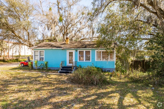
Property Record
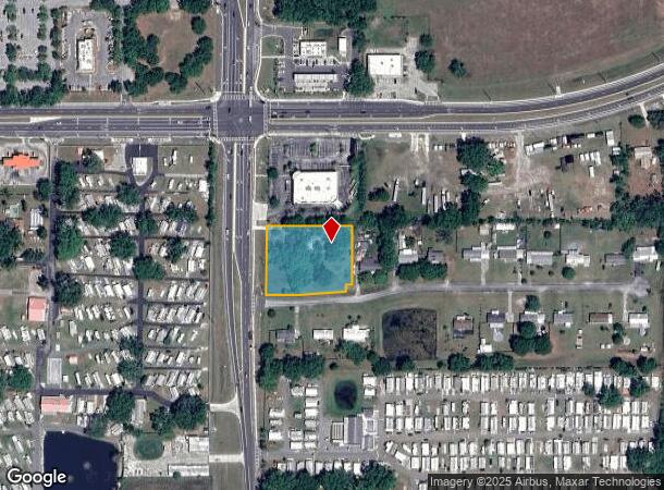
4142 Morris Bridge Rd, Wesley Chapel, FL 33543
NEARBY LISTINGS FOR SALE OR LEASE
Property Detail
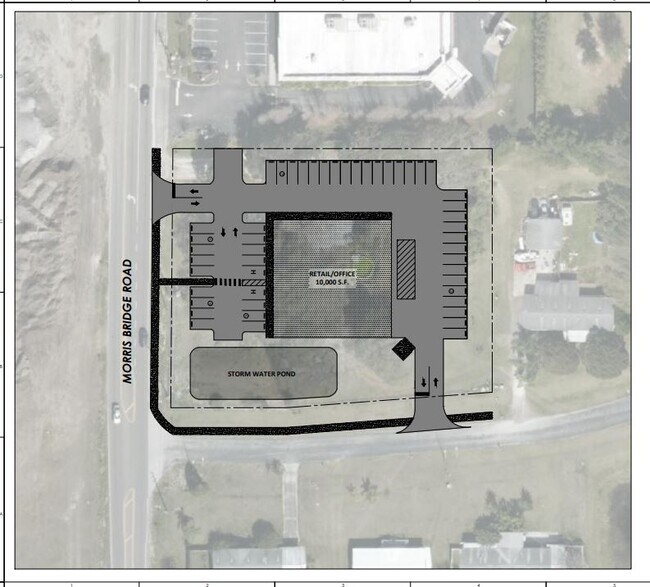
4142 Morris Bridge Rd
Tampa-St. Petersburg-Clearwater, FL
Crossroads Subdivision
18-26-21-0000-02300-0000
Pasco
Sfr
Florida
X
1.33 AC
12101C0453F
Pasco County
936 SF
Tampa/St Petersburg
DEMOGRAPHICS near 4142 Morris Bridge Rd
1 Mile
3 Mile
5 Mile
2024 Total Population
7,310
37,368
103,835
2029 Population
8,989
45,822
126,868
Pop Growth 2024-2029
+ 22.97%
+ 22.62%
+ 22.18%
Average Age
51
45
43
2024 Total Households
3,298
15,177
40,897
HH Growth 2024-2029
+ 22.86%
+ 22.52%
+ 22.16%
Median Household Inc
$45,493
$56,325
$60,534
Avg Household Size
2.10
2.40
2.50
2024 Avg HH Vehicles
1.00
2.00
2.00
Median Home Value
$89,642
$207,945
$227,091
Median Year Built
1992
1996
1998
Nearby Places
- Restaurants
- Banks
- Shops
- Fitness
- Groceries
PUBLIC TRANSPORTATION
AIRPORT
Tampa International
DRIVE
WALK
Distance
Tampa International
50 min
36.6 mi
Freight Ports
Port of Tampa Bay
DRIVE
WALK
Distance
Port of Tampa Bay
46 min
32.3 mi
SALE & LEASE HISTORY
LISTING DATE
SALE/LEASE

Sep 24, 2016
For Sale
Feb 17, 2021
For Sale
Apr 15, 2022
For Sale
Nearby Properties
Address
Land Use
TOTAL SIZE
Lot Size
Zoning
Address
Land Use
TOTAL SIZE
Lot Size
Zoning
277,779 SF
18.93 AC
MPUD
Address
Land Use
TOTAL SIZE
Lot Size
Zoning
253,292 SF
22.26 AC
MPUD
Address
Land Use
TOTAL SIZE
Lot Size
Zoning
309,662 SF
59.03 AC
MF1
Address
Land Use
TOTAL SIZE
Lot Size
Zoning
252,942 SF
13.59 AC
MPUD
Address
Land Use
TOTAL SIZE
Lot Size
Zoning
245,602 SF
12.57 AC
MPUD
Address
Land Use
TOTAL SIZE
Lot Size
Zoning
109,440 SF
3.28 AC
C2
Address
Land Use
TOTAL SIZE
Lot Size
Zoning
92,475 SF
19.45 AC
MPUD
Address
Land Use
TOTAL SIZE
Lot Size
Zoning
19.81 AC
MPUD
Address
Land Use
TOTAL SIZE
Lot Size
Zoning
129,416 SF
3.87 AC
C2
Address
Land Use
TOTAL SIZE
Lot Size
Zoning
33.29 AC
MPUD
Address
Land Use
TOTAL SIZE
Lot Size
Zoning
93,395 SF
6.71 AC
MPUD
Address
Land Use
TOTAL SIZE
Lot Size
Zoning
22.39 AC
MPUD
Address
Land Use
TOTAL SIZE
Lot Size
Zoning
11,189 SF
34.32 AC
C2
Address
Land Use
TOTAL SIZE
Lot Size
Zoning
82,605 SF
37.03 AC
AR
Address
Land Use
TOTAL SIZE
Lot Size
Zoning
69,405 SF
2.15 AC
MPUD
Address
Land Use
TOTAL SIZE
Lot Size
Zoning
101.06 AC
MPUD
Address
Land Use
TOTAL SIZE
Lot Size
Zoning
104,720 SF
13.22 AC
C2
Address
Land Use
TOTAL SIZE
Lot Size
Zoning
32,076 SF
3.58 AC
PUD
Address
Land Use
TOTAL SIZE
Lot Size
Zoning
64,769 SF
11.78 AC
C2
Address
Land Use
TOTAL SIZE
Lot Size
Zoning
209.20 AC
MPUD
Address
Land Use
TOTAL SIZE
Lot Size
Zoning
107,022 SF
13.27 AC
C2
Address
Land Use
TOTAL SIZE
Lot Size
Zoning
39,560 SF
6.31 AC
MPUD
Address
Land Use
TOTAL SIZE
Lot Size
Zoning
76,015 SF
9.18 AC
C2
Address
Land Use
TOTAL SIZE
Lot Size
Zoning
61,636 SF
6.84 AC
C2
Address
Land Use
TOTAL SIZE
Lot Size
Zoning
38,397 SF
7.18 AC
C2
Address
Land Use
TOTAL SIZE
Lot Size
Zoning
58,090 SF
5.30 AC
MF1
Address
Land Use
TOTAL SIZE
Lot Size
Zoning
20,543 SF
4.18 AC
C2
Address
Land Use
TOTAL SIZE
Lot Size
Zoning
63,200 SF
29.69 AC
C2
Address
Land Use
TOTAL SIZE
Lot Size
Zoning
58,184 SF
3.93 AC
C2
Address
Land Use
TOTAL SIZE
Lot Size
Zoning
97.70 AC
MPUD
The World's #1 Commercial Real Estate Marketplace
Connect with us
© 2025 CoStar Group
The information above has been obtained from sources believed reliable. While we do not doubt its accuracy we have not verified it and make no guarantee, warranty or representation about it. It is your responsibility to independently confirm its accuracy and completeness. Any projections, opinions, assumptions, or estimates used are for example only and do not represent the current or future performance of the property. The value of this transaction to you depends on tax and other factors which should be evaluated by your tax, financial, and legal advisors. You and your advisors should conduct a careful, independent investigation of the property to determine to your satisfaction the suitability of the property for your needs.