Property Record
4145 Nw 53Rd Ave, Gainesville, FL 32653


NEARBY LISTINGS FOR SALE OR LEASE
Property Detail
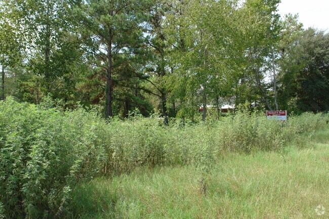
4145 Nw 53Rd Ave
Gainesville, FL
A Minor Sub
06070-010-002
A MINOR S/D BK 1 PG 97 LOT 2 OR 3925/ 1458
Departmentstore
Alachua
X
Florida
12001C0284E
2
2025
0.80 AC
2025
Northwest Gainesville
001201
Other Market Areas
15,688 SF
DEMOGRAPHICS near 4145 Nw 53Rd Ave
1 Mile
3 Mile
5 Mile
2024 Total Population
8,008
46,898
120,038
2029 Population
8,351
49,187
125,666
Pop Growth 2024-2029
+ 4.28%
+ 4.88%
+ 4.69%
Average Age
44
42
36
2024 Total Households
3,549
20,665
49,407
HH Growth 2024-2029
+ 4.37%
+ 4.96%
+ 4.92%
Median Household Inc
$80,746
$78,955
$53,250
Avg Household Size
2.20
2.20
2.20
2024 Avg HH Vehicles
2.00
2.00
2.00
Median Home Value
$253,899
$241,868
$241,162
Median Year Built
1988
1984
1984
Nearby Places
Map Layers
Map Styles
 Street
 Aerial
- Restaurants
- Banks
- Shops
- Fitness
- Groceries
PUBLIC TRANSPORTATION
AIRPORT
Gainesville Regional
DRIVE
WALK
Distance
Gainesville Regional
20 min
8.9 mi
Freight Ports
Jacksonville Port
DRIVE
WALK
Distance
Jacksonville Port
105 min
78.8 mi
Nearby Properties
Address
Land Use
TOTAL SIZE
Lot Size
Zoning
Address
Land Use
TOTAL SIZE
Lot Size
Zoning
141,984 SF
20 AC
HM
Address
Land Use
TOTAL SIZE
Lot Size
Zoning
153,592 SF
24.98 AC
R-2
Address
Land Use
TOTAL SIZE
Lot Size
Zoning
626,679 SF
41.04 AC
A
Address
Land Use
TOTAL SIZE
Lot Size
Zoning
395,561 SF
19.11 AC
PD
Address
Land Use
TOTAL SIZE
Lot Size
Zoning
349,789 SF
28.08 AC
PD
Address
Land Use
TOTAL SIZE
Lot Size
Zoning
794,044 SF
80.54 AC
PD
Address
Land Use
TOTAL SIZE
Lot Size
Zoning
385,880 SF
21.51 AC
PD
Address
Land Use
TOTAL SIZE
Lot Size
Zoning
272,730 SF
20.13 AC
PD
Address
Land Use
TOTAL SIZE
Lot Size
Zoning
210,566 SF
19.13 AC
MU1
Address
Land Use
TOTAL SIZE
Lot Size
Zoning
233,458 SF
16.30 AC
PD
Address
Land Use
TOTAL SIZE
Lot Size
Zoning
127,507 SF
18 AC
ED
Address
Land Use
TOTAL SIZE
Lot Size
Zoning
242,053 SF
26.93 AC
R-2A
Address
Land Use
TOTAL SIZE
Lot Size
Zoning
206,923 SF
15.32 AC
ED
Address
Land Use
TOTAL SIZE
Lot Size
Zoning
188,858 SF
15 AC
ED
Address
Land Use
TOTAL SIZE
Lot Size
Zoning
74,722 SF
9.71 AC
PD
Address
Land Use
TOTAL SIZE
Lot Size
Zoning
80,709 SF
10.81 AC
MU2
Address
Land Use
TOTAL SIZE
Lot Size
Zoning
152,739 SF
15.30 AC
RMF6
Address
Land Use
TOTAL SIZE
Lot Size
Zoning
69,139 SF
2.18 AC
I1
Address
Land Use
TOTAL SIZE
Lot Size
Zoning
216,468 SF
17.27 AC
R-2A
Address
Land Use
TOTAL SIZE
Lot Size
Zoning
267,206 SF
9.65 AC
RMF8
Address
Land Use
TOTAL SIZE
Lot Size
Zoning
138,593 SF
10 AC
PD
Address
Land Use
TOTAL SIZE
Lot Size
Zoning
87,345 SF
20.68 AC
HM
Address
Land Use
TOTAL SIZE
Lot Size
Zoning
129,624 SF
11.27 AC
RMF7
Address
Land Use
TOTAL SIZE
Lot Size
Zoning
58,472 SF
14.89 AC
ED
Address
Land Use
TOTAL SIZE
Lot Size
Zoning
44,982 SF
6.48 AC
MU2
Address
Land Use
TOTAL SIZE
Lot Size
Zoning
103,590 SF
12.68 AC
R-2
Address
Land Use
TOTAL SIZE
Lot Size
Zoning
109,946 SF
24.56 AC
I2
Address
Land Use
TOTAL SIZE
Lot Size
Zoning
93,250 SF
2.20 AC
BA
Address
Land Use
TOTAL SIZE
Lot Size
Zoning
156,001 SF
10.10 AC
PD
Address
Land Use
TOTAL SIZE
Lot Size
Zoning
125,867 SF
13.43 AC
RMF6
The World's #1 Commercial Real Estate Marketplace
Connect with us
© 2025 CoStar Group
The information above has been obtained from sources believed reliable. While we do not doubt its accuracy we have not verified it and make no guarantee, warranty or representation about it. It is your responsibility to independently confirm its accuracy and completeness. Any projections, opinions, assumptions, or estimates used are for example only and do not represent the current or future performance of the property. The value of this transaction to you depends on tax and other factors which should be evaluated by your tax, financial, and legal advisors. You and your advisors should conduct a careful, independent investigation of the property to determine to your satisfaction the suitability of the property for your needs.