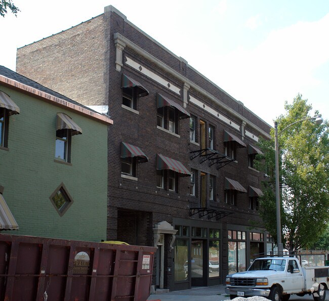
Property Record
415 13Th St, Moline, IL 61265


Property Detail
415 13Th St
Davenport/Moline/Rock Island
LOT 1 HISTORIC BLOCK 28 SUBDIVISION. SHEET 15
Davenport-Moline-Rock Island, IA-IL
ROCK ISLAND
08-32-347-001
Illinois
Commercialnec
1
2024
0.20 AC
2024
Downtown Moline
022300
NEARBY LISTINGS FOR SALE OR LEASE
-
-
View all Moline listings for sale on LoopNet.com
DEMOGRAPHICS near 415 13Th St
1 mile
3 mile
5 mile
2025 Total Population
11,074
77,060
178,763
2030 Population
11,062
77,101
179,588
Pop Growth 2025-2030
(0.11%)
+ 0.05%
+ 0.46%
Average Age
38
40
40
2025 Total Households
4,592
32,892
75,759
HH Growth 2025-2030
(0.09%)
+ 0.09%
+ 0.53%
Median Household Inc
$47,253
$62,154
$64,858
Avg Household Size
2.30
2.20
2.20
2025 Avg HH Vehicles
2.00
2.00
2.00
Median Home Value
$127,234
$158,407
$168,235
Median Year Built
1946
1950
1957
Nearby Places
Map Layers
Map Styles
 Street
 Aerial
Layers
 Traffic
 Biking
Places
Listings with unknown addresses are not visible on the map
- Restaurants
- Banks
- Shops
- Fitness
- Groceries
PUBLIC TRANSPORTATION
AIRPORT
Quad Cities International
Drive
Walk
Distance
Quad Cities International
11 min
5.2 mi
Freight Ports
Port Milwaukee
Drive
Walk
Distance
Port Milwaukee
236 min
205.8 mi
Nearby Properties
Address
Land Use
TOTAL SIZE
Lot Size
Zoning
Address
Land Use
TOTAL SIZE
Lot Size
Zoning
157,798 SF
25.37 AC
Address
Land Use
TOTAL SIZE
Lot Size
Zoning
190,832 SF
3.88 AC
Address
Land Use
TOTAL SIZE
Lot Size
Zoning
76,808 SF
1.94 AC
Address
Land Use
TOTAL SIZE
Lot Size
Zoning
9,658 SF
8.07 AC
Address
Land Use
TOTAL SIZE
Lot Size
Zoning
153,329 SF
2.35 AC
Address
Land Use
TOTAL SIZE
Lot Size
Zoning
65,958 SF
15.04 AC
Address
Land Use
TOTAL SIZE
Lot Size
Zoning
159,973 SF
0.87 AC
Address
Land Use
TOTAL SIZE
Lot Size
Zoning
71,108 SF
8.99 AC
Address
Land Use
TOTAL SIZE
Lot Size
Zoning
61,126 SF
1.57 AC
Address
Land Use
TOTAL SIZE
Lot Size
Zoning
40,307 SF
1.25 AC
Address
Land Use
TOTAL SIZE
Lot Size
Zoning
67,439 SF
2.02 AC
Address
Land Use
TOTAL SIZE
Lot Size
Zoning
133,712 SF
2.31 AC
Address
Land Use
TOTAL SIZE
Lot Size
Zoning
79,949 SF
2.63 AC
Address
Land Use
TOTAL SIZE
Lot Size
Zoning
2,400 SF
228.12 AC
Address
Land Use
TOTAL SIZE
Lot Size
Zoning
59,668 SF
7.80 AC
Address
Land Use
TOTAL SIZE
Lot Size
Zoning
96,335 SF
8.83 AC
Address
Land Use
TOTAL SIZE
Lot Size
Zoning
29,883 SF
5.80 AC
Address
Land Use
TOTAL SIZE
Lot Size
Zoning
7.86 AC
Address
Land Use
TOTAL SIZE
Lot Size
Zoning
21,273 SF
8.98 AC
Address
Land Use
TOTAL SIZE
Lot Size
Zoning
21,273 SF
8.98 AC
Address
Land Use
TOTAL SIZE
Lot Size
Zoning
28,292 SF
3.76 AC
Address
Land Use
TOTAL SIZE
Lot Size
Zoning
56,544 SF
0.22 AC
Address
Land Use
TOTAL SIZE
Lot Size
Zoning
122,806 SF
6.25 AC
Address
Land Use
TOTAL SIZE
Lot Size
Zoning
52,742 SF
6.09 AC
Address
Land Use
TOTAL SIZE
Lot Size
Zoning
113,581 SF
5.87 AC
Address
Land Use
TOTAL SIZE
Lot Size
Zoning
5,816 SF
6.87 AC
Address
Land Use
TOTAL SIZE
Lot Size
Zoning
108,500 SF
2.41 AC
MOL
Address
Land Use
TOTAL SIZE
Lot Size
Zoning
3,916 SF
9.30 AC
Address
Land Use
TOTAL SIZE
Lot Size
Zoning
13,440 SF
15.87 AC
The World's #1 Commercial Real Estate Marketplace
Connect with us
© 2026 CoStar Group
The information above has been obtained from sources believed reliable. While we do not doubt its accuracy we have not verified it and make no guarantee, warranty or representation about it. It is your responsibility to independently confirm its accuracy and completeness. Any projections, opinions, assumptions, or estimates used are for example only and do not represent the current or future performance of the property. The value of this transaction to you depends on tax and other factors which should be evaluated by your tax, financial, and legal advisors. You and your advisors should conduct a careful, independent investigation of the property to determine to your satisfaction the suitability of the property for your needs.