Property Record
415 E Haley St, Santa Barbara, CA 93101


Property Detail
415 E Haley St
Santa Maria-Santa Barbara, CA
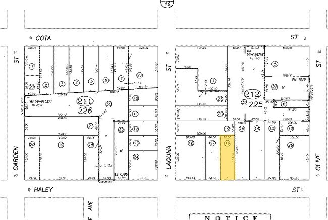
LOT 3 BLK 225
031-212-016
Santa Barbara
Lightindustrial
California
CM
3
AH Areas with a 1% annual chance of shallow flooding, usually in the form of a pond, withan average depth ranging from 1 to 3 feet. These areas have a 26% chance of flooding over the life of a 30-year mortgage.
0.17 AC
2024
N Santa Barbara/Goleta
2025
Santa Barbara/Sta Maria/Goleta
000900
NEARBY LISTINGS FOR SALE OR LEASE
DEMOGRAPHICS near 415 E Haley St
1 mile
3 mile
5 mile
2025 Total Population
19,406
82,669
108,456
2030 Population
19,143
82,236
108,377
Pop Growth 2025-2030
(1.36%)
(0.52%)
(0.07%)
Average Age
39
41
43
2025 Total Households
7,979
32,453
43,147
HH Growth 2025-2030
(1.37%)
(0.57%)
(0.12%)
Median Household Inc
$75,579
$99,684
$105,476
Avg Household Size
2.30
2.40
2.40
2025 Avg HH Vehicles
1.00
2.00
2.00
Median Home Value
$1,102,905
$1,121,057
$1,115,553
Median Year Built
1962
1961
1964
Nearby Places
Map Layers
Map Styles
 Street
 Aerial
Transit
 Traffic
 Biking
Places
Listings with unknown addresses are not visible on the map
- Restaurants
- Banks
- Shops
- Fitness
- Groceries
PUBLIC TRANSPORTATION
COMMUTER RAIL
Santa Barbara (Coast Starlight - Amtrak, Pacific Surfliner - Amtrak)
Drive
Walk
Distance
Santa Barbara (Coast Starlight - Amtrak, Pacific Surfliner - Amtrak)
3 min
14 min
0.7 mi
AIRPORT
Santa Barbara Municipal
Drive
Walk
Distance
Santa Barbara Municipal
29 min
13.1 mi
Freight Ports
The Port of Hueneme
Drive
Walk
Distance
The Port of Hueneme
54 min
39.6 mi
Nearby Properties
Address
Land Use
TOTAL SIZE
Lot Size
Zoning
Address
Land Use
TOTAL SIZE
Lot Size
Zoning
710 SF
9.92 AC
SP8
Address
Land Use
TOTAL SIZE
Lot Size
Zoning
12.32 AC
CV
Address
Land Use
TOTAL SIZE
Lot Size
Zoning
21.85 AC
HRC1SP
Address
Land Use
TOTAL SIZE
Lot Size
Zoning
16.87 AC
E3SD2
Address
Land Use
TOTAL SIZE
Lot Size
Zoning
0.39 AC
C2
Address
Land Use
TOTAL SIZE
Lot Size
Zoning
7.06 AC
R240R
Address
Land Use
TOTAL SIZE
Lot Size
Zoning
Address
Land Use
TOTAL SIZE
Lot Size
Zoning
1.16 AC
Address
Land Use
TOTAL SIZE
Lot Size
Zoning
77.82 AC
A2SD3
Address
Land Use
TOTAL SIZE
Lot Size
Zoning
183,552 SF
50.14 AC
SP5
Address
Land Use
TOTAL SIZE
Lot Size
Zoning
1.12 AC
HRC1SD
Address
Land Use
TOTAL SIZE
Lot Size
Zoning
0.75 AC
HRC2SD
Address
Land Use
TOTAL SIZE
Lot Size
Zoning
0.37 AC
C2
Address
Land Use
TOTAL SIZE
Lot Size
Zoning
1.35 AC
CM
Address
Land Use
TOTAL SIZE
Lot Size
Zoning
6.59 AC
R2SD3
Address
Land Use
TOTAL SIZE
Lot Size
Zoning
0.57 AC
CM
Address
Land Use
TOTAL SIZE
Lot Size
Zoning
4.32 AC
CP
Address
Land Use
TOTAL SIZE
Lot Size
Zoning
0.99 AC
Address
Land Use
TOTAL SIZE
Lot Size
Zoning
1.32 AC
Address
Land Use
TOTAL SIZE
Lot Size
Zoning
7.44 AC
OM1SD3
Address
Land Use
TOTAL SIZE
Lot Size
Zoning
1 AC
HRC1SD
Address
Land Use
TOTAL SIZE
Lot Size
Zoning
1.65 AC
HRC2SD
Address
Land Use
TOTAL SIZE
Lot Size
Zoning
0.48 AC
HRC2SD
Address
Land Use
TOTAL SIZE
Lot Size
Zoning
2.62 AC
C2
Address
Land Use
TOTAL SIZE
Lot Size
Zoning
1.29 AC
HRC1SD
Address
Land Use
TOTAL SIZE
Lot Size
Zoning
11.37 AC
E1
Address
Land Use
TOTAL SIZE
Lot Size
Zoning
27,346 SF
8.72 AC
SP7
Address
Land Use
TOTAL SIZE
Lot Size
Zoning
1,525 SF
2.40 AC
SP8
Address
Land Use
TOTAL SIZE
Lot Size
Zoning
0.30 AC
C2
Address
Land Use
TOTAL SIZE
Lot Size
Zoning
1 AC
C2
The World's #1 Commercial Real Estate Marketplace
Connect with us
© 2026 CoStar Group
The information above has been obtained from sources believed reliable. While we do not doubt its accuracy we have not verified it and make no guarantee, warranty or representation about it. It is your responsibility to independently confirm its accuracy and completeness. Any projections, opinions, assumptions, or estimates used are for example only and do not represent the current or future performance of the property. The value of this transaction to you depends on tax and other factors which should be evaluated by your tax, financial, and legal advisors. You and your advisors should conduct a careful, independent investigation of the property to determine to your satisfaction the suitability of the property for your needs.