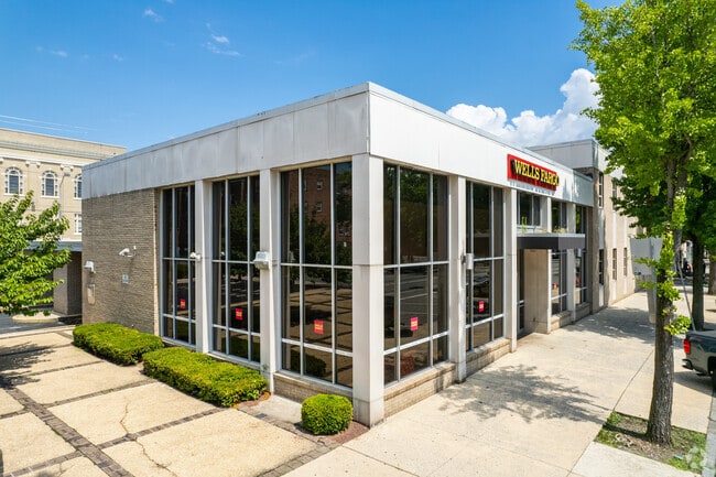
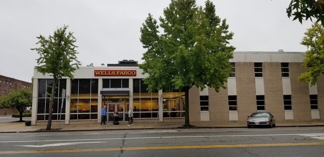
Property Record
415 E High St, Pottstown, PA 19464
Property Detail
415 E High St
16-00-14908-007
PARCEL 1 SEE 16-00-14908-00-7
Financialbuilding
MONTGOMERY
D
Pennsylvania
B and X Area of moderate flood hazard, usually the area between the limits of the 100-year and 500-year floods.
1
0
0.62 AC
2025
West Montgomery County
208903
Philadelphia
7,570 SF
Philadelphia-Camden-Wilmington, PA-NJ-DE-MD
NEARBY LISTINGS FOR SALE OR LEASE
DEMOGRAPHICS near 415 E High St
1 mile
3 mile
5 mile
2025 Total Population
16,064
51,367
85,858
2030 Population
16,315
52,431
87,820
Pop Growth 2025-2030
+ 1.56%
+ 2.07%
+ 2.29%
Average Age
38
40
41
2025 Total Households
6,550
20,417
32,919
HH Growth 2025-2030
+ 1.56%
+ 2.08%
+ 2.31%
Median Household Inc
$50,838
$73,525
$88,830
Avg Household Size
2.30
2.40
2.50
2025 Avg HH Vehicles
2.00
2.00
2.00
Median Home Value
$150,618
$255,141
$330,254
Median Year Built
1947
1960
1970
Nearby Places
Map Layers
Map Styles
 Street
 Aerial
Layers
 Traffic
 Biking
Places
Listings with unknown addresses are not visible on the map
- Restaurants
- Banks
- Shops
- Fitness
- Groceries
SALE & LEASE HISTORY
LISTING DATE
SALE/LEASE

Nov 08, 2021
For Sale
Jul 29, 2023
For Lease
Jul 29, 2023
For Sale
Aug 25, 2017
For Lease
Nearby Properties
Address
Land Use
TOTAL SIZE
Lot Size
Zoning
Address
Land Use
TOTAL SIZE
Lot Size
Zoning
707,965 SF
80.33 AC
RMHD
Address
Land Use
TOTAL SIZE
Lot Size
Zoning
406,166 SF
65.54 AC
C
Address
Land Use
TOTAL SIZE
Lot Size
Zoning
327,827 SF
21 AC
RMD
Address
Land Use
TOTAL SIZE
Lot Size
Zoning
309,443 SF
20.56 AC
GE
Address
Land Use
TOTAL SIZE
Lot Size
Zoning
172,766 SF
43.12 AC
R3
Address
Land Use
TOTAL SIZE
Lot Size
Zoning
181,947 SF
8.19 AC
RMD
Address
Land Use
TOTAL SIZE
Lot Size
Zoning
191,272 SF
48.22 AC
R2
Address
Land Use
TOTAL SIZE
Lot Size
Zoning
240,140 SF
31.50 AC
R3
Address
Land Use
TOTAL SIZE
Lot Size
Zoning
123,946 SF
39.60 AC
R2
Address
Land Use
TOTAL SIZE
Lot Size
Zoning
135,368 SF
5.31 AC
DG
Address
Land Use
TOTAL SIZE
Lot Size
Zoning
150,711 SF
21.72 AC
HB
Address
Land Use
TOTAL SIZE
Lot Size
Zoning
216,693 SF
38 AC
I1
Address
Land Use
TOTAL SIZE
Lot Size
Zoning
176,741 SF
17.40 AC
HB
Address
Land Use
TOTAL SIZE
Lot Size
Zoning
589,859 SF
53.31 AC
C2
Address
Land Use
TOTAL SIZE
Lot Size
Zoning
138,563 SF
12.98 AC
C
Address
Land Use
TOTAL SIZE
Lot Size
Zoning
94,997 SF
6 AC
R3
Address
Land Use
TOTAL SIZE
Lot Size
Zoning
681,836 SF
40.12 AC
HI
Address
Land Use
TOTAL SIZE
Lot Size
Zoning
245,651 SF
20.79 AC
R2
Address
Land Use
TOTAL SIZE
Lot Size
Zoning
165,168 SF
11.10 AC
C2
Address
Land Use
TOTAL SIZE
Lot Size
Zoning
175,151 SF
14.74 AC
RMHD
Address
Land Use
TOTAL SIZE
Lot Size
Zoning
166,912 SF
11.10 AC
R4
Address
Land Use
TOTAL SIZE
Lot Size
Zoning
66,270 SF
1.20 AC
R1
Address
Land Use
TOTAL SIZE
Lot Size
Zoning
104,075 SF
14 AC
SC
Address
Land Use
TOTAL SIZE
Lot Size
Zoning
86,532 SF
13 AC
R3
Address
Land Use
TOTAL SIZE
Lot Size
Zoning
79,010 SF
13.75 AC
C2
Address
Land Use
TOTAL SIZE
Lot Size
Zoning
70,319 SF
7.31 AC
CO
Address
Land Use
TOTAL SIZE
Lot Size
Zoning
77,944 SF
0.47 AC
D
Address
Land Use
TOTAL SIZE
Lot Size
Zoning
61,031 SF
14.54 AC
R3
Address
Land Use
TOTAL SIZE
Lot Size
Zoning
73,443 SF
13.14 AC
R2
Address
Land Use
TOTAL SIZE
Lot Size
Zoning
45,138 SF
9.13 AC
C
The World's #1 Commercial Real Estate Marketplace
Connect with us
© 2026 CoStar Group
The information above has been obtained from sources believed reliable. While we do not doubt its accuracy we have not verified it and make no guarantee, warranty or representation about it. It is your responsibility to independently confirm its accuracy and completeness. Any projections, opinions, assumptions, or estimates used are for example only and do not represent the current or future performance of the property. The value of this transaction to you depends on tax and other factors which should be evaluated by your tax, financial, and legal advisors. You and your advisors should conduct a careful, independent investigation of the property to determine to your satisfaction the suitability of the property for your needs.