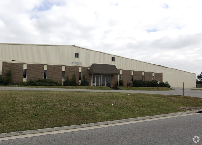
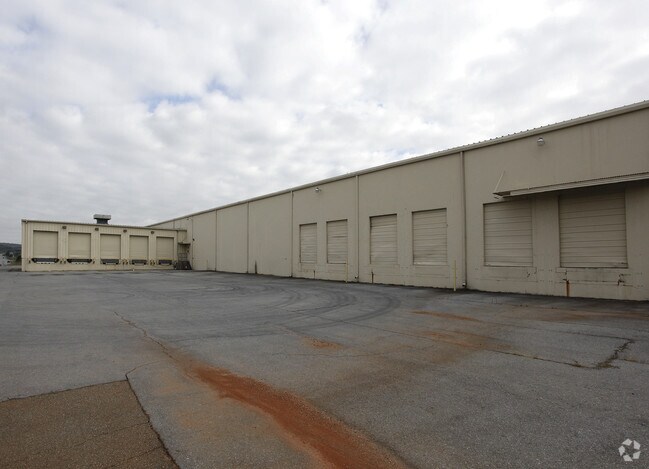
Property Record
415 Grassdale Rd, Cartersville, GA 30121

Property Detail
415 Grassdale Rd
C082-0002-004
LL 18 D 4
Industrialgeneral
BARTOW
IN
Georgia
B and X Area of moderate flood hazard, usually the area between the limits of the 100-year and 500-year floods.
18
2025
15.08 AC
2025
Kennesaw/Acworth
960403
Atlanta
172,760 SF
Atlanta-Sandy Springs-Roswell, GA
NEARBY LISTINGS FOR SALE OR LEASE
DEMOGRAPHICS near 415 Grassdale Rd
1 mile
3 mile
5 mile
2024 Total Population
7,312
34,978
58,667
2029 Population
7,810
37,430
62,688
Pop Growth 2024-2029
+ 6.81%
+ 7.01%
+ 6.85%
Average Age
39
39
40
2024 Total Households
3,133
13,076
22,035
HH Growth 2024-2029
+ 6.99%
+ 7.11%
+ 6.90%
Median Household Inc
$62,887
$73,464
$79,395
Avg Household Size
2.30
2.60
2.60
2024 Avg HH Vehicles
2.00
2.00
2.00
Median Home Value
$260,546
$291,349
$314,867
Median Year Built
1990
1994
1994
Nearby Places
Map Layers
Map Styles
 Street
 Aerial
Transit
 Traffic
 Biking
Places
Listings with unknown addresses are not visible on the map
- Restaurants
- Banks
- Shops
- Fitness
- Groceries
SALE & LEASE HISTORY
LISTING DATE
SALE/LEASE

Sep 24, 2016
For Lease
Sep 23, 2016
For Sale
Nearby Properties
Address
Land Use
TOTAL SIZE
Lot Size
Zoning
Address
Land Use
TOTAL SIZE
Lot Size
Zoning
141,651 SF
181.89 AC
I1
Address
Land Use
TOTAL SIZE
Lot Size
Zoning
67,428 SF
36.96 AC
Address
Land Use
TOTAL SIZE
Lot Size
Zoning
7,488 SF
38.49 AC
IN
Address
Land Use
TOTAL SIZE
Lot Size
Zoning
90,497 SF
24.36 AC
Address
Land Use
TOTAL SIZE
Lot Size
Zoning
Address
Land Use
TOTAL SIZE
Lot Size
Zoning
250,701 SF
15.17 AC
C1
Address
Land Use
TOTAL SIZE
Lot Size
Zoning
Address
Land Use
TOTAL SIZE
Lot Size
Zoning
998,421 SF
85.80 AC
I1
Address
Land Use
TOTAL SIZE
Lot Size
Zoning
244,800 SF
17.44 AC
Address
Land Use
TOTAL SIZE
Lot Size
Zoning
148,808 SF
30.74 AC
A1
Address
Land Use
TOTAL SIZE
Lot Size
Zoning
33,096 SF
15.80 AC
Address
Land Use
TOTAL SIZE
Lot Size
Zoning
683.23 AC
Address
Land Use
TOTAL SIZE
Lot Size
Zoning
Address
Land Use
TOTAL SIZE
Lot Size
Zoning
766,373 SF
267.91 AC
I2
Address
Land Use
TOTAL SIZE
Lot Size
Zoning
51,681 SF
16 AC
Address
Land Use
TOTAL SIZE
Lot Size
Zoning
615.33 AC
Address
Land Use
TOTAL SIZE
Lot Size
Zoning
84,852 SF
6.78 AC
A1
Address
Land Use
TOTAL SIZE
Lot Size
Zoning
91,110 SF
17.09 AC
Address
Land Use
TOTAL SIZE
Lot Size
Zoning
151,571 SF
25.82 AC
Address
Land Use
TOTAL SIZE
Lot Size
Zoning
1,081.62 AC
Address
Land Use
TOTAL SIZE
Lot Size
Zoning
13.86 AC
IN
Address
Land Use
TOTAL SIZE
Lot Size
Zoning
3,696 SF
12 AC
IN
Address
Land Use
TOTAL SIZE
Lot Size
Zoning
211,821 SF
20.32 AC
Address
Land Use
TOTAL SIZE
Lot Size
Zoning
144,416 SF
40.01 AC
A1
Address
Land Use
TOTAL SIZE
Lot Size
Zoning
60,361 SF
13.66 AC
A1
Address
Land Use
TOTAL SIZE
Lot Size
Zoning
20.79 AC
RESIDENTIA
Address
Land Use
TOTAL SIZE
Lot Size
Zoning
8,760 SF
151.31 AC
IN
Address
Land Use
TOTAL SIZE
Lot Size
Zoning
196,426 SF
37.60 AC
IN
Address
Land Use
TOTAL SIZE
Lot Size
Zoning
9,560 SF
12 AC
R3
Address
Land Use
TOTAL SIZE
Lot Size
Zoning
12,769 SF
4.44 AC
C1
The World's #1 Commercial Real Estate Marketplace
Connect with us
© 2026 CoStar Group
The information above has been obtained from sources believed reliable. While we do not doubt its accuracy we have not verified it and make no guarantee, warranty or representation about it. It is your responsibility to independently confirm its accuracy and completeness. Any projections, opinions, assumptions, or estimates used are for example only and do not represent the current or future performance of the property. The value of this transaction to you depends on tax and other factors which should be evaluated by your tax, financial, and legal advisors. You and your advisors should conduct a careful, independent investigation of the property to determine to your satisfaction the suitability of the property for your needs.