No Photo
Property Record
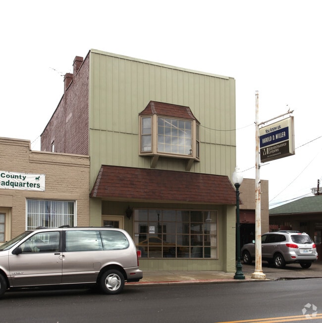
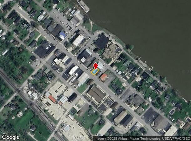
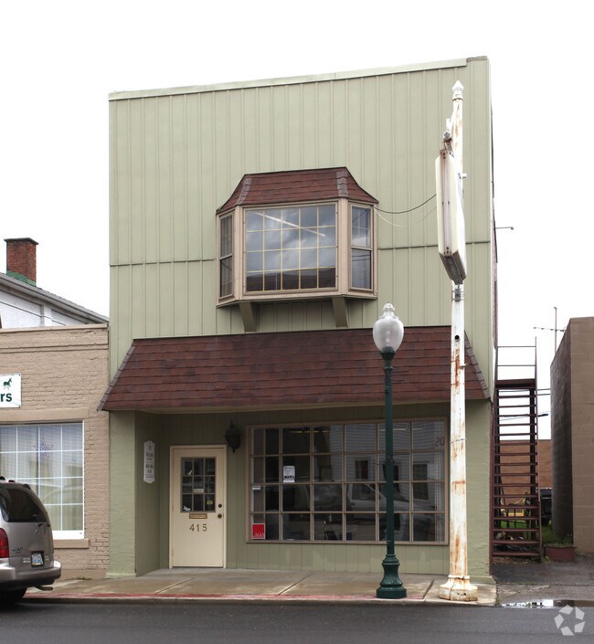
415 Main St, Greenup, KY 41144
NEARBY LISTINGS FOR SALE OR LEASE
-
-
View all Greenup listings for sale on LoopNet.com
Property Detail
415 Main St
148-20-03-098.00
MAIN ST TR
Institutionalgeneral
Greenup
AE
Kentucky
21089C0179D
0.12 AC
2025
Greenup County
2025
Huntington/Ashland
040502
Huntington-Ashland, WV-KY-OH
2,636 SF
DEMOGRAPHICS near 415 Main St
1 Mile
3 Mile
5 Mile
2024 Total Population
1,112
4,078
11,007
2029 Population
1,085
4,004
10,822
Pop Growth 2024-2029
(2.43%)
(1.81%)
(1.68%)
Average Age
43
42
42
2024 Total Households
421
1,550
4,257
HH Growth 2024-2029
(2.38%)
(1.74%)
(1.62%)
Median Household Inc
$49,285
$50,774
$52,059
Avg Household Size
2.40
2.40
2.40
2024 Avg HH Vehicles
2.00
2.00
2.00
Median Home Value
$127,397
$128,274
$131,226
Median Year Built
1968
1977
1980
Nearby Places
Map Layers
Map Styles
 Street
 Aerial
- Restaurants
- Banks
- Shops
- Fitness
- Groceries
PUBLIC TRANSPORTATION
AIRPORT
Tri-State/Milton J Ferguson Field
DRIVE
WALK
Distance
Tri-State/Milton J Ferguson Field
39 min
25.6 mi
Nearby Properties
Address
Land Use
TOTAL SIZE
Lot Size
Zoning
Address
Land Use
TOTAL SIZE
Lot Size
Zoning
Address
Land Use
TOTAL SIZE
Lot Size
Zoning
60.39 AC
Address
Land Use
TOTAL SIZE
Lot Size
Zoning
181,336 SF
10.97 AC
Address
Land Use
TOTAL SIZE
Lot Size
Zoning
0.93 AC
Address
Land Use
TOTAL SIZE
Lot Size
Zoning
Address
Land Use
TOTAL SIZE
Lot Size
Zoning
6.38 AC
Address
Land Use
TOTAL SIZE
Lot Size
Zoning
31.10 AC
Address
Land Use
TOTAL SIZE
Lot Size
Zoning
Address
Land Use
TOTAL SIZE
Lot Size
Zoning
12.26 AC
Address
Land Use
TOTAL SIZE
Lot Size
Zoning
16.15 AC
Address
Land Use
TOTAL SIZE
Lot Size
Zoning
1.29 AC
Address
Land Use
TOTAL SIZE
Lot Size
Zoning
18,560 SF
Address
Land Use
TOTAL SIZE
Lot Size
Zoning
85,406 SF
44.17 AC
Address
Land Use
TOTAL SIZE
Lot Size
Zoning
3.59 AC
Address
Land Use
TOTAL SIZE
Lot Size
Zoning
227.46 AC
Address
Land Use
TOTAL SIZE
Lot Size
Zoning
15 AC
Address
Land Use
TOTAL SIZE
Lot Size
Zoning
4.60 AC
Address
Land Use
TOTAL SIZE
Lot Size
Zoning
1.04 AC
Address
Land Use
TOTAL SIZE
Lot Size
Zoning
1,980 SF
10.23 AC
Address
Land Use
TOTAL SIZE
Lot Size
Zoning
10,640 SF
Address
Land Use
TOTAL SIZE
Lot Size
Zoning
Address
Land Use
TOTAL SIZE
Lot Size
Zoning
Address
Land Use
TOTAL SIZE
Lot Size
Zoning
20,916 SF
4.50 AC
Address
Land Use
TOTAL SIZE
Lot Size
Zoning
105,628 SF
190.73 AC
Address
Land Use
TOTAL SIZE
Lot Size
Zoning
0.29 AC
Address
Land Use
TOTAL SIZE
Lot Size
Zoning
7,200 SF
0.21 AC
Address
Land Use
TOTAL SIZE
Lot Size
Zoning
125,790 SF
11.79 AC
Address
Land Use
TOTAL SIZE
Lot Size
Zoning
Address
Land Use
TOTAL SIZE
Lot Size
Zoning
5,625 SF
0.62 AC
Address
Land Use
TOTAL SIZE
Lot Size
Zoning
3,404 SF
1.34 AC
The World's #1 Commercial Real Estate Marketplace
Connect with us
© 2026 CoStar Group
The information above has been obtained from sources believed reliable. While we do not doubt its accuracy we have not verified it and make no guarantee, warranty or representation about it. It is your responsibility to independently confirm its accuracy and completeness. Any projections, opinions, assumptions, or estimates used are for example only and do not represent the current or future performance of the property. The value of this transaction to you depends on tax and other factors which should be evaluated by your tax, financial, and legal advisors. You and your advisors should conduct a careful, independent investigation of the property to determine to your satisfaction the suitability of the property for your needs.