Property Record
415 W Us Highway 79, Rockdale, TX 76567
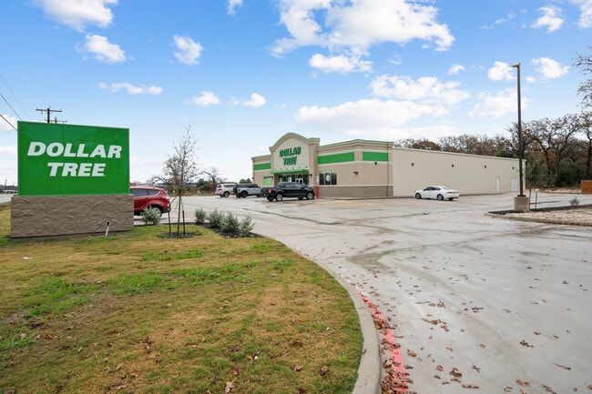

Property Detail
415 W Us Highway 79
R71144
A3250 ST. CLAIR, DUNCAN,2.041 ACRES
Commercialnec
MILAM
2025
Texas
2025
2.04 AC
950300
Central Texas Area
5,000 SF
Other Market Areas
NEARBY LISTINGS FOR SALE OR LEASE
-
-
View all Rockdale listings for sale on LoopNet.com
DEMOGRAPHICS near 415 W Us Highway 79
1 mile
3 mile
5 mile
2025 Total Population
2,611
7,552
8,584
2030 Population
2,706
7,966
9,033
Pop Growth 2025-2030
+ 3.64%
+ 5.48%
+ 5.23%
Average Age
41
41
41
2025 Total Households
1,064
2,954
3,364
HH Growth 2025-2030
+ 3.85%
+ 5.59%
+ 5.35%
Median Household Inc
$54,276
$45,197
$46,923
Avg Household Size
2.50
2.50
2.50
2025 Avg HH Vehicles
2.00
2.00
2.00
Median Home Value
$261,111
$182,726
$190,624
Median Year Built
1976
1976
1977
Nearby Places
Map Layers
Map Styles
 Street
 Aerial
Transit
 Traffic
 Biking
Places
Listings with unknown addresses are not visible on the map
- Restaurants
- Banks
- Shops
- Fitness
- Groceries
SALE & LEASE HISTORY
LISTING DATE
SALE/LEASE

Feb 10, 2025
For Sale
Nearby Properties
Address
Land Use
TOTAL SIZE
Lot Size
Zoning
Address
Land Use
TOTAL SIZE
Lot Size
Zoning
165,657 SF
26 AC
Address
Land Use
TOTAL SIZE
Lot Size
Zoning
45,463 SF
22.50 AC
Address
Land Use
TOTAL SIZE
Lot Size
Zoning
41,956 SF
5.48 AC
Address
Land Use
TOTAL SIZE
Lot Size
Zoning
2,300 SF
25 AC
Address
Land Use
TOTAL SIZE
Lot Size
Zoning
85,620 SF
20.32 AC
Address
Land Use
TOTAL SIZE
Lot Size
Zoning
104,519 SF
23.33 AC
Address
Land Use
TOTAL SIZE
Lot Size
Zoning
130,200 SF
7.91 AC
Address
Land Use
TOTAL SIZE
Lot Size
Zoning
7,440 SF
43 AC
Address
Land Use
TOTAL SIZE
Lot Size
Zoning
64,754 SF
9.68 AC
Address
Land Use
TOTAL SIZE
Lot Size
Zoning
211.45 AC
Address
Land Use
TOTAL SIZE
Lot Size
Zoning
6,004 SF
206.50 AC
Address
Land Use
TOTAL SIZE
Lot Size
Zoning
25,120 SF
3.02 AC
Address
Land Use
TOTAL SIZE
Lot Size
Zoning
30,436 SF
9.99 AC
Address
Land Use
TOTAL SIZE
Lot Size
Zoning
33,792 SF
2.34 AC
Address
Land Use
TOTAL SIZE
Lot Size
Zoning
22,681 SF
0.74 AC
Address
Land Use
TOTAL SIZE
Lot Size
Zoning
9,580 SF
1.21 AC
Address
Land Use
TOTAL SIZE
Lot Size
Zoning
12,920 SF
4.53 AC
Address
Land Use
TOTAL SIZE
Lot Size
Zoning
1,296 SF
168.77 AC
Address
Land Use
TOTAL SIZE
Lot Size
Zoning
59,075 SF
4.85 AC
Address
Land Use
TOTAL SIZE
Lot Size
Zoning
3,416 SF
133.26 AC
Address
Land Use
TOTAL SIZE
Lot Size
Zoning
98,756 SF
4.60 AC
Address
Land Use
TOTAL SIZE
Lot Size
Zoning
408 SF
89.18 AC
Address
Land Use
TOTAL SIZE
Lot Size
Zoning
15,680 SF
0.46 AC
Address
Land Use
TOTAL SIZE
Lot Size
Zoning
4,198 SF
0.41 AC
Address
Land Use
TOTAL SIZE
Lot Size
Zoning
4,030 SF
104.80 AC
Address
Land Use
TOTAL SIZE
Lot Size
Zoning
76,397 SF
2.99 AC
Address
Land Use
TOTAL SIZE
Lot Size
Zoning
158,124 SF
4.93 AC
Address
Land Use
TOTAL SIZE
Lot Size
Zoning
135.95 AC
The World's #1 Commercial Real Estate Marketplace
Connect with us
© 2026 CoStar Group
The information above has been obtained from sources believed reliable. While we do not doubt its accuracy we have not verified it and make no guarantee, warranty or representation about it. It is your responsibility to independently confirm its accuracy and completeness. Any projections, opinions, assumptions, or estimates used are for example only and do not represent the current or future performance of the property. The value of this transaction to you depends on tax and other factors which should be evaluated by your tax, financial, and legal advisors. You and your advisors should conduct a careful, independent investigation of the property to determine to your satisfaction the suitability of the property for your needs.