Property Record
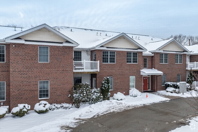
4150 Ewalt Rd, Gibsonia, PA 15044


Property Detail
4150 Ewalt Rd
Pittsburgh, PA
ORCHARD PARK REV PLAN - CONSOLIDATION OF LOTS 158 & 159 LOT 158-R = 76.84 X 87.54 X 89.53 X 211.29 X 124.09 X 246.1
1506-B-00241-0000-00
Allegheny
Apartment
Pennsylvania
B and X Area of moderate flood hazard, usually the area between the limits of the 100-year and 500-year floods.
241
2024
1.04 AC
2025
Outlying Allegheny County
408002
Pittsburgh
1,008 SF
NEARBY LISTINGS FOR SALE OR LEASE
-
-
View all Gibsonia listings for sale on LoopNet.com
DEMOGRAPHICS near 4150 Ewalt Rd
1 mile
3 mile
5 mile
2025 Total Population
4,822
25,189
55,664
2030 Population
4,686
24,693
54,891
Pop Growth 2025-2030
(2.82%)
(1.97%)
(1.39%)
Average Age
42
44
44
2025 Total Households
1,841
9,839
21,567
HH Growth 2025-2030
(2.82%)
(1.98%)
(1.47%)
Median Household Inc
$112,291
$127,275
$122,816
Avg Household Size
2.60
2.50
2.50
2025 Avg HH Vehicles
2.00
2.00
2.00
Median Home Value
$353,108
$366,821
$380,849
Median Year Built
1981
1983
1981
Nearby Places
Map Layers
Map Styles
 Street
 Aerial
Layers
 Traffic
 Biking
Places
Listings with unknown addresses are not visible on the map
- Restaurants
- Banks
- Shops
- Fitness
- Groceries
PUBLIC TRANSPORTATION
AIRPORT
Pittsburgh International
Drive
Walk
Distance
Pittsburgh International
49 min
24.4 mi
Arnold Palmer Regional
Drive
Walk
Distance
Arnold Palmer Regional
67 min
47.4 mi
Nearby Properties
Address
Land Use
TOTAL SIZE
Lot Size
Zoning
Address
Land Use
TOTAL SIZE
Lot Size
Zoning
115.10 AC
Address
Land Use
TOTAL SIZE
Lot Size
Zoning
36.18 AC
Address
Land Use
TOTAL SIZE
Lot Size
Zoning
211.69 AC
Address
Land Use
TOTAL SIZE
Lot Size
Zoning
28.38 AC
Address
Land Use
TOTAL SIZE
Lot Size
Zoning
Address
Land Use
TOTAL SIZE
Lot Size
Zoning
Address
Land Use
TOTAL SIZE
Lot Size
Zoning
5,902 SF
368.70 AC
Address
Land Use
TOTAL SIZE
Lot Size
Zoning
2,616 SF
11.65 AC
Address
Land Use
TOTAL SIZE
Lot Size
Zoning
Address
Land Use
TOTAL SIZE
Lot Size
Zoning
Address
Land Use
TOTAL SIZE
Lot Size
Zoning
Address
Land Use
TOTAL SIZE
Lot Size
Zoning
12.25 AC
Address
Land Use
TOTAL SIZE
Lot Size
Zoning
1,465 SF
11.68 AC
Address
Land Use
TOTAL SIZE
Lot Size
Zoning
13.17 AC
Address
Land Use
TOTAL SIZE
Lot Size
Zoning
1,426 SF
16.11 AC
Address
Land Use
TOTAL SIZE
Lot Size
Zoning
14.48 AC
Address
Land Use
TOTAL SIZE
Lot Size
Zoning
8.23 AC
Address
Land Use
TOTAL SIZE
Lot Size
Zoning
4,434 SF
11.82 AC
Address
Land Use
TOTAL SIZE
Lot Size
Zoning
Address
Land Use
TOTAL SIZE
Lot Size
Zoning
Address
Land Use
TOTAL SIZE
Lot Size
Zoning
6.67 AC
Address
Land Use
TOTAL SIZE
Lot Size
Zoning
14.55 AC
Address
Land Use
TOTAL SIZE
Lot Size
Zoning
41.36 AC
Address
Land Use
TOTAL SIZE
Lot Size
Zoning
21.70 AC
Address
Land Use
TOTAL SIZE
Lot Size
Zoning
Address
Land Use
TOTAL SIZE
Lot Size
Zoning
Address
Land Use
TOTAL SIZE
Lot Size
Zoning
Address
Land Use
TOTAL SIZE
Lot Size
Zoning
8.36 AC
Address
Land Use
TOTAL SIZE
Lot Size
Zoning
Address
Land Use
TOTAL SIZE
Lot Size
Zoning
12.31 AC
The World's #1 Commercial Real Estate Marketplace
Connect with us
© 2026 CoStar Group
The information above has been obtained from sources believed reliable. While we do not doubt its accuracy we have not verified it and make no guarantee, warranty or representation about it. It is your responsibility to independently confirm its accuracy and completeness. Any projections, opinions, assumptions, or estimates used are for example only and do not represent the current or future performance of the property. The value of this transaction to you depends on tax and other factors which should be evaluated by your tax, financial, and legal advisors. You and your advisors should conduct a careful, independent investigation of the property to determine to your satisfaction the suitability of the property for your needs.