Property Record
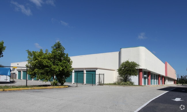
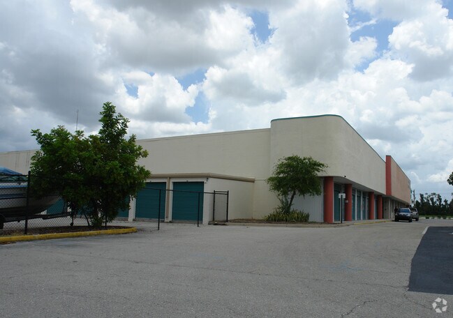
4150 Hancock Bridge Pky, North Fort Myers, FL 33903

NEARBY LISTINGS FOR SALE OR LEASE
-
-
No Photo
-
View all North Fort Myers listings for sale on LoopNet.com
Property Detail
4150 Hancock Bridge Pky
Cape Coral-Fort Myers, FL
N. 41 Corridor
16-44-24-19-00000.0330
HANCOCK SQUARE PB 30 PG 99 LOT 33 LESS INST #2005-6837
Regionalshoppingcenterormallwithanchorstore
Lee
AE
Florida
12071C0268G
33
2024
11.60 AC
2025
Cape Coral
020600
Southwest Florida
124,101 SF
DEMOGRAPHICS near 4150 Hancock Bridge Pky
1 Mile
3 Mile
5 Mile
2024 Total Population
10,052
56,707
166,477
2029 Population
11,705
66,849
196,655
Pop Growth 2024-2029
+ 16.44%
+ 17.88%
+ 18.13%
Average Age
43
44
44
2024 Total Households
3,948
23,286
67,740
HH Growth 2024-2029
+ 15.93%
+ 17.59%
+ 17.69%
Median Household Inc
$67,265
$61,212
$56,831
Avg Household Size
2.50
2.40
2.40
2024 Avg HH Vehicles
2.00
2.00
2.00
Median Home Value
$269,145
$257,211
$240,479
Median Year Built
1985
1989
1988
Nearby Places
- Restaurants
- Banks
- Shops
- Fitness
- Groceries
PUBLIC TRANSPORTATION
AIRPORT
Southwest Florida International
DRIVE
WALK
Distance
Southwest Florida International
32 min
18.3 mi
Punta Gorda
DRIVE
WALK
Distance
Punta Gorda
35 min
23.6 mi
Freight Ports
Port Manatee
DRIVE
WALK
Distance
Port Manatee
115 min
95.3 mi
Nearby Properties
Address
Land Use
TOTAL SIZE
Lot Size
Zoning
Address
Land Use
TOTAL SIZE
Lot Size
Zoning
634,872 SF
43.30 AC
C1-D
Address
Land Use
TOTAL SIZE
Lot Size
Zoning
214,515 SF
30.60 AC
I-1
Address
Land Use
TOTAL SIZE
Lot Size
Zoning
485,271 SF
20.05 AC
CORR
Address
Land Use
TOTAL SIZE
Lot Size
Zoning
646,502 SF
6.11 AC
PUD
Address
Land Use
TOTAL SIZE
Lot Size
Zoning
552,157 SF
4.20 AC
PUD
Address
Land Use
TOTAL SIZE
Lot Size
Zoning
347,871 SF
29.40 AC
RML
Address
Land Use
TOTAL SIZE
Lot Size
Zoning
13.60 AC
CC
Address
Land Use
TOTAL SIZE
Lot Size
Zoning
339,525 SF
38.30 AC
R1BD
Address
Land Use
TOTAL SIZE
Lot Size
Zoning
333,938 SF
35.80 AC
C-1
Address
Land Use
TOTAL SIZE
Lot Size
Zoning
61,844 SF
7.31 AC
CC
Address
Land Use
TOTAL SIZE
Lot Size
Zoning
138,476 SF
4.11 AC
CORR
Address
Land Use
TOTAL SIZE
Lot Size
Zoning
451,348 SF
21.43 AC
CPD
Address
Land Use
TOTAL SIZE
Lot Size
Zoning
101,204 SF
12.34 AC
P1-D
Address
Land Use
TOTAL SIZE
Lot Size
Zoning
139,978 SF
10.75 AC
C-1
Address
Land Use
TOTAL SIZE
Lot Size
Zoning
76,154 SF
2.88 AC
U-CTR
Address
Land Use
TOTAL SIZE
Lot Size
Zoning
142,773 SF
10.82 AC
C-1
Address
Land Use
TOTAL SIZE
Lot Size
Zoning
101,999 SF
7.17 AC
P-1
Address
Land Use
TOTAL SIZE
Lot Size
Zoning
124,182 SF
13.30 AC
CORR
Address
Land Use
TOTAL SIZE
Lot Size
Zoning
151,620 SF
19.97 AC
RM-2
Address
Land Use
TOTAL SIZE
Lot Size
Zoning
76,042 SF
7.50 AC
CORR
Address
Land Use
TOTAL SIZE
Lot Size
Zoning
82,478 SF
15.46 AC
CORR
Address
Land Use
TOTAL SIZE
Lot Size
Zoning
212,616 SF
6.61 AC
CORR/CPO
Address
Land Use
TOTAL SIZE
Lot Size
Zoning
128,355 SF
19.24 AC
C-1
Address
Land Use
TOTAL SIZE
Lot Size
Zoning
112,356 SF
18.99 AC
AG-2
Address
Land Use
TOTAL SIZE
Lot Size
Zoning
109,404 SF
14.22 AC
AG-2
Address
Land Use
TOTAL SIZE
Lot Size
Zoning
74,678 SF
8.97 AC
CPD
Address
Land Use
TOTAL SIZE
Lot Size
Zoning
227,560 SF
27.45 AC
C1-D
Address
Land Use
TOTAL SIZE
Lot Size
Zoning
92,632 SF
32 AC
R1BD
Address
Land Use
TOTAL SIZE
Lot Size
Zoning
10,377 SF
3.34 AC
RML
The World's #1 Commercial Real Estate Marketplace
Connect with us
© 2025 CoStar Group
The information above has been obtained from sources believed reliable. While we do not doubt its accuracy we have not verified it and make no guarantee, warranty or representation about it. It is your responsibility to independently confirm its accuracy and completeness. Any projections, opinions, assumptions, or estimates used are for example only and do not represent the current or future performance of the property. The value of this transaction to you depends on tax and other factors which should be evaluated by your tax, financial, and legal advisors. You and your advisors should conduct a careful, independent investigation of the property to determine to your satisfaction the suitability of the property for your needs.