Property Record
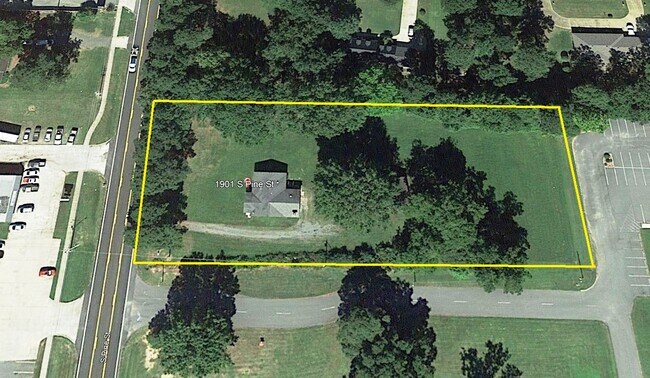
4150 Highway 89 S, Cabot, AR 72023

NEARBY LISTINGS FOR SALE OR LEASE
Property Detail
4150 Highway 89 S
Little Rock-North Little Rock-Conway, AR
Cabot City Area
723-70411-363
PT NW NW SE (229.78X 173)
Taxexempt
Lonoke
X
Arkansas
05085C0084F
1
2023
0.80 AC
2025
Lonoke County
020206
Little Rock/N Little Rock
DEMOGRAPHICS near 4150 Highway 89 S
1 mile
3 mile
5 mile
2024 Total Population
5,367
23,975
39,948
2029 Population
5,784
26,140
43,442
Pop Growth 2024-2029
+ 7.77%
+ 9.03%
+ 8.75%
Average Age
38
38
39
2024 Total Households
2,007
9,097
15,017
HH Growth 2024-2029
+ 8.02%
+ 9.27%
+ 8.96%
Median Household Inc
$59,535
$59,976
$68,515
Avg Household Size
2.60
2.60
2.60
2024 Avg HH Vehicles
2.00
2.00
2.00
Median Home Value
$174,510
$170,015
$174,448
Median Year Built
2001
1998
1997
Nearby Places
Map Layers
Map Styles
 Street
 Aerial
Transit
 Traffic
 Biking
Places
Listings with unknown addresses are not visible on the map
- Restaurants
- Banks
- Shops
- Fitness
- Groceries
PUBLIC TRANSPORTATION
AIRPORT
Bill and Hillary Clinton Ntl/Adams Field
Drive
Walk
Distance
Bill and Hillary Clinton Ntl/Adams Field
35 min
27.0 mi
Freight Ports
Port of Shreveport
Drive
Walk
Distance
Port of Shreveport
281 min
258.0 mi
Nearby Properties
Address
Land Use
TOTAL SIZE
Lot Size
Zoning
Address
Land Use
TOTAL SIZE
Lot Size
Zoning
44,884 SF
9.65 AC
Address
Land Use
TOTAL SIZE
Lot Size
Zoning
139,126 SF
10 AC
Address
Land Use
TOTAL SIZE
Lot Size
Zoning
42,336 SF
6.80 AC
Address
Land Use
TOTAL SIZE
Lot Size
Zoning
67,672 SF
5.23 AC
Address
Land Use
TOTAL SIZE
Lot Size
Zoning
15,600 SF
3 AC
Address
Land Use
TOTAL SIZE
Lot Size
Zoning
4,551 SF
3 AC
Address
Land Use
TOTAL SIZE
Lot Size
Zoning
41,952 SF
1.50 AC
Address
Land Use
TOTAL SIZE
Lot Size
Zoning
4,031 SF
1.70 AC
Address
Land Use
TOTAL SIZE
Lot Size
Zoning
2,960 SF
1.23 AC
Address
Land Use
TOTAL SIZE
Lot Size
Zoning
3,096 SF
1.62 AC
Address
Land Use
TOTAL SIZE
Lot Size
Zoning
2,797 SF
0.75 AC
Address
Land Use
TOTAL SIZE
Lot Size
Zoning
2,541 SF
3.16 AC
Address
Land Use
TOTAL SIZE
Lot Size
Zoning
32,080 SF
14.22 AC
Address
Land Use
TOTAL SIZE
Lot Size
Zoning
3,349 SF
0.31 AC
Address
Land Use
TOTAL SIZE
Lot Size
Zoning
4,792 SF
1.74 AC
Address
Land Use
TOTAL SIZE
Lot Size
Zoning
3,068 SF
3.88 AC
Address
Land Use
TOTAL SIZE
Lot Size
Zoning
15,678 SF
1.50 AC
Address
Land Use
TOTAL SIZE
Lot Size
Zoning
2,868 SF
0.92 AC
Address
Land Use
TOTAL SIZE
Lot Size
Zoning
2,628 SF
2.17 AC
Address
Land Use
TOTAL SIZE
Lot Size
Zoning
2,869 SF
0.43 AC
Address
Land Use
TOTAL SIZE
Lot Size
Zoning
5,685 SF
16 AC
Address
Land Use
TOTAL SIZE
Lot Size
Zoning
2,821 SF
0.27 AC
Address
Land Use
TOTAL SIZE
Lot Size
Zoning
4,115 SF
0.60 AC
Address
Land Use
TOTAL SIZE
Lot Size
Zoning
3,785 SF
11 AC
Address
Land Use
TOTAL SIZE
Lot Size
Zoning
5,040 SF
0.47 AC
Address
Land Use
TOTAL SIZE
Lot Size
Zoning
5,187 SF
1.50 AC
Address
Land Use
TOTAL SIZE
Lot Size
Zoning
8,916 SF
60 AC
Address
Land Use
TOTAL SIZE
Lot Size
Zoning
30,486 SF
2.19 AC
Address
Land Use
TOTAL SIZE
Lot Size
Zoning
3,057 SF
2.10 AC
Address
Land Use
TOTAL SIZE
Lot Size
Zoning
2,851 SF
0.81 AC
The World's #1 Commercial Real Estate Marketplace
Connect with us
© 2026 CoStar Group
The information above has been obtained from sources believed reliable. While we do not doubt its accuracy we have not verified it and make no guarantee, warranty or representation about it. It is your responsibility to independently confirm its accuracy and completeness. Any projections, opinions, assumptions, or estimates used are for example only and do not represent the current or future performance of the property. The value of this transaction to you depends on tax and other factors which should be evaluated by your tax, financial, and legal advisors. You and your advisors should conduct a careful, independent investigation of the property to determine to your satisfaction the suitability of the property for your needs.