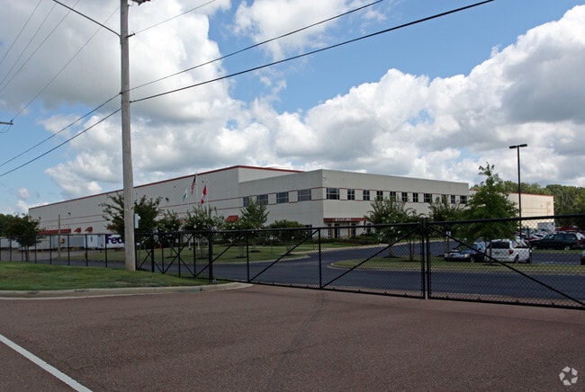
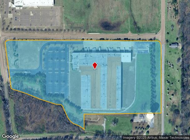
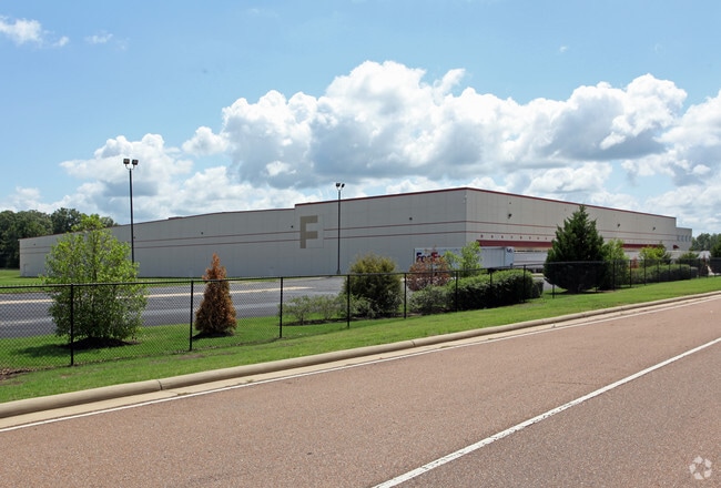
Property Record
4150 Old Airways Blvd, Southaven, MS 38671
NEARBY LISTINGS FOR SALE OR LEASE
Property Detail
4150 Old Airways Blvd
Memphis, TN-MS-AR
Business Park Resub
2073070100000500
DESOTO CENTER BUSINESS PARK RESUB OF LOT 3 LOT 5
Commercialnec
DeSoto
X
Mississippi
28033C0090H
5
2025
25.85 AC
2025
DeSoto
070635
Memphis
262,006 SF
DEMOGRAPHICS near 4150 Old Airways Blvd
1 Mile
3 Mile
5 Mile
2024 Total Population
1,170
29,561
83,740
2029 Population
1,287
32,792
91,887
Pop Growth 2024-2029
+ 10.00%
+ 10.93%
+ 9.73%
Average Age
39
37
38
2024 Total Households
372
11,352
31,317
HH Growth 2024-2029
+ 9.95%
+ 11.08%
+ 9.81%
Median Household Inc
$125,558
$70,176
$61,710
Avg Household Size
3.10
2.60
2.60
2024 Avg HH Vehicles
2.00
2.00
2.00
Median Home Value
$278,648
$245,942
$211,370
Median Year Built
2003
2000
1995
Nearby Places
Map Layers
Map Styles
 Street
 Aerial
- Restaurants
- Banks
- Shops
- Fitness
- Groceries
PUBLIC TRANSPORTATION
AIRPORT
Memphis International
DRIVE
WALK
Distance
Memphis International
18 min
11.4 mi
Freight Ports
Port of Shreveport
DRIVE
WALK
Distance
Port of Shreveport
420 min
385.0 mi
Nearby Properties
Address
Land Use
TOTAL SIZE
Lot Size
Zoning
Address
Land Use
TOTAL SIZE
Lot Size
Zoning
1,021,440 SF
57.67 AC
M-1
Address
Land Use
TOTAL SIZE
Lot Size
Zoning
1,197,486 SF
59.47 AC
PBP
Address
Land Use
TOTAL SIZE
Lot Size
Zoning
906,200 SF
73.05 AC
PBP
Address
Land Use
TOTAL SIZE
Lot Size
Zoning
864,024 SF
51.02 AC
PBP
Address
Land Use
TOTAL SIZE
Lot Size
Zoning
946,430 SF
62.60 AC
PBP
Address
Land Use
TOTAL SIZE
Lot Size
Zoning
23,183 SF
33.02 AC
PUD
Address
Land Use
TOTAL SIZE
Lot Size
Zoning
842,678 SF
51 AC
PBP
Address
Land Use
TOTAL SIZE
Lot Size
Zoning
412,218 SF
37.80 AC
PBP
Address
Land Use
TOTAL SIZE
Lot Size
Zoning
581,346 SF
39.98 AC
PUD
Address
Land Use
TOTAL SIZE
Lot Size
Zoning
62,561 SF
33.01 AC
PUD
Address
Land Use
TOTAL SIZE
Lot Size
Zoning
864,160 SF
44.14 AC
PBP
Address
Land Use
TOTAL SIZE
Lot Size
Zoning
18,830 SF
25.45 AC
PUD
Address
Land Use
TOTAL SIZE
Lot Size
Zoning
473,820 SF
56.29 AC
PBP
Address
Land Use
TOTAL SIZE
Lot Size
Zoning
15,472 SF
25.97 AC
PUD
Address
Land Use
TOTAL SIZE
Lot Size
Zoning
581,530 SF
51.64 AC
PBP
Address
Land Use
TOTAL SIZE
Lot Size
Zoning
14,122 SF
24 AC
PUD
Address
Land Use
TOTAL SIZE
Lot Size
Zoning
553,179 SF
36.77 AC
PBP
Address
Land Use
TOTAL SIZE
Lot Size
Zoning
514,885 SF
35.91 AC
PBP
Address
Land Use
TOTAL SIZE
Lot Size
Zoning
454,272 SF
22.28 AC
PBP
Address
Land Use
TOTAL SIZE
Lot Size
Zoning
328,440 SF
24.49 AC
PBP
Address
Land Use
TOTAL SIZE
Lot Size
Zoning
34,358 SF
26.89 AC
C-4
Address
Land Use
TOTAL SIZE
Lot Size
Zoning
20,588 SF
14 AC
PUD
Address
Land Use
TOTAL SIZE
Lot Size
Zoning
70,434 SF
25 AC
C-4
Address
Land Use
TOTAL SIZE
Lot Size
Zoning
344,190 SF
15.98 AC
PBP
Address
Land Use
TOTAL SIZE
Lot Size
Zoning
13,129 SF
12 AC
PUD
Address
Land Use
TOTAL SIZE
Lot Size
Zoning
300,764 SF
22.13 AC
PBP
Address
Land Use
TOTAL SIZE
Lot Size
Zoning
10,341 SF
13.94 AC
RM-6
Address
Land Use
TOTAL SIZE
Lot Size
Zoning
316,720 SF
21.20 AC
PBP
Address
Land Use
TOTAL SIZE
Lot Size
Zoning
198,387 SF
19.49 AC
C-4
The World's #1 Commercial Real Estate Marketplace
Connect with us
© 2026 CoStar Group
The information above has been obtained from sources believed reliable. While we do not doubt its accuracy we have not verified it and make no guarantee, warranty or representation about it. It is your responsibility to independently confirm its accuracy and completeness. Any projections, opinions, assumptions, or estimates used are for example only and do not represent the current or future performance of the property. The value of this transaction to you depends on tax and other factors which should be evaluated by your tax, financial, and legal advisors. You and your advisors should conduct a careful, independent investigation of the property to determine to your satisfaction the suitability of the property for your needs.