Property Record
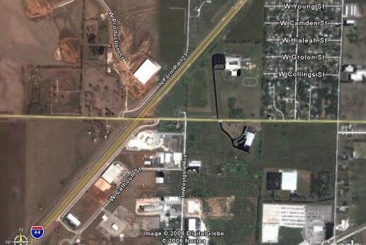
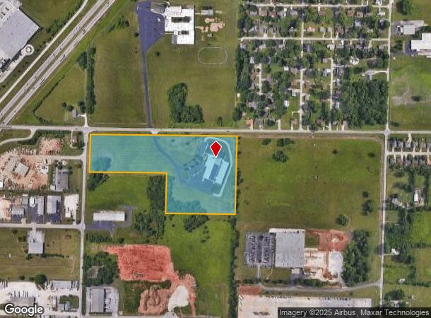
4150 W Division St, Springfield, MO 65802
Property Detail
4150 W Division St
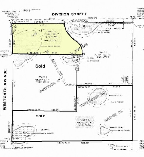
13-17-201-014
16.25A M/L BEG 17.46 FT E NW COR NW1/4 NW1/4 17/29/22 S 372. 88 FT E 699.51 FT S 340.37 FT E 612.56 FT N 713 FT M/L W TO BEG
Manufacturinglight
Greene
X
Missouri
29077C0326E
16.25 AC
2025
Northwest
2025
Springfield
004304
Springfield, MO
32,886 SF
NEARBY LISTINGS FOR SALE OR LEASE
DEMOGRAPHICS near 4150 W Division St
1 mile
3 mile
5 mile
2024 Total Population
1,601
33,203
99,047
2029 Population
1,672
34,523
103,279
Pop Growth 2024-2029
+ 4.43%
+ 3.98%
+ 4.27%
Average Age
39
38
37
2024 Total Households
650
13,353
41,028
HH Growth 2024-2029
+ 4.46%
+ 4.16%
+ 4.68%
Median Household Inc
$49,721
$46,812
$42,538
Avg Household Size
2.40
2.40
2.20
2024 Avg HH Vehicles
2.00
2.00
2.00
Median Home Value
$129,386
$127,407
$139,907
Median Year Built
1978
1989
1980
Nearby Places
Map Layers
Map Styles
 Street
 Aerial
Transit
 Traffic
 Biking
Places
Listings with unknown addresses are not visible on the map
- Restaurants
- Banks
- Shops
- Fitness
- Groceries
PUBLIC TRANSPORTATION
AIRPORT
Springfield-Branson Ntl
Drive
Walk
Distance
Springfield-Branson Ntl
14 min
4.3 mi
Freight Ports
Tulsa Port of Inola
Drive
Walk
Distance
Tulsa Port of Inola
190 min
168.7 mi
Nearby Properties
Address
Land Use
TOTAL SIZE
Lot Size
Zoning
Address
Land Use
TOTAL SIZE
Lot Size
Zoning
82.16 AC
Address
Land Use
TOTAL SIZE
Lot Size
Zoning
320,532 SF
33.54 AC
INC
Address
Land Use
TOTAL SIZE
Lot Size
Zoning
23.75 AC
Address
Land Use
TOTAL SIZE
Lot Size
Zoning
22.64 AC
INC
Address
Land Use
TOTAL SIZE
Lot Size
Zoning
11 AC
INC
Address
Land Use
TOTAL SIZE
Lot Size
Zoning
511.19 AC
Address
Land Use
TOTAL SIZE
Lot Size
Zoning
234,926 SF
9.41 AC
INC
Address
Land Use
TOTAL SIZE
Lot Size
Zoning
102,925 SF
57.24 AC
INC
Address
Land Use
TOTAL SIZE
Lot Size
Zoning
2.92 AC
INC
Address
Land Use
TOTAL SIZE
Lot Size
Zoning
93,916 SF
7.91 AC
INC
Address
Land Use
TOTAL SIZE
Lot Size
Zoning
29.42 AC
INC
Address
Land Use
TOTAL SIZE
Lot Size
Zoning
154,470 SF
16.97 AC
INC
Address
Land Use
TOTAL SIZE
Lot Size
Zoning
20.54 AC
Address
Land Use
TOTAL SIZE
Lot Size
Zoning
Address
Land Use
TOTAL SIZE
Lot Size
Zoning
83,380 SF
7.20 AC
INC
Address
Land Use
TOTAL SIZE
Lot Size
Zoning
Address
Land Use
TOTAL SIZE
Lot Size
Zoning
12.39 AC
Address
Land Use
TOTAL SIZE
Lot Size
Zoning
78,239 SF
10.01 AC
INC
Address
Land Use
TOTAL SIZE
Lot Size
Zoning
Address
Land Use
TOTAL SIZE
Lot Size
Zoning
77,160 SF
6.31 AC
INC
Address
Land Use
TOTAL SIZE
Lot Size
Zoning
55,568 SF
2.13 AC
INC
Address
Land Use
TOTAL SIZE
Lot Size
Zoning
75,000 SF
8.92 AC
INC
Address
Land Use
TOTAL SIZE
Lot Size
Zoning
52,772 SF
5.12 AC
INC
Address
Land Use
TOTAL SIZE
Lot Size
Zoning
13.80 AC
C-2
Address
Land Use
TOTAL SIZE
Lot Size
Zoning
504,804 SF
34.94 AC
INC
Address
Land Use
TOTAL SIZE
Lot Size
Zoning
148,940 SF
10.08 AC
M-2
Address
Land Use
TOTAL SIZE
Lot Size
Zoning
115,000 SF
10.71 AC
INC
Address
Land Use
TOTAL SIZE
Lot Size
Zoning
7.90 AC
INC
Address
Land Use
TOTAL SIZE
Lot Size
Zoning
90,928 SF
5.36 AC
INC
Address
Land Use
TOTAL SIZE
Lot Size
Zoning
11.87 AC
INC
The World's #1 Commercial Real Estate Marketplace
Connect with us
© 2026 CoStar Group
The information above has been obtained from sources believed reliable. While we do not doubt its accuracy we have not verified it and make no guarantee, warranty or representation about it. It is your responsibility to independently confirm its accuracy and completeness. Any projections, opinions, assumptions, or estimates used are for example only and do not represent the current or future performance of the property. The value of this transaction to you depends on tax and other factors which should be evaluated by your tax, financial, and legal advisors. You and your advisors should conduct a careful, independent investigation of the property to determine to your satisfaction the suitability of the property for your needs.