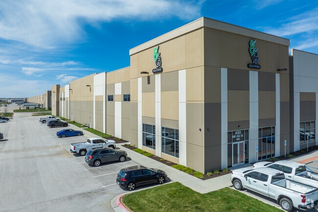
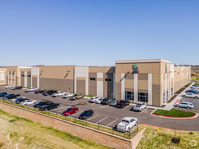
Property Record
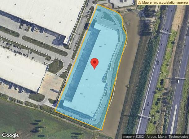
4151 Nw 41St St, Riverside, MO 64150
NEARBY LISTINGS FOR SALE OR LEASE
Property Detail
4151 Nw 41St St
Kansas City, MO-KS
Riverside Horizons East 1St
23-30-08-000-000-008-000
RIVERSIDE HORIZONS EAST 1ST LOT 8
Warehouse
Platte
X
Missouri
29095C0125G
8
2024
10.82 AC
2025
Riverside/Parkville
030101
Kansas City
409,280 SF
DEMOGRAPHICS near 4151 Nw 41St St
1 Mile
3 Mile
5 Mile
2024 Total Population
892
38,112
164,398
2029 Population
974
39,982
170,050
Pop Growth 2024-2029
+ 9.19%
+ 4.91%
+ 3.44%
Average Age
41
38
37
2024 Total Households
337
15,557
66,671
HH Growth 2024-2029
+ 9.20%
+ 5.04%
+ 3.80%
Median Household Inc
$74,740
$64,542
$57,605
Avg Household Size
2.40
2.40
2.40
2024 Avg HH Vehicles
2.00
2.00
2.00
Median Home Value
$288,524
$231,024
$180,424
Median Year Built
1975
1975
1968
Nearby Places
Map Layers
Map Styles
 Street
 Aerial
- Restaurants
- Banks
- Shops
- Fitness
- Groceries
PUBLIC TRANSPORTATION
AIRPORT
Kansas City International
DRIVE
WALK
Distance
Kansas City International
22 min
15.5 mi
Freight Ports
Tulsa Port Of Catoosa
DRIVE
WALK
Distance
Tulsa Port Of Catoosa
272 min
241.8 mi
SALE & LEASE HISTORY
LISTING DATE
SALE/LEASE

May 12, 2020
For Lease
Jan 26, 2024
For Lease
Nearby Properties
Address
Land Use
TOTAL SIZE
Lot Size
Zoning
Address
Land Use
TOTAL SIZE
Lot Size
Zoning
846,143 SF
51.25 AC
Address
Land Use
TOTAL SIZE
Lot Size
Zoning
215,920 SF
38.28 AC
Address
Land Use
TOTAL SIZE
Lot Size
Zoning
4,012,734 SF
574.30 AC
KM3
Address
Land Use
TOTAL SIZE
Lot Size
Zoning
139,499 SF
20.51 AC
KR1B
Address
Land Use
TOTAL SIZE
Lot Size
Zoning
239,083 SF
85.48 AC
KM3
Address
Land Use
TOTAL SIZE
Lot Size
Zoning
Address
Land Use
TOTAL SIZE
Lot Size
Zoning
491,448 SF
22.53 AC
Address
Land Use
TOTAL SIZE
Lot Size
Zoning
824,130 SF
20.12 AC
Address
Land Use
TOTAL SIZE
Lot Size
Zoning
552,085 SF
21.81 AC
Address
Land Use
TOTAL SIZE
Lot Size
Zoning
36,576 SF
4.46 AC
Address
Land Use
TOTAL SIZE
Lot Size
Zoning
340,930 SF
15.31 AC
Address
Land Use
TOTAL SIZE
Lot Size
Zoning
656,640 SF
20.07 AC
Address
Land Use
TOTAL SIZE
Lot Size
Zoning
271,430 SF
15.70 AC
Address
Land Use
TOTAL SIZE
Lot Size
Zoning
245,507 SF
14.22 AC
Address
Land Use
TOTAL SIZE
Lot Size
Zoning
480,000 SF
20.10 AC
Address
Land Use
TOTAL SIZE
Lot Size
Zoning
58.54 AC
Address
Land Use
TOTAL SIZE
Lot Size
Zoning
479,408 SF
14.94 AC
Address
Land Use
TOTAL SIZE
Lot Size
Zoning
221,952 SF
28.85 AC
Address
Land Use
TOTAL SIZE
Lot Size
Zoning
420,508 SF
13.95 AC
Address
Land Use
TOTAL SIZE
Lot Size
Zoning
Address
Land Use
TOTAL SIZE
Lot Size
Zoning
194,298 SF
9.73 AC
Address
Land Use
TOTAL SIZE
Lot Size
Zoning
Address
Land Use
TOTAL SIZE
Lot Size
Zoning
396,848 SF
10 AC
Address
Land Use
TOTAL SIZE
Lot Size
Zoning
47,042 SF
3.47 AC
Address
Land Use
TOTAL SIZE
Lot Size
Zoning
12.17 AC
Address
Land Use
TOTAL SIZE
Lot Size
Zoning
Address
Land Use
TOTAL SIZE
Lot Size
Zoning
358,806 SF
24.99 AC
Address
Land Use
TOTAL SIZE
Lot Size
Zoning
17.36 AC
Address
Land Use
TOTAL SIZE
Lot Size
Zoning
14.99 AC
The World's #1 Commercial Real Estate Marketplace
Connect with us
© 2026 CoStar Group
The information above has been obtained from sources believed reliable. While we do not doubt its accuracy we have not verified it and make no guarantee, warranty or representation about it. It is your responsibility to independently confirm its accuracy and completeness. Any projections, opinions, assumptions, or estimates used are for example only and do not represent the current or future performance of the property. The value of this transaction to you depends on tax and other factors which should be evaluated by your tax, financial, and legal advisors. You and your advisors should conduct a careful, independent investigation of the property to determine to your satisfaction the suitability of the property for your needs.