Property Record
4151 Shrestha Dr, Bay City, MI 48706
NEARBY LISTINGS FOR SALE OR LEASE
Property Detail
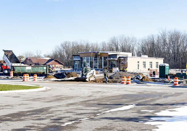
4151 Shrestha Dr
Bay City, MI
S & S Dev 3
09-010-S34-000-013-00
LOT 15 OF S & S DEVELOPMENT NO. 3
Officebuilding
Bay
X
Michigan
26145C0075E
15
2024
1.09 AC
2025
Midland/Flint
285800
Other Market Areas
8,600 SF
DEMOGRAPHICS near 4151 Shrestha Dr
1 Mile
3 Mile
5 Mile
2024 Total Population
6,408
43,730
69,178
2029 Population
6,309
43,336
68,547
Pop Growth 2024-2029
(1.54%)
(0.90%)
(0.91%)
Average Age
42
42
43
2024 Total Households
2,793
19,267
30,491
HH Growth 2024-2029
(1.68%)
(0.98%)
(0.93%)
Median Household Inc
$56,178
$49,646
$51,558
Avg Household Size
2.20
2.20
2.20
2024 Avg HH Vehicles
2.00
2.00
2.00
Median Home Value
$89,767
$90,920
$97,440
Median Year Built
1959
1954
1956
Nearby Places
Map Layers
Map Styles
 Street
 Aerial
- Restaurants
- Banks
- Shops
- Fitness
- Groceries
PUBLIC TRANSPORTATION
AIRPORT
MBS International
DRIVE
WALK
Distance
MBS International
24 min
15.1 mi
Freight Ports
Port of Toledo
DRIVE
WALK
Distance
Port of Toledo
185 min
159.8 mi
Nearby Properties
Address
Land Use
TOTAL SIZE
Lot Size
Zoning
Address
Land Use
TOTAL SIZE
Lot Size
Zoning
97,304 SF
3.61 AC
C-3 CTRL B
Address
Land Use
TOTAL SIZE
Lot Size
Zoning
536,802 SF
450 AC
I-2
Address
Land Use
TOTAL SIZE
Lot Size
Zoning
164,241 SF
10.08 AC
RM-1
Address
Land Use
TOTAL SIZE
Lot Size
Zoning
16.52 AC
R-3
Address
Land Use
TOTAL SIZE
Lot Size
Zoning
167,100 SF
35.59 AC
M-2 GEN IN
Address
Land Use
TOTAL SIZE
Lot Size
Zoning
60,200 SF
9.50 AC
C-3 CTRL B
Address
Land Use
TOTAL SIZE
Lot Size
Zoning
169,440 SF
16.54 AC
RM-1
Address
Land Use
TOTAL SIZE
Lot Size
Zoning
1.87 AC
C-3 CTRL B
Address
Land Use
TOTAL SIZE
Lot Size
Zoning
57,000 SF
1.09 AC
C-3 CTRL B
Address
Land Use
TOTAL SIZE
Lot Size
Zoning
41,011 SF
8.28 AC
C-2
Address
Land Use
TOTAL SIZE
Lot Size
Zoning
50,965 SF
0.83 AC
C-3 CTRL B
Address
Land Use
TOTAL SIZE
Lot Size
Zoning
39,417 SF
0.23 AC
C-3 CTRL B
Address
Land Use
TOTAL SIZE
Lot Size
Zoning
63,200 SF
1.97 AC
C-3 CTRL B
Address
Land Use
TOTAL SIZE
Lot Size
Zoning
C-3 CTRL B
Address
Land Use
TOTAL SIZE
Lot Size
Zoning
45,072 SF
4.81 AC
C-2B HWY B
Address
Land Use
TOTAL SIZE
Lot Size
Zoning
156,600 SF
9.11 AC
M-1 LT IND
Address
Land Use
TOTAL SIZE
Lot Size
Zoning
7,200 SF
0.69 AC
C-3 CTRL B
Address
Land Use
TOTAL SIZE
Lot Size
Zoning
139,237 SF
5.47 AC
C-3 CTRL B
Address
Land Use
TOTAL SIZE
Lot Size
Zoning
163,673 SF
17.85 AC
RM-1
Address
Land Use
TOTAL SIZE
Lot Size
Zoning
Address
Land Use
TOTAL SIZE
Lot Size
Zoning
107,921 SF
10.91 AC
C-2
Address
Land Use
TOTAL SIZE
Lot Size
Zoning
85,264 SF
5 AC
RM-1
Address
Land Use
TOTAL SIZE
Lot Size
Zoning
32.23 AC
C
Address
Land Use
TOTAL SIZE
Lot Size
Zoning
36,243 SF
3.41 AC
C-2
Address
Land Use
TOTAL SIZE
Lot Size
Zoning
109,649 SF
11.29 AC
C-2
Address
Land Use
TOTAL SIZE
Lot Size
Zoning
60,889 SF
Address
Land Use
TOTAL SIZE
Lot Size
Zoning
58,981 SF
3.09 AC
C
Address
Land Use
TOTAL SIZE
Lot Size
Zoning
472,836 SF
33.72 AC
C-2
Address
Land Use
TOTAL SIZE
Lot Size
Zoning
48.55 AC
M-2 GEN IN
Address
Land Use
TOTAL SIZE
Lot Size
Zoning
37,230 SF
10.03 AC
C-2
The World's #1 Commercial Real Estate Marketplace
Connect with us
© 2025 CoStar Group
The information above has been obtained from sources believed reliable. While we do not doubt its accuracy we have not verified it and make no guarantee, warranty or representation about it. It is your responsibility to independently confirm its accuracy and completeness. Any projections, opinions, assumptions, or estimates used are for example only and do not represent the current or future performance of the property. The value of this transaction to you depends on tax and other factors which should be evaluated by your tax, financial, and legal advisors. You and your advisors should conduct a careful, independent investigation of the property to determine to your satisfaction the suitability of the property for your needs.