Property Record
4152 3Rd St, Detroit, MI 48201
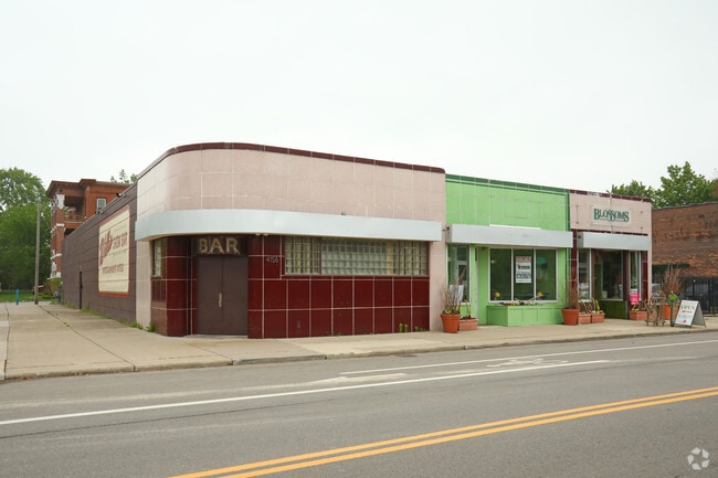

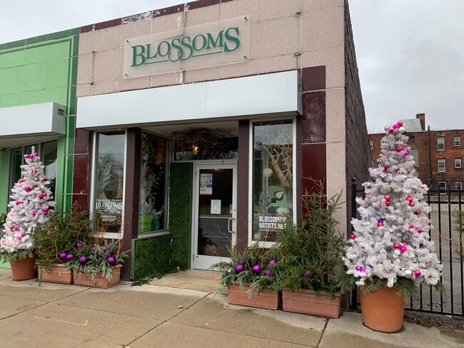
This Property Is For Sale
NEARBY LISTINGS FOR SALE OR LEASE
Property Detail
4152 3Rd St
04-003407
Cass Farm
Storebuilding
E THIRD 6 BLK 96 AND VAC WILLIS ADJ CASS FARM SUB L1 P175-7 PLATS, W C R 4/34 83 X 150
X
Wayne
26163C0280E
Michigan
2025
0.29 AC
2025
Detroit-New Center
520400
Detroit
6,229 SF
Detroit-Warren-Dearborn, MI
DEMOGRAPHICS near 4152 3Rd St
1 Mile
3 Mile
5 Mile
2024 Total Population
22,496
108,172
288,631
2029 Population
22,112
107,884
288,041
Pop Growth 2024-2029
(1.71%)
(0.27%)
(0.20%)
Average Age
36
39
38
2024 Total Households
11,383
51,996
119,168
HH Growth 2024-2029
(1.27%)
(0.42%)
(0.01%)
Median Household Inc
$31,438
$36,860
$34,180
Avg Household Size
1.70
1.90
2.30
2024 Avg HH Vehicles
1.00
1.00
1.00
Median Home Value
$358,469
$152,752
$92,107
Median Year Built
1969
1951
1948
Nearby Places
Map Layers
Map Styles
 Street
 Aerial
- Restaurants
- Banks
- Shops
- Fitness
- Groceries
PUBLIC TRANSPORTATION
AIRPORT
Detroit City
DRIVE
WALK
Distance
Detroit City
14 min
6.7 mi
Detroit Metro Wayne County
DRIVE
WALK
Distance
Detroit Metro Wayne County
30 min
24.0 mi
Freight Ports
Port of Baltimore
DRIVE
WALK
Distance
Port of Baltimore
1 min
399.8 mi
Nearby Properties
Address
Land Use
TOTAL SIZE
Lot Size
Zoning
Address
Land Use
TOTAL SIZE
Lot Size
Zoning
3,032,363 SF
24.24 AC
SD5
Address
Land Use
TOTAL SIZE
Lot Size
Zoning
6,112,830 SF
13.67 AC
PD
Address
Land Use
TOTAL SIZE
Lot Size
Zoning
409,438 SF
0.83 AC
B6
Address
Land Use
TOTAL SIZE
Lot Size
Zoning
1,409,416 SF
13.53 AC
R6
Address
Land Use
TOTAL SIZE
Lot Size
Zoning
1,553,311 SF
3.05 AC
SD5
Address
Land Use
TOTAL SIZE
Lot Size
Zoning
1,994,989 SF
4.97 AC
B5
Address
Land Use
TOTAL SIZE
Lot Size
Zoning
873,048 SF
7.70 AC
R6
Address
Land Use
TOTAL SIZE
Lot Size
Zoning
1,478,866 SF
2.88 AC
PCA
Address
Land Use
TOTAL SIZE
Lot Size
Zoning
1,017,009 SF
1.35 AC
R6
Address
Land Use
TOTAL SIZE
Lot Size
Zoning
848,598 SF
8.78 AC
SD5
Address
Land Use
TOTAL SIZE
Lot Size
Zoning
252,150 SF
2.46 AC
SD5
Address
Land Use
TOTAL SIZE
Lot Size
Zoning
185,300 SF
3.36 AC
SD5
Address
Land Use
TOTAL SIZE
Lot Size
Zoning
1,847,449 SF
13.85 AC
PD
Address
Land Use
TOTAL SIZE
Lot Size
Zoning
6,620 SF
9.43 AC
B6
Address
Land Use
TOTAL SIZE
Lot Size
Zoning
1,004,872 SF
1.05 AC
PCA
Address
Land Use
TOTAL SIZE
Lot Size
Zoning
720,653 SF
1.53 AC
PCA
Address
Land Use
TOTAL SIZE
Lot Size
Zoning
3,793,609 SF
265.70 AC
M4
Address
Land Use
TOTAL SIZE
Lot Size
Zoning
895,279 SF
3.58 AC
PCA
Address
Land Use
TOTAL SIZE
Lot Size
Zoning
1,149,710 SF
1.07 AC
B5
Address
Land Use
TOTAL SIZE
Lot Size
Zoning
503,688 SF
Address
Land Use
TOTAL SIZE
Lot Size
Zoning
919,213 SF
B5
Address
Land Use
TOTAL SIZE
Lot Size
Zoning
568,546 SF
B5
Address
Land Use
TOTAL SIZE
Lot Size
Zoning
874,160 SF
9.91 AC
R6
Address
Land Use
TOTAL SIZE
Lot Size
Zoning
520,897 SF
0.85 AC
Address
Land Use
TOTAL SIZE
Lot Size
Zoning
306,496 SF
1.91 AC
R6
Address
Land Use
TOTAL SIZE
Lot Size
Zoning
430,286 SF
1.14 AC
PCA
Address
Land Use
TOTAL SIZE
Lot Size
Zoning
437,558 SF
0.72 AC
Address
Land Use
TOTAL SIZE
Lot Size
Zoning
187,652 SF
Address
Land Use
TOTAL SIZE
Lot Size
Zoning
268,746 SF
B5
Address
Land Use
TOTAL SIZE
Lot Size
Zoning
576,286 SF
1.66 AC
B4
The World's #1 Commercial Real Estate Marketplace
Connect with us
© 2026 CoStar Group
The information above has been obtained from sources believed reliable. While we do not doubt its accuracy we have not verified it and make no guarantee, warranty or representation about it. It is your responsibility to independently confirm its accuracy and completeness. Any projections, opinions, assumptions, or estimates used are for example only and do not represent the current or future performance of the property. The value of this transaction to you depends on tax and other factors which should be evaluated by your tax, financial, and legal advisors. You and your advisors should conduct a careful, independent investigation of the property to determine to your satisfaction the suitability of the property for your needs.