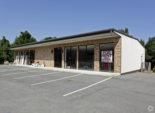
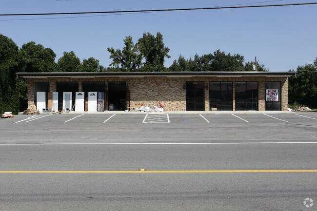
Property Record
41525 Highway 195, Haleyville, AL 35565
NEARBY LISTINGS FOR SALE OR LEASE
Property Detail
41525 Highway 195
Storebuilding
COM INT W LN SEC 27 T9 R10 AND N ROW HWY 195 TH NELY ALG ROW 540 S TO POB CONT NELY 105 NW 210 SW 105 SE 210 TO POB
X
Winston
01133C0180D
Alabama
2025
0.92 AC
2024
Other Market Areas
9656003040
05-08-27-0-200-030.000
5,200 SF
DEMOGRAPHICS near 41525 Highway 195
1 Mile
3 Mile
5 Mile
2024 Total Population
396
5,323
8,646
2029 Population
389
5,292
8,580
Pop Growth 2024-2029
(1.77%)
(0.58%)
(0.76%)
Average Age
42
42
42
2024 Total Households
168
2,222
3,597
HH Growth 2024-2029
(1.79%)
(0.59%)
(0.75%)
Median Household Inc
$45,789
$48,338
$46,013
Avg Household Size
2.30
2.30
2.30
2024 Avg HH Vehicles
2.00
2.00
2.00
Median Home Value
$128,846
$116,808
$109,023
Median Year Built
1979
1975
1977
Nearby Places
Map Layers
Map Styles
 Street
 Aerial
- Restaurants
- Banks
- Shops
- Fitness
- Groceries
Nearby Properties
Address
Land Use
TOTAL SIZE
Lot Size
Zoning
Address
Land Use
TOTAL SIZE
Lot Size
Zoning
139,475 SF
51 AC
Address
Land Use
TOTAL SIZE
Lot Size
Zoning
47,666 SF
6.10 AC
Address
Land Use
TOTAL SIZE
Lot Size
Zoning
30,451 SF
1.70 AC
Address
Land Use
TOTAL SIZE
Lot Size
Zoning
24,985 SF
3.50 AC
Address
Land Use
TOTAL SIZE
Lot Size
Zoning
24,069 SF
1.90 AC
Address
Land Use
TOTAL SIZE
Lot Size
Zoning
18,400 SF
1.20 AC
Address
Land Use
TOTAL SIZE
Lot Size
Zoning
7,383 SF
1.01 AC
Address
Land Use
TOTAL SIZE
Lot Size
Zoning
2,476 SF
0.90 AC
Address
Land Use
TOTAL SIZE
Lot Size
Zoning
9,500 SF
1.10 AC
Address
Land Use
TOTAL SIZE
Lot Size
Zoning
15,252 SF
5 AC
Address
Land Use
TOTAL SIZE
Lot Size
Zoning
19,500 SF
1.05 AC
Address
Land Use
TOTAL SIZE
Lot Size
Zoning
3,702 SF
0.28 AC
Address
Land Use
TOTAL SIZE
Lot Size
Zoning
1,152 SF
3 AC
Address
Land Use
TOTAL SIZE
Lot Size
Zoning
15,080 SF
0.86 AC
Address
Land Use
TOTAL SIZE
Lot Size
Zoning
2,736 SF
0.60 AC
Address
Land Use
TOTAL SIZE
Lot Size
Zoning
6,346 SF
1.06 AC
The World's #1 Commercial Real Estate Marketplace
Connect with us
© 2026 CoStar Group
The information above has been obtained from sources believed reliable. While we do not doubt its accuracy we have not verified it and make no guarantee, warranty or representation about it. It is your responsibility to independently confirm its accuracy and completeness. Any projections, opinions, assumptions, or estimates used are for example only and do not represent the current or future performance of the property. The value of this transaction to you depends on tax and other factors which should be evaluated by your tax, financial, and legal advisors. You and your advisors should conduct a careful, independent investigation of the property to determine to your satisfaction the suitability of the property for your needs.