Property Record
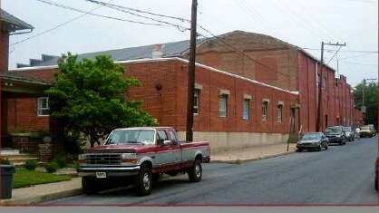
4154 Roosevelt St, Whitehall, PA 18052


NEARBY LISTINGS FOR SALE OR LEASE
Property Detail
4154 Roosevelt St
558040606115-1
LOTS: 020
Multifamilydwelling
Lehigh
X
Pennsylvania
42095C0217E
20
2025
1.21 AC
2025
Lehigh Valley
005601
Philadelphia
44,041 SF
Allentown-Bethlehem-Easton, PA-NJ
DEMOGRAPHICS near 4154 Roosevelt St
1 Mile
3 Mile
5 Mile
2024 Total Population
4,285
33,712
85,108
2029 Population
4,317
33,909
85,728
Pop Growth 2024-2029
+ 0.75%
+ 0.58%
+ 0.73%
Average Age
42
42
42
2024 Total Households
1,667
13,558
33,798
HH Growth 2024-2029
+ 0.72%
+ 0.58%
+ 0.71%
Median Household Inc
$75,218
$76,016
$73,874
Avg Household Size
2.60
2.50
2.50
2024 Avg HH Vehicles
2.00
2.00
2.00
Median Home Value
$253,149
$236,250
$243,647
Median Year Built
1974
1968
1971
Nearby Places
Map Layers
Map Styles
 Street
 Aerial
- Restaurants
- Banks
- Shops
- Fitness
- Groceries
PUBLIC TRANSPORTATION
AIRPORT
Lehigh Valley International
DRIVE
WALK
Distance
Lehigh Valley International
18 min
8.1 mi
Freight Ports
Port of Philadelphia
DRIVE
WALK
Distance
Port of Philadelphia
89 min
67.0 mi
SALE & LEASE HISTORY
LISTING DATE
SALE/LEASE

Sep 25, 2016
For Lease
Nearby Properties
Address
Land Use
TOTAL SIZE
Lot Size
Zoning
Address
Land Use
TOTAL SIZE
Lot Size
Zoning
230,853 SF
96.66 AC
R-3
Address
Land Use
TOTAL SIZE
Lot Size
Zoning
175,714 SF
46.35 AC
R-3
Address
Land Use
TOTAL SIZE
Lot Size
Zoning
504,475 SF
39.36 AC
I
Address
Land Use
TOTAL SIZE
Lot Size
Zoning
85.20 AC
I2
Address
Land Use
TOTAL SIZE
Lot Size
Zoning
50,343 SF
10 AC
R-3A
Address
Land Use
TOTAL SIZE
Lot Size
Zoning
45,176 SF
11.04 AC
R-4
Address
Land Use
TOTAL SIZE
Lot Size
Zoning
164,816 SF
48.85 AC
R1
Address
Land Use
TOTAL SIZE
Lot Size
Zoning
64,809 SF
9.66 AC
SR
Address
Land Use
TOTAL SIZE
Lot Size
Zoning
316,786 SF
29.22 AC
I2
Address
Land Use
TOTAL SIZE
Lot Size
Zoning
24,878 SF
20.66 AC
AR
Address
Land Use
TOTAL SIZE
Lot Size
Zoning
65,524 SF
22.48 AC
I
Address
Land Use
TOTAL SIZE
Lot Size
Zoning
55,048 SF
12.47 AC
C-2A
Address
Land Use
TOTAL SIZE
Lot Size
Zoning
3,611 SF
108 AC
ME-I
Address
Land Use
TOTAL SIZE
Lot Size
Zoning
11,040 SF
4.18 AC
C-1
Address
Land Use
TOTAL SIZE
Lot Size
Zoning
56,720 SF
4.17 AC
C-1
Address
Land Use
TOTAL SIZE
Lot Size
Zoning
8,280 SF
4.20 AC
R-5
Address
Land Use
TOTAL SIZE
Lot Size
Zoning
32,917 SF
6.04 AC
R-3A
Address
Land Use
TOTAL SIZE
Lot Size
Zoning
15,750 SF
5.10 AC
R-6
Address
Land Use
TOTAL SIZE
Lot Size
Zoning
6,799 SF
2.82 AC
R-5
Address
Land Use
TOTAL SIZE
Lot Size
Zoning
9,068 SF
6.10 AC
R-4
Address
Land Use
TOTAL SIZE
Lot Size
Zoning
1,920 SF
26.19 AC
VR
Address
Land Use
TOTAL SIZE
Lot Size
Zoning
15,789 SF
8.78 AC
R-4
Address
Land Use
TOTAL SIZE
Lot Size
Zoning
42,602 SF
17.93 AC
SR
Address
Land Use
TOTAL SIZE
Lot Size
Zoning
3,050 SF
3.91 AC
C-2
Address
Land Use
TOTAL SIZE
Lot Size
Zoning
1,815 SF
29.80 AC
R-6
Address
Land Use
TOTAL SIZE
Lot Size
Zoning
24,572 SF
3.03 AC
C-2
Address
Land Use
TOTAL SIZE
Lot Size
Zoning
2,339 SF
202.96 AC
OS-2
Address
Land Use
TOTAL SIZE
Lot Size
Zoning
79.14 AC
OS-2
Address
Land Use
TOTAL SIZE
Lot Size
Zoning
12,376 SF
4.04 AC
R-5A
The World's #1 Commercial Real Estate Marketplace
Connect with us
© 2026 CoStar Group
The information above has been obtained from sources believed reliable. While we do not doubt its accuracy we have not verified it and make no guarantee, warranty or representation about it. It is your responsibility to independently confirm its accuracy and completeness. Any projections, opinions, assumptions, or estimates used are for example only and do not represent the current or future performance of the property. The value of this transaction to you depends on tax and other factors which should be evaluated by your tax, financial, and legal advisors. You and your advisors should conduct a careful, independent investigation of the property to determine to your satisfaction the suitability of the property for your needs.