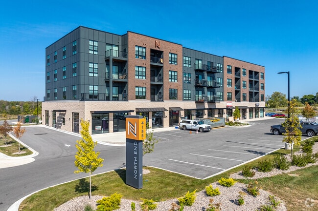
Property Record
4155 N Galaxy Dr, Appleton, WI 54913

Property Detail
4155 N Galaxy Dr
Appleton, WI
LOT 7 CSM 8272
10-1-0380-09
OUTAGAMIE
Commercialnec
Wisconsin
2024
6.66 AC
2024
Outer Outagamie County
012505
Green Bay
NEARBY LISTINGS FOR SALE OR LEASE
-
-
View all Appleton listings for lease on LoopNet.com
DEMOGRAPHICS near 4155 N Galaxy Dr
1 mile
3 mile
5 mile
2024 Total Population
6,799
60,411
123,467
2029 Population
7,067
62,698
127,952
Pop Growth 2024-2029
+ 3.94%
+ 3.79%
+ 3.63%
Average Age
43
40
40
2024 Total Households
2,686
25,014
51,468
HH Growth 2024-2029
+ 3.76%
+ 3.76%
+ 3.62%
Median Household Inc
$108,141
$71,576
$69,526
Avg Household Size
2.50
2.30
2.30
2024 Avg HH Vehicles
2.00
2.00
2.00
Median Home Value
$313,171
$204,674
$200,224
Median Year Built
1995
1975
1977
Nearby Places
Map Layers
Map Styles
 Street
 Aerial
Transit
 Traffic
 Biking
Places
Listings with unknown addresses are not visible on the map
- Restaurants
- Banks
- Shops
- Fitness
- Groceries
PUBLIC TRANSPORTATION
AIRPORT
Appleton International
Drive
Walk
Distance
Appleton International
15 min
9.8 mi
Green Bay/Austin Straubel International
Drive
Walk
Distance
Green Bay/Austin Straubel International
33 min
25.9 mi
Freight Ports
Port Milwaukee
Drive
Walk
Distance
Port Milwaukee
128 min
111.6 mi
SALE & LEASE HISTORY
LISTING DATE
SALE/LEASE

Jun 06, 2024
For Lease
Aug 18, 2022
For Lease
Nearby Properties
Address
Land Use
TOTAL SIZE
Lot Size
Zoning
Address
Land Use
TOTAL SIZE
Lot Size
Zoning
154,889 SF
1 AC
C2
Address
Land Use
TOTAL SIZE
Lot Size
Zoning
500,700 SF
47.17 AC
Address
Land Use
TOTAL SIZE
Lot Size
Zoning
189,107 SF
13.37 AC
Address
Land Use
TOTAL SIZE
Lot Size
Zoning
84,620 SF
92.18 AC
C2
Address
Land Use
TOTAL SIZE
Lot Size
Zoning
70,136 SF
6.34 AC
C2
Address
Land Use
TOTAL SIZE
Lot Size
Zoning
2,032 SF
18.48 AC
R3
Address
Land Use
TOTAL SIZE
Lot Size
Zoning
65,818 SF
8.01 AC
C2
Address
Land Use
TOTAL SIZE
Lot Size
Zoning
6.59 AC
M1
Address
Land Use
TOTAL SIZE
Lot Size
Zoning
278,801 SF
20.94 AC
Address
Land Use
TOTAL SIZE
Lot Size
Zoning
194,573 SF
19.99 AC
Address
Land Use
TOTAL SIZE
Lot Size
Zoning
53,321 SF
2.51 AC
CBD
Address
Land Use
TOTAL SIZE
Lot Size
Zoning
44,164 SF
0.62 AC
CBD
Address
Land Use
TOTAL SIZE
Lot Size
Zoning
17.43 AC
M2
Address
Land Use
TOTAL SIZE
Lot Size
Zoning
40,560 SF
6.67 AC
R3
Address
Land Use
TOTAL SIZE
Lot Size
Zoning
107,202 SF
39.98 AC
C2
Address
Land Use
TOTAL SIZE
Lot Size
Zoning
66,504 SF
5.25 AC
C2
Address
Land Use
TOTAL SIZE
Lot Size
Zoning
14,024 SF
9.34 AC
PDR3
Address
Land Use
TOTAL SIZE
Lot Size
Zoning
15,560 SF
15.24 AC
Address
Land Use
TOTAL SIZE
Lot Size
Zoning
13,994 SF
8.13 AC
R3
Address
Land Use
TOTAL SIZE
Lot Size
Zoning
5,394 SF
0.30 AC
CBD
Address
Land Use
TOTAL SIZE
Lot Size
Zoning
25,705 SF
2.03 AC
PDR3
Address
Land Use
TOTAL SIZE
Lot Size
Zoning
45,039 SF
5.31 AC
M1
Address
Land Use
TOTAL SIZE
Lot Size
Zoning
83,926 SF
7.35 AC
C2
Address
Land Use
TOTAL SIZE
Lot Size
Zoning
45,646 SF
44 SF
PDC2
Address
Land Use
TOTAL SIZE
Lot Size
Zoning
25.59 AC
Address
Land Use
TOTAL SIZE
Lot Size
Zoning
248,212 SF
7.87 AC
M2
Address
Land Use
TOTAL SIZE
Lot Size
Zoning
6,000 SF
1.70 AC
CBD
Address
Land Use
TOTAL SIZE
Lot Size
Zoning
7,979 SF
6.64 AC
C2
Address
Land Use
TOTAL SIZE
Lot Size
Zoning
12.02 AC
M2
The World's #1 Commercial Real Estate Marketplace
Connect with us
© 2026 CoStar Group
The information above has been obtained from sources believed reliable. While we do not doubt its accuracy we have not verified it and make no guarantee, warranty or representation about it. It is your responsibility to independently confirm its accuracy and completeness. Any projections, opinions, assumptions, or estimates used are for example only and do not represent the current or future performance of the property. The value of this transaction to you depends on tax and other factors which should be evaluated by your tax, financial, and legal advisors. You and your advisors should conduct a careful, independent investigation of the property to determine to your satisfaction the suitability of the property for your needs.