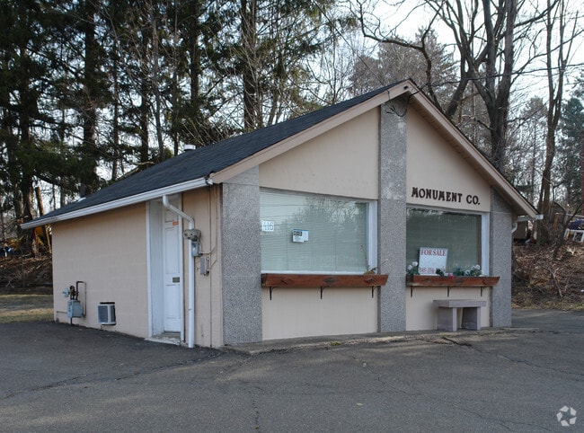
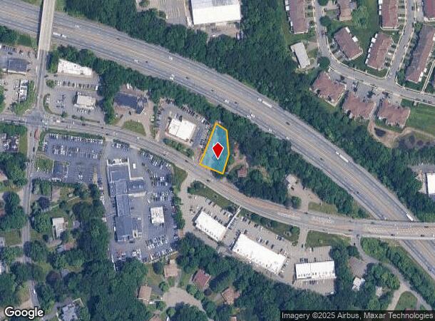
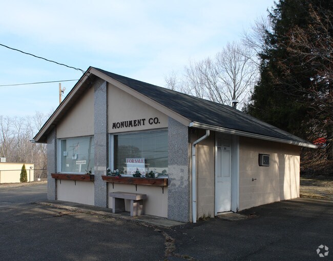
Property Record
416 Route 59, Airmont, NY 10952
NEARBY LISTINGS FOR SALE OR LEASE
Property Detail
416 Route 59
392621-056-010-0001-005-000-0000
Rockland
Officebuilding
New York
X
5.0
36087C0152G
0.32 AC
2023
Ramapo
2024
Northern New Jersey
012505
New York-Jersey City-White Plains, NY-NJ
1,879 SF
DEMOGRAPHICS near 416 Route 59
1 Mile
3 Mile
5 Mile
2024 Total Population
13,958
125,734
231,630
2029 Population
13,877
125,138
230,849
Pop Growth 2024-2029
(0.58%)
(0.47%)
(0.34%)
Average Age
29
32
36
2024 Total Households
3,048
32,974
67,979
HH Growth 2024-2029
(0.52%)
(0.42%)
(0.29%)
Median Household Inc
$65,329
$79,277
$98,968
Avg Household Size
4.10
3.60
3.20
2024 Avg HH Vehicles
1.00
2.00
2.00
Median Home Value
$798,085
$624,024
$605,593
Median Year Built
1986
1974
1974
Nearby Places
- Restaurants
- Banks
- Shops
- Fitness
- Groceries
PUBLIC TRANSPORTATION
COMMUTER RAIL
Spring Valley (Pascack Valley Line - NJ Transit Commuter Rail (NJ Transit))
DRIVE
WALK
Distance
Spring Valley (Pascack Valley Line - NJ Transit Commuter Rail (NJ Transit))
4 min
2.5 mi
Mahwah (Bergen County/Port Jervis Line - NJ Transit Commuter Rail (NJ Transit), Main/Port Jervis Line - NJ Transit Commuter Rail (NJ Transit))
DRIVE
WALK
Distance
Mahwah (Bergen County/Port Jervis Line - NJ Transit Commuter Rail (NJ Transit), Main/Port Jervis Line - NJ Transit Commuter Rail (NJ Transit))
8 min
4.9 mi
AIRPORT
Westchester County
DRIVE
WALK
Distance
Westchester County
38 min
27.0 mi
LaGuardia
DRIVE
WALK
Distance
LaGuardia
54 min
36.4 mi
New York Stewart International
DRIVE
WALK
Distance
New York Stewart International
51 min
39.0 mi
Freight Ports
Port Newark Container Terminal
DRIVE
WALK
Distance
Port Newark Container Terminal
53 min
38.7 mi
SALE & LEASE HISTORY
LISTING DATE
SALE/LEASE

Sep 24, 2020
For Lease
Nearby Properties
Address
Land Use
TOTAL SIZE
Lot Size
Zoning
Address
Land Use
TOTAL SIZE
Lot Size
Zoning
609,540 SF
174.09 AC
R-50
Address
Land Use
TOTAL SIZE
Lot Size
Zoning
539,911 SF
38.80 AC
05
Address
Land Use
TOTAL SIZE
Lot Size
Zoning
219,765 SF
29.88 AC
07
Address
Land Use
TOTAL SIZE
Lot Size
Zoning
76,083 SF
0.96 AC
05
Address
Land Use
TOTAL SIZE
Lot Size
Zoning
290,428 SF
35.56 AC
R35
Address
Land Use
TOTAL SIZE
Lot Size
Zoning
859,490 SF
49.12 AC
PI
Address
Land Use
TOTAL SIZE
Lot Size
Zoning
70,527 SF
10.20 AC
RSH
Address
Land Use
TOTAL SIZE
Lot Size
Zoning
275,724 SF
40 AC
R1
Address
Land Use
TOTAL SIZE
Lot Size
Zoning
38,056 SF
21.21 AC
R-15C
Address
Land Use
TOTAL SIZE
Lot Size
Zoning
1,547 SF
6.60 AC
Address
Land Use
TOTAL SIZE
Lot Size
Zoning
282,001 SF
49.29 AC
RR50
Address
Land Use
TOTAL SIZE
Lot Size
Zoning
243,977 SF
27.29 AC
R40
Address
Land Use
TOTAL SIZE
Lot Size
Zoning
148,712 SF
34.01 AC
PLI
Address
Land Use
TOTAL SIZE
Lot Size
Zoning
338,337 SF
21.12 AC
05
Address
Land Use
TOTAL SIZE
Lot Size
Zoning
227,607 SF
12.99 AC
RSH
Address
Land Use
TOTAL SIZE
Lot Size
Zoning
1,315 SF
8 AC
R5
Address
Land Use
TOTAL SIZE
Lot Size
Zoning
35,648 SF
10 AC
NS
Address
Land Use
TOTAL SIZE
Lot Size
Zoning
5.50 AC
R15
Address
Land Use
TOTAL SIZE
Lot Size
Zoning
91,625 SF
7.12 AC
R-15C
Address
Land Use
TOTAL SIZE
Lot Size
Zoning
149,965 SF
26.04 AC
R35
Address
Land Use
TOTAL SIZE
Lot Size
Zoning
99,420 SF
3.90 AC
LI
Address
Land Use
TOTAL SIZE
Lot Size
Zoning
110,145 SF
7.16 AC
R-35
Address
Land Use
TOTAL SIZE
Lot Size
Zoning
183,010 SF
15.30 AC
05
Address
Land Use
TOTAL SIZE
Lot Size
Zoning
Address
Land Use
TOTAL SIZE
Lot Size
Zoning
574,462 SF
124.73 AC
05
Address
Land Use
TOTAL SIZE
Lot Size
Zoning
82,192 SF
10.77 AC
05
Address
Land Use
TOTAL SIZE
Lot Size
Zoning
110,400 SF
6.16 AC
RSH
Address
Land Use
TOTAL SIZE
Lot Size
Zoning
146,244 SF
10.49 AC
RSH
Address
Land Use
TOTAL SIZE
Lot Size
Zoning
169,145 SF
8.70 AC
R-15
Address
Land Use
TOTAL SIZE
Lot Size
Zoning
144,385 SF
20.68 AC
R-25
The World's #1 Commercial Real Estate Marketplace
Connect with us
© 2025 CoStar Group
The information above has been obtained from sources believed reliable. While we do not doubt its accuracy we have not verified it and make no guarantee, warranty or representation about it. It is your responsibility to independently confirm its accuracy and completeness. Any projections, opinions, assumptions, or estimates used are for example only and do not represent the current or future performance of the property. The value of this transaction to you depends on tax and other factors which should be evaluated by your tax, financial, and legal advisors. You and your advisors should conduct a careful, independent investigation of the property to determine to your satisfaction the suitability of the property for your needs.