Property Record
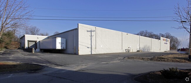
416 Southbridge St, Auburn, MA 01501


NEARBY LISTINGS FOR SALE OR LEASE
Property Detail
416 Southbridge St
AUBU-000032-000000-000002
Worcester
Departmentstore
Massachusetts
X
2
25027C0804E
4.25 AC
2025
Worcester Metro
2025
Boston
736300
Worcester, MA-CT
44,023 SF
DEMOGRAPHICS near 416 Southbridge St
1 Mile
3 Mile
5 Mile
2024 Total Population
5,871
37,340
151,937
2029 Population
5,878
37,103
150,147
Pop Growth 2024-2029
+ 0.12%
(0.63%)
(1.18%)
Average Age
42
40
39
2024 Total Households
2,295
13,705
58,781
HH Growth 2024-2029
+ 0.04%
(0.63%)
(1.12%)
Median Household Inc
$111,097
$84,961
$63,067
Avg Household Size
2.50
2.40
2.40
2024 Avg HH Vehicles
2.00
2.00
1.00
Median Home Value
$330,666
$324,432
$323,818
Median Year Built
1957
1956
1950
Nearby Places
Map Layers
Map Styles
 Street
 Aerial
- Restaurants
- Banks
- Shops
- Fitness
- Groceries
PUBLIC TRANSPORTATION
COMMUTER RAIL
DRIVE
WALK
Distance
9 min
5.1 mi
Worcester (Framingham/Worcester Line - Massachusetts Bay Transportation Authority Commuter Rail (Purple Line))
DRIVE
WALK
Distance
Worcester (Framingham/Worcester Line - Massachusetts Bay Transportation Authority Commuter Rail (Purple Line))
9 min
5.4 mi
AIRPORT
Worcester Regional
DRIVE
WALK
Distance
Worcester Regional
17 min
7.0 mi
SALE & LEASE HISTORY
LISTING DATE
SALE/LEASE

May 15, 2018
For Lease
Nearby Properties
Address
Land Use
TOTAL SIZE
Lot Size
Zoning
Address
Land Use
TOTAL SIZE
Lot Size
Zoning
142.98 AC
Address
Land Use
TOTAL SIZE
Lot Size
Zoning
25,000 SF
99.10 AC
MG-.5
Address
Land Use
TOTAL SIZE
Lot Size
Zoning
1,760 SF
105.54 AC
ML10
Address
Land Use
TOTAL SIZE
Lot Size
Zoning
164,378 SF
21.40 AC
Address
Land Use
TOTAL SIZE
Lot Size
Zoning
69.46 AC
RS-7
Address
Land Use
TOTAL SIZE
Lot Size
Zoning
159,355 SF
207.62 AC
RL-7
Address
Land Use
TOTAL SIZE
Lot Size
Zoning
118,112 SF
6.54 AC
Address
Land Use
TOTAL SIZE
Lot Size
Zoning
41.84 AC
Address
Land Use
TOTAL SIZE
Lot Size
Zoning
36.67 AC
Address
Land Use
TOTAL SIZE
Lot Size
Zoning
279,977 SF
17.80 AC
Address
Land Use
TOTAL SIZE
Lot Size
Zoning
200 SF
50.14 AC
MG-2
Address
Land Use
TOTAL SIZE
Lot Size
Zoning
14.66 AC
BG-2
Address
Land Use
TOTAL SIZE
Lot Size
Zoning
92,604 SF
1 AC
Address
Land Use
TOTAL SIZE
Lot Size
Zoning
210,001 SF
13.14 AC
Address
Land Use
TOTAL SIZE
Lot Size
Zoning
70,400 SF
17.10 AC
Address
Land Use
TOTAL SIZE
Lot Size
Zoning
8.77 AC
BL-1
Address
Land Use
TOTAL SIZE
Lot Size
Zoning
13,417 SF
28.90 AC
MG-.5
Address
Land Use
TOTAL SIZE
Lot Size
Zoning
93,548 SF
1.43 AC
BL-1
Address
Land Use
TOTAL SIZE
Lot Size
Zoning
169,822 SF
18.80 AC
RL-7
Address
Land Use
TOTAL SIZE
Lot Size
Zoning
21.72 AC
Address
Land Use
TOTAL SIZE
Lot Size
Zoning
29.34 AC
RS-7
Address
Land Use
TOTAL SIZE
Lot Size
Zoning
124,100 SF
5.03 AC
RG-5
Address
Land Use
TOTAL SIZE
Lot Size
Zoning
199,424 SF
12.97 AC
ML-.5
Address
Land Use
TOTAL SIZE
Lot Size
Zoning
4.51 AC
RS-7
Address
Land Use
TOTAL SIZE
Lot Size
Zoning
116,919 SF
17.60 AC
Address
Land Use
TOTAL SIZE
Lot Size
Zoning
67,814 SF
10.52 AC
ML20
Address
Land Use
TOTAL SIZE
Lot Size
Zoning
42.81 AC
Address
Land Use
TOTAL SIZE
Lot Size
Zoning
2.62 AC
RG-5
Address
Land Use
TOTAL SIZE
Lot Size
Zoning
107,484 SF
11.70 AC
The World's #1 Commercial Real Estate Marketplace
Connect with us
© 2025 CoStar Group
The information above has been obtained from sources believed reliable. While we do not doubt its accuracy we have not verified it and make no guarantee, warranty or representation about it. It is your responsibility to independently confirm its accuracy and completeness. Any projections, opinions, assumptions, or estimates used are for example only and do not represent the current or future performance of the property. The value of this transaction to you depends on tax and other factors which should be evaluated by your tax, financial, and legal advisors. You and your advisors should conduct a careful, independent investigation of the property to determine to your satisfaction the suitability of the property for your needs.