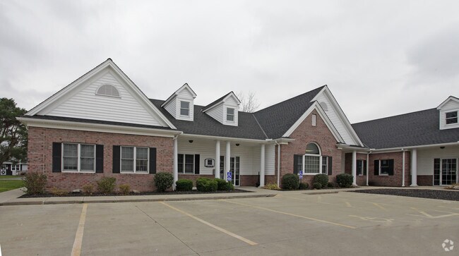
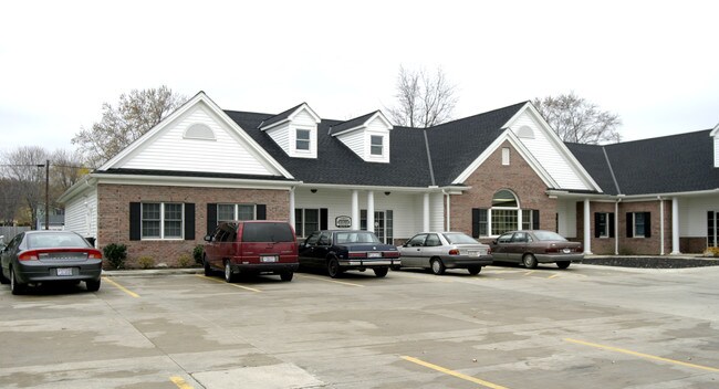
Property Record
41641 N Bridge Dr, Elyria, OH 44035
NEARBY LISTINGS FOR SALE OR LEASE
-
-
View all Elyria listings for sale on LoopNet.com
Property Detail
41641 N Bridge Dr
Cleveland-Elyria, OH
Henderson Colorado Industrial Developmen
02-00-051-142-033
18.00 X 150.74 LAND CONTRACT 1/12/21
Commercialnec
Lorain
X
Ohio
39093C0108E
0.15 AC
2024
Lorain County
2024
Cleveland
070600
DEMOGRAPHICS near 41641 N Bridge Dr
1 Mile
3 Mile
5 Mile
2024 Total Population
3,183
44,231
145,219
2029 Population
3,315
46,139
151,400
Pop Growth 2024-2029
+ 4.15%
+ 4.31%
+ 4.26%
Average Age
42
41
40
2024 Total Households
1,328
18,320
60,226
HH Growth 2024-2029
+ 4.14%
+ 4.26%
+ 4.23%
Median Household Inc
$41,701
$43,029
$49,823
Avg Household Size
2.30
2.30
2.30
2024 Avg HH Vehicles
2.00
2.00
2.00
Median Home Value
$116,430
$115,119
$138,196
Median Year Built
1958
1960
1962
Nearby Places
Map Layers
Map Styles
 Street
 Aerial
- Restaurants
- Banks
- Shops
- Fitness
- Groceries
PUBLIC TRANSPORTATION
AIRPORT
Cleveland-Hopkins International
DRIVE
WALK
Distance
Cleveland-Hopkins International
36 min
20.7 mi
Freight Ports
Port of Toledo
DRIVE
WALK
Distance
Port of Toledo
112 min
89.9 mi
Nearby Properties
Address
Land Use
TOTAL SIZE
Lot Size
Zoning
Address
Land Use
TOTAL SIZE
Lot Size
Zoning
83,865 SF
6.94 AC
Address
Land Use
TOTAL SIZE
Lot Size
Zoning
87,851 SF
15.44 AC
Address
Land Use
TOTAL SIZE
Lot Size
Zoning
41,684 SF
3.51 AC
Address
Land Use
TOTAL SIZE
Lot Size
Zoning
53,266 SF
3 AC
Address
Land Use
TOTAL SIZE
Lot Size
Zoning
53,266 SF
13.30 AC
Address
Land Use
TOTAL SIZE
Lot Size
Zoning
52,392 SF
2.71 AC
Address
Land Use
TOTAL SIZE
Lot Size
Zoning
41,372 SF
2.42 AC
Address
Land Use
TOTAL SIZE
Lot Size
Zoning
43,773 SF
3.41 AC
Address
Land Use
TOTAL SIZE
Lot Size
Zoning
48,951 SF
15.71 AC
Address
Land Use
TOTAL SIZE
Lot Size
Zoning
53,266 SF
12.90 AC
Address
Land Use
TOTAL SIZE
Lot Size
Zoning
115,497 SF
0.93 AC
Address
Land Use
TOTAL SIZE
Lot Size
Zoning
118,800 SF
1.01 AC
Address
Land Use
TOTAL SIZE
Lot Size
Zoning
1,887 SF
435.37 AC
Address
Land Use
TOTAL SIZE
Lot Size
Zoning
52,602 SF
9.31 AC
Address
Land Use
TOTAL SIZE
Lot Size
Zoning
46,708 SF
8.56 AC
Address
Land Use
TOTAL SIZE
Lot Size
Zoning
79,705 SF
1.60 AC
Address
Land Use
TOTAL SIZE
Lot Size
Zoning
99,979 SF
3.54 AC
Address
Land Use
TOTAL SIZE
Lot Size
Zoning
52,176 SF
0.31 AC
Address
Land Use
TOTAL SIZE
Lot Size
Zoning
25,923 SF
5.16 AC
Address
Land Use
TOTAL SIZE
Lot Size
Zoning
235,786 SF
12.06 AC
Address
Land Use
TOTAL SIZE
Lot Size
Zoning
29,029 SF
6.71 AC
Address
Land Use
TOTAL SIZE
Lot Size
Zoning
19,655 SF
0.56 AC
Address
Land Use
TOTAL SIZE
Lot Size
Zoning
127,750 SF
8.37 AC
Address
Land Use
TOTAL SIZE
Lot Size
Zoning
25,056 SF
0.17 AC
Address
Land Use
TOTAL SIZE
Lot Size
Zoning
107,175 SF
3.30 AC
Address
Land Use
TOTAL SIZE
Lot Size
Zoning
3,992 SF
17.13 AC
Address
Land Use
TOTAL SIZE
Lot Size
Zoning
30,133 SF
45.59 AC
Address
Land Use
TOTAL SIZE
Lot Size
Zoning
21,332 SF
2.16 AC
Address
Land Use
TOTAL SIZE
Lot Size
Zoning
16,844 SF
2.32 AC
Address
Land Use
TOTAL SIZE
Lot Size
Zoning
29,681 SF
3.62 AC
The World's #1 Commercial Real Estate Marketplace
Connect with us
© 2026 CoStar Group
The information above has been obtained from sources believed reliable. While we do not doubt its accuracy we have not verified it and make no guarantee, warranty or representation about it. It is your responsibility to independently confirm its accuracy and completeness. Any projections, opinions, assumptions, or estimates used are for example only and do not represent the current or future performance of the property. The value of this transaction to you depends on tax and other factors which should be evaluated by your tax, financial, and legal advisors. You and your advisors should conduct a careful, independent investigation of the property to determine to your satisfaction the suitability of the property for your needs.