Property Record
4847 Us Highway 180 W, Breckenridge, TX 76424

NEARBY LISTINGS FOR SALE OR LEASE
-
-
View all Breckenridge listings for sale on LoopNet.com
Property Detail
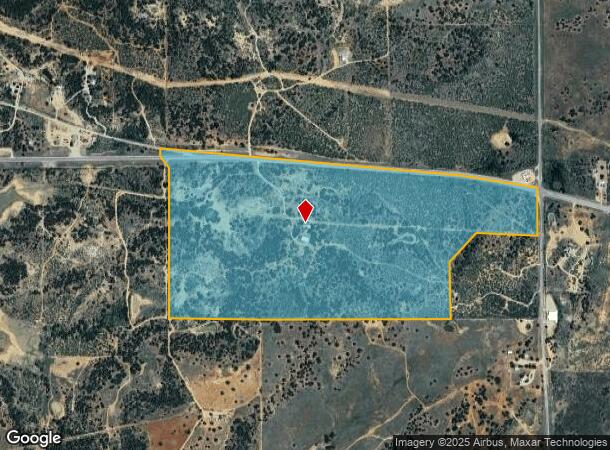
4847 Us Highway 180 W
R21091
BLK: 8 ABSTRACT: 2644
Agriculturalland
Stephens
2025
Texas
2025
192.17 AC
950500
Central Texas Area
2,760 SF
Other Market Areas
DEMOGRAPHICS near 4847 Us Highway 180 W
1 Mile
3 Mile
5 Mile
2024 Total Population
22
1,578
6,872
2029 Population
22
1,564
6,889
Pop Growth 2024-2029
0.00%
(0.89%)
+ 0.25%
Average Age
48
46
41
2024 Total Households
10
685
2,753
HH Growth 2024-2029
(10.00%)
(0.58%)
+ 0.36%
Median Household Inc
$32,500
$51,547
$45,887
Avg Household Size
2.00
2.30
2.50
2024 Avg HH Vehicles
2.00
2.00
2.00
Median Home Value
$87,499
$204,286
$89,380
Median Year Built
1971
1976
1971
Nearby Places
Map Layers
Map Styles
 Street
 Aerial
- Restaurants
- Banks
- Shops
- Fitness
- Groceries
SALE & LEASE HISTORY
LISTING DATE
SALE/LEASE

Jul 24, 2017
For Sale
Nearby Properties
Address
Land Use
TOTAL SIZE
Lot Size
Zoning
Address
Land Use
TOTAL SIZE
Lot Size
Zoning
70,515 SF
8.47 AC
Address
Land Use
TOTAL SIZE
Lot Size
Zoning
47,204 SF
4.86 AC
Address
Land Use
TOTAL SIZE
Lot Size
Zoning
25,330 SF
5.37 AC
Address
Land Use
TOTAL SIZE
Lot Size
Zoning
18,322 SF
3.69 AC
Address
Land Use
TOTAL SIZE
Lot Size
Zoning
8,908 SF
1.82 AC
Address
Land Use
TOTAL SIZE
Lot Size
Zoning
12,400 SF
5 AC
Address
Land Use
TOTAL SIZE
Lot Size
Zoning
16,100 SF
3.40 AC
Address
Land Use
TOTAL SIZE
Lot Size
Zoning
13,328 SF
5.22 AC
Address
Land Use
TOTAL SIZE
Lot Size
Zoning
4,673 SF
0.98 AC
Address
Land Use
TOTAL SIZE
Lot Size
Zoning
6,240 SF
3 AC
Address
Land Use
TOTAL SIZE
Lot Size
Zoning
17,760 SF
3.06 AC
Address
Land Use
TOTAL SIZE
Lot Size
Zoning
3,668 SF
26.06 AC
Address
Land Use
TOTAL SIZE
Lot Size
Zoning
8,877 SF
2.33 AC
Address
Land Use
TOTAL SIZE
Lot Size
Zoning
29,425 SF
3.65 AC
Address
Land Use
TOTAL SIZE
Lot Size
Zoning
22,000 SF
3.84 AC
Address
Land Use
TOTAL SIZE
Lot Size
Zoning
3,646 SF
1.36 AC
Address
Land Use
TOTAL SIZE
Lot Size
Zoning
3,510 SF
108.59 AC
Address
Land Use
TOTAL SIZE
Lot Size
Zoning
4,134 SF
1.70 AC
Address
Land Use
TOTAL SIZE
Lot Size
Zoning
Address
Land Use
TOTAL SIZE
Lot Size
Zoning
3,411 SF
1.03 AC
Address
Land Use
TOTAL SIZE
Lot Size
Zoning
2,890 SF
7.22 AC
Address
Land Use
TOTAL SIZE
Lot Size
Zoning
2,520 SF
16.40 AC
Address
Land Use
TOTAL SIZE
Lot Size
Zoning
2,512 SF
4.91 AC
Address
Land Use
TOTAL SIZE
Lot Size
Zoning
2,965 SF
27.17 AC
Address
Land Use
TOTAL SIZE
Lot Size
Zoning
3,503 SF
7 AC
Address
Land Use
TOTAL SIZE
Lot Size
Zoning
2,135 SF
10 AC
Address
Land Use
TOTAL SIZE
Lot Size
Zoning
3,672 SF
5.38 AC
Address
Land Use
TOTAL SIZE
Lot Size
Zoning
1,861 SF
6.49 AC
Address
Land Use
TOTAL SIZE
Lot Size
Zoning
4,471 SF
6.69 AC
Address
Land Use
TOTAL SIZE
Lot Size
Zoning
5,280 SF
9.82 AC
The World's #1 Commercial Real Estate Marketplace
Connect with us
© 2026 CoStar Group
The information above has been obtained from sources believed reliable. While we do not doubt its accuracy we have not verified it and make no guarantee, warranty or representation about it. It is your responsibility to independently confirm its accuracy and completeness. Any projections, opinions, assumptions, or estimates used are for example only and do not represent the current or future performance of the property. The value of this transaction to you depends on tax and other factors which should be evaluated by your tax, financial, and legal advisors. You and your advisors should conduct a careful, independent investigation of the property to determine to your satisfaction the suitability of the property for your needs.