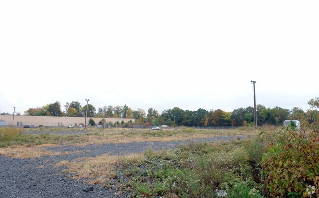
Property Record
4175 Stonecroft Blvd, Chantilly, VA 20151


NEARBY LISTINGS FOR SALE OR LEASE
Property Detail
4175 Stonecroft Blvd
Washington-Arlington-Alexandria, DC-VA-MD-WV
Westfax Llc Land
0343-01-0001D
WESTFAX LLC LAND PCL B2
Vehiclerentalsvehiclesales
Fairfax
X
Virginia
51107C0390E
1d
2024
9.86 AC
2025
Route 28 Corridor South
490104
Washington, DC
53,477 SF
DEMOGRAPHICS near 4175 Stonecroft Blvd
1 Mile
3 Mile
5 Mile
2024 Total Population
2,923
52,481
198,016
2029 Population
2,862
52,898
198,840
Pop Growth 2024-2029
(2.09%)
+ 0.79%
+ 0.42%
Average Age
36
38
37
2024 Total Households
856
16,653
67,328
HH Growth 2024-2029
(2.34%)
+ 0.58%
+ 0.27%
Median Household Inc
$101,228
$155,448
$145,454
Avg Household Size
3.20
3.10
2.90
2024 Avg HH Vehicles
2.00
2.00
2.00
Median Home Value
$425,477
$642,381
$663,740
Median Year Built
1986
1990
1994
Nearby Places
Map Layers
Map Styles
 Street
 Aerial
- Restaurants
- Banks
- Shops
- Fitness
- Groceries
PUBLIC TRANSPORTATION
AIRPORT
Washington Dulles International
DRIVE
WALK
Distance
Washington Dulles International
18 min
4.2 mi
Ronald Reagan Washington Ntl
DRIVE
WALK
Distance
Ronald Reagan Washington Ntl
43 min
28.2 mi
Freight Ports
Port of Baltimore
DRIVE
WALK
Distance
Port of Baltimore
87 min
63.8 mi
Nearby Properties
Address
Land Use
TOTAL SIZE
Lot Size
Zoning
Address
Land Use
TOTAL SIZE
Lot Size
Zoning
760,000 SF
2,461.49 AC
110
Address
Land Use
TOTAL SIZE
Lot Size
Zoning
1,030,157 SF
47.95 AC
550
Address
Land Use
TOTAL SIZE
Lot Size
Zoning
778,426 SF
48.02 AC
CLI
Address
Land Use
TOTAL SIZE
Lot Size
Zoning
440,870 SF
47.69 AC
550
Address
Land Use
TOTAL SIZE
Lot Size
Zoning
274,000 SF
82.17 AC
PDGI
Address
Land Use
TOTAL SIZE
Lot Size
Zoning
3,419,876 SF
64.12 AC
530
Address
Land Use
TOTAL SIZE
Lot Size
Zoning
1,049,614 SF
67.73 AC
596
Address
Land Use
TOTAL SIZE
Lot Size
Zoning
520,500 SF
7.29 AC
400
Address
Land Use
TOTAL SIZE
Lot Size
Zoning
451,000 SF
7.50 AC
550
Address
Land Use
TOTAL SIZE
Lot Size
Zoning
325,000 SF
22.05 AC
550
Address
Land Use
TOTAL SIZE
Lot Size
Zoning
507,264 SF
10.44 AC
400
Address
Land Use
TOTAL SIZE
Lot Size
Zoning
507,280 SF
50.06 AC
530
Address
Land Use
TOTAL SIZE
Lot Size
Zoning
423,718 SF
26.11 AC
596
Address
Land Use
TOTAL SIZE
Lot Size
Zoning
513,947 SF
22.23 AC
400
Address
Land Use
TOTAL SIZE
Lot Size
Zoning
387,620 SF
6.01 AC
350
Address
Land Use
TOTAL SIZE
Lot Size
Zoning
398,828 SF
3.77 AC
350
Address
Land Use
TOTAL SIZE
Lot Size
Zoning
382,440 SF
3.85 AC
350
Address
Land Use
TOTAL SIZE
Lot Size
Zoning
508,026 SF
43.41 AC
PDGI
Address
Land Use
TOTAL SIZE
Lot Size
Zoning
348,187 SF
40.06 AC
530
Address
Land Use
TOTAL SIZE
Lot Size
Zoning
453,939 SF
17.70 AC
320
Address
Land Use
TOTAL SIZE
Lot Size
Zoning
315,098 SF
15.09 AC
596
Address
Land Use
TOTAL SIZE
Lot Size
Zoning
263,312 SF
10.89 AC
303
Address
Land Use
TOTAL SIZE
Lot Size
Zoning
248,146 SF
12.44 AC
540
Address
Land Use
TOTAL SIZE
Lot Size
Zoning
265,828 SF
17.81 AC
530
Address
Land Use
TOTAL SIZE
Lot Size
Zoning
145,409 SF
11.62 AC
540
Address
Land Use
TOTAL SIZE
Lot Size
Zoning
368,206 SF
22.50 AC
550
Address
Land Use
TOTAL SIZE
Lot Size
Zoning
293,514 SF
10.90 AC
540
Address
Land Use
TOTAL SIZE
Lot Size
Zoning
178,723 SF
32.94 AC
550
Address
Land Use
TOTAL SIZE
Lot Size
Zoning
71,552 SF
127.91 AC
596
Address
Land Use
TOTAL SIZE
Lot Size
Zoning
192,875 SF
20.99 AC
400
The World's #1 Commercial Real Estate Marketplace
Connect with us
© 2025 CoStar Group
The information above has been obtained from sources believed reliable. While we do not doubt its accuracy we have not verified it and make no guarantee, warranty or representation about it. It is your responsibility to independently confirm its accuracy and completeness. Any projections, opinions, assumptions, or estimates used are for example only and do not represent the current or future performance of the property. The value of this transaction to you depends on tax and other factors which should be evaluated by your tax, financial, and legal advisors. You and your advisors should conduct a careful, independent investigation of the property to determine to your satisfaction the suitability of the property for your needs.