Property Record
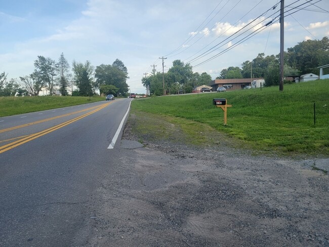
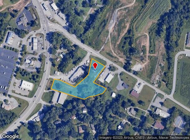
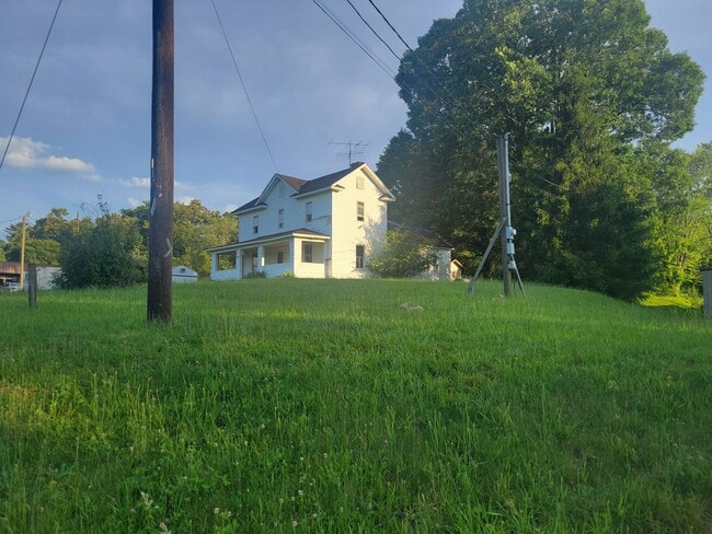
4178 Haywood Rd, Mills River, NC 28759
This Property Is For Sale
NEARBY LISTINGS FOR SALE OR LEASE
Property Detail
4178 Haywood Rd
Asheville
Henderson
Asheville, NC
North Carolina
9631745617
2.10 AC
Sfr
Henderson County
2,047 SF
DEMOGRAPHICS near 4178 Haywood Rd
1 Mile
3 Mile
5 Mile
2024 Total Population
1,373
10,624
32,510
2029 Population
1,426
10,955
33,518
Pop Growth 2024-2029
+ 3.86%
+ 3.12%
+ 3.10%
Average Age
45
44
45
2024 Total Households
551
4,091
13,385
HH Growth 2024-2029
+ 3.81%
+ 3.23%
+ 3.07%
Median Household Inc
$73,032
$83,836
$71,946
Avg Household Size
2.50
2.60
2.40
2024 Avg HH Vehicles
2.00
2.00
2.00
Median Home Value
$354,304
$352,658
$331,151
Median Year Built
1989
1992
1991
Nearby Places
- Restaurants
- Banks
- Shops
- Fitness
- Groceries
PUBLIC TRANSPORTATION
AIRPORT
Asheville Regional
DRIVE
WALK
Distance
Asheville Regional
7 min
4.8 mi
Freight Ports
North Charleston Terminal
DRIVE
WALK
Distance
North Charleston Terminal
277 min
246.2 mi
Nearby Properties
Address
Land Use
TOTAL SIZE
Lot Size
Zoning
Address
Land Use
TOTAL SIZE
Lot Size
Zoning
58,200 SF
121.14 AC
10003355~R
Address
Land Use
TOTAL SIZE
Lot Size
Zoning
21.70 AC
10005690~M
Address
Land Use
TOTAL SIZE
Lot Size
Zoning
365,659 SF
38.28 AC
9958527~M-
Address
Land Use
TOTAL SIZE
Lot Size
Zoning
14,704 SF
3.31 AC
10007972~M
Address
Land Use
TOTAL SIZE
Lot Size
Zoning
3,000 SF
48.13 AC
10010496~M
Address
Land Use
TOTAL SIZE
Lot Size
Zoning
77,152 SF
13.84 AC
9933538~MR
Address
Land Use
TOTAL SIZE
Lot Size
Zoning
112,100 SF
14.22 AC
9975597~MR
Address
Land Use
TOTAL SIZE
Lot Size
Zoning
83,741 SF
24.39 AC
9959040~MR
Address
Land Use
TOTAL SIZE
Lot Size
Zoning
178,825 SF
25.05 AC
1016341~MR
Address
Land Use
TOTAL SIZE
Lot Size
Zoning
237,185 SF
17.57 AC
9962196~MR
Address
Land Use
TOTAL SIZE
Lot Size
Zoning
3,190 SF
21.46 AC
1016340~MR
Address
Land Use
TOTAL SIZE
Lot Size
Zoning
22,929 SF
330.47 AC
10004441~R
Address
Land Use
TOTAL SIZE
Lot Size
Zoning
90,000 SF
9.43 AC
1001311~MR
Address
Land Use
TOTAL SIZE
Lot Size
Zoning
47,129 SF
42.82 AC
10005418~M
Address
Land Use
TOTAL SIZE
Lot Size
Zoning
12.51 AC
1018240~MR
Address
Land Use
TOTAL SIZE
Lot Size
Zoning
142,457 SF
40.51 AC
1016823~MR
Address
Land Use
TOTAL SIZE
Lot Size
Zoning
7.74 AC
10010785~M
Address
Land Use
TOTAL SIZE
Lot Size
Zoning
118,800 SF
19.15 AC
9975228~MR
Address
Land Use
TOTAL SIZE
Lot Size
Zoning
22,685 SF
6.97 AC
1016853~MR
Address
Land Use
TOTAL SIZE
Lot Size
Zoning
30,771 SF
5.57 AC
9947305~MR
Address
Land Use
TOTAL SIZE
Lot Size
Zoning
23,307 SF
183.97 AC
9933591~MR
Address
Land Use
TOTAL SIZE
Lot Size
Zoning
12.40 AC
10008589~M
Address
Land Use
TOTAL SIZE
Lot Size
Zoning
82,202 SF
9.95 AC
10001357~M
Address
Land Use
TOTAL SIZE
Lot Size
Zoning
75,600 SF
14.13 AC
802157~MR-
Address
Land Use
TOTAL SIZE
Lot Size
Zoning
89,796 SF
12.96 AC
9962193~MR
Address
Land Use
TOTAL SIZE
Lot Size
Zoning
33,162 SF
7.52 AC
10002967~M
Address
Land Use
TOTAL SIZE
Lot Size
Zoning
35,046 SF
8.14 AC
10009290~M
Address
Land Use
TOTAL SIZE
Lot Size
Zoning
30,138 SF
7.66 AC
1017727~MR
Address
Land Use
TOTAL SIZE
Lot Size
Zoning
107,550 SF
10.25 AC
9962194~MR
Address
Land Use
TOTAL SIZE
Lot Size
Zoning
42,126 SF
4.56 AC
10005927~M
The World's #1 Commercial Real Estate Marketplace
Connect with us
© 2025 CoStar Group
The information above has been obtained from sources believed reliable. While we do not doubt its accuracy we have not verified it and make no guarantee, warranty or representation about it. It is your responsibility to independently confirm its accuracy and completeness. Any projections, opinions, assumptions, or estimates used are for example only and do not represent the current or future performance of the property. The value of this transaction to you depends on tax and other factors which should be evaluated by your tax, financial, and legal advisors. You and your advisors should conduct a careful, independent investigation of the property to determine to your satisfaction the suitability of the property for your needs.