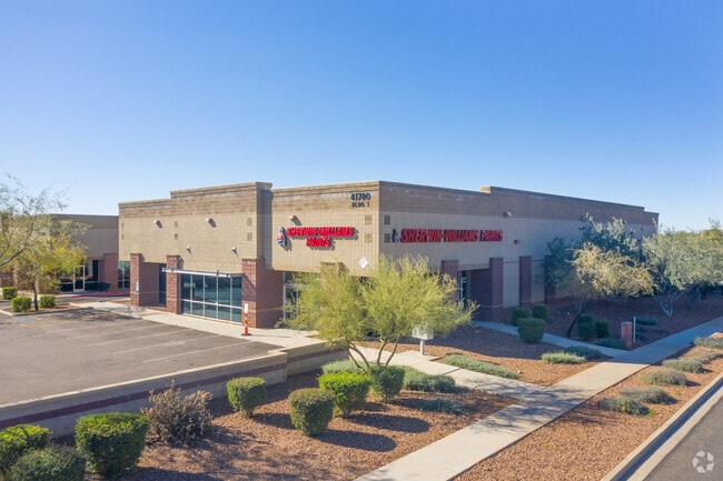
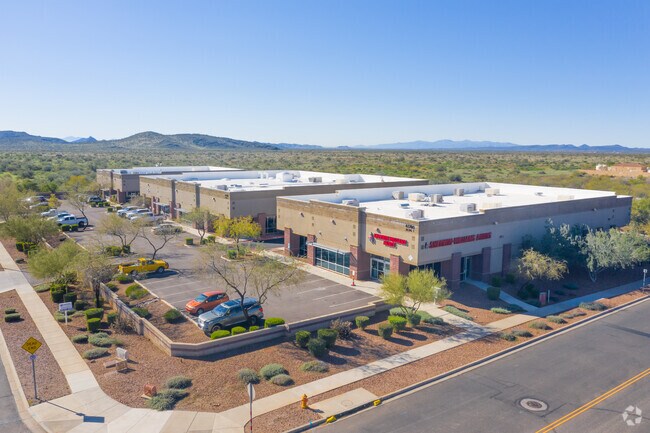
Property Record
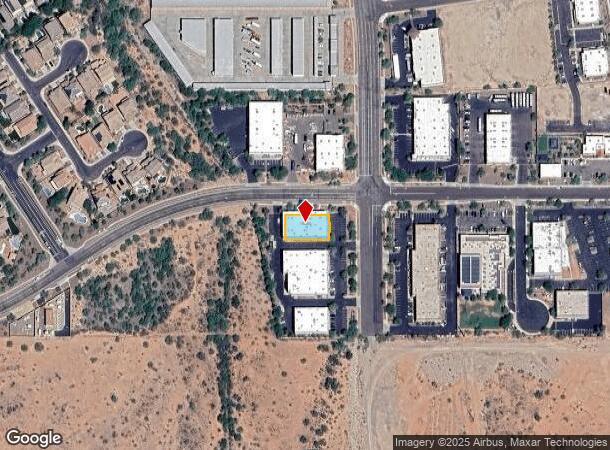
41780 N Vision Way, Phoenix, AZ 85086

Current Lease Availabilities
NEARBY LISTINGS FOR SALE OR LEASE
Property Detail
41780 N Vision Way
Phoenix-Mesa-Scottsdale, AZ
Anthem Commerce Park Lot 31 Industrial C
203-03-715
ANTHEM COMMERCE PARK LOT 31 INDUSTRIAL CONDO MCR 721-21
Warehouse
Maricopa
X
Arizona
04013C0835L
31
2025
0.27 AC
2025
Deer Vly/Pinnacle Pk
610002
Phoenix
11,414 SF
DEMOGRAPHICS near 41780 N Vision Way
1 Mile
3 Mile
5 Mile
2024 Total Population
7,155
27,647
44,290
2029 Population
7,715
29,826
47,822
Pop Growth 2024-2029
+ 7.83%
+ 7.88%
+ 7.97%
Average Age
38
42
42
2024 Total Households
2,340
9,250
15,398
HH Growth 2024-2029
+ 7.82%
+ 7.85%
+ 7.95%
Median Household Inc
$103,797
$112,201
$112,941
Avg Household Size
2.90
2.80
2.70
2024 Avg HH Vehicles
2.00
2.00
2.00
Median Home Value
$387,356
$454,735
$463,826
Median Year Built
2005
2004
2004
Nearby Places
Map Layers
Map Styles
 Street
 Aerial
- Restaurants
- Banks
- Shops
- Fitness
- Groceries
PUBLIC TRANSPORTATION
AIRPORT
Phoenix Sky Harbor International
DRIVE
WALK
Distance
Phoenix Sky Harbor International
48 min
37.5 mi
Nearby Properties
Address
Land Use
TOTAL SIZE
Lot Size
Zoning
Address
Land Use
TOTAL SIZE
Lot Size
Zoning
41.99 AC
Address
Land Use
TOTAL SIZE
Lot Size
Zoning
306,185 SF
60 AC
R-2
Address
Land Use
TOTAL SIZE
Lot Size
Zoning
324,653 SF
48.16 AC
C-C
Address
Land Use
TOTAL SIZE
Lot Size
Zoning
390,032 SF
19.70 AC
M-H
Address
Land Use
TOTAL SIZE
Lot Size
Zoning
208,981 SF
22.09 AC
C-C
Address
Land Use
TOTAL SIZE
Lot Size
Zoning
86,142 SF
16.03 AC
R-7
Address
Land Use
TOTAL SIZE
Lot Size
Zoning
84,515 SF
14.14 AC
R-7
Address
Land Use
TOTAL SIZE
Lot Size
Zoning
11,982 SF
1.01 AC
I-L
Address
Land Use
TOTAL SIZE
Lot Size
Zoning
10.25 AC
C2
Address
Land Use
TOTAL SIZE
Lot Size
Zoning
113,519 SF
12.18 AC
C-C
Address
Land Use
TOTAL SIZE
Lot Size
Zoning
79,802 SF
15 AC
R-6
Address
Land Use
TOTAL SIZE
Lot Size
Zoning
144,316 SF
6.40 AC
C-T
Address
Land Use
TOTAL SIZE
Lot Size
Zoning
54,866 SF
9.50 AC
C-C
Address
Land Use
TOTAL SIZE
Lot Size
Zoning
57,601 SF
8.16 AC
RU43
Address
Land Use
TOTAL SIZE
Lot Size
Zoning
119,647 SF
8.70 AC
R-8
Address
Land Use
TOTAL SIZE
Lot Size
Zoning
77,274 SF
7.34 AC
C-C
Address
Land Use
TOTAL SIZE
Lot Size
Zoning
119,810 SF
7.50 AC
C-T
Address
Land Use
TOTAL SIZE
Lot Size
Zoning
15,854 SF
24.69 AC
R-8
Address
Land Use
TOTAL SIZE
Lot Size
Zoning
53,242 SF
4.54 AC
C-C
Address
Land Use
TOTAL SIZE
Lot Size
Zoning
44,055 SF
4.54 AC
C2
Address
Land Use
TOTAL SIZE
Lot Size
Zoning
44,502 SF
2.17 AC
C-C
Address
Land Use
TOTAL SIZE
Lot Size
Zoning
24,469 SF
3.53 AC
R-43AG
Address
Land Use
TOTAL SIZE
Lot Size
Zoning
35,503 SF
14.48 AC
C-C
Address
Land Use
TOTAL SIZE
Lot Size
Zoning
69,802 SF
5.21 AC
C-C
Address
Land Use
TOTAL SIZE
Lot Size
Zoning
18,486 SF
4.76 AC
R-7
Address
Land Use
TOTAL SIZE
Lot Size
Zoning
32,729 SF
4.10 AC
C-C
Address
Land Use
TOTAL SIZE
Lot Size
Zoning
31,077 SF
5.33 AC
C-C
Address
Land Use
TOTAL SIZE
Lot Size
Zoning
361 SF
51.66 AC
R-43AG
Address
Land Use
TOTAL SIZE
Lot Size
Zoning
20,782 SF
2.57 AC
C-T
Address
Land Use
TOTAL SIZE
Lot Size
Zoning
59,400 SF
2.50 AC
C-C
The World's #1 Commercial Real Estate Marketplace
Connect with us
© 2026 CoStar Group
The information above has been obtained from sources believed reliable. While we do not doubt its accuracy we have not verified it and make no guarantee, warranty or representation about it. It is your responsibility to independently confirm its accuracy and completeness. Any projections, opinions, assumptions, or estimates used are for example only and do not represent the current or future performance of the property. The value of this transaction to you depends on tax and other factors which should be evaluated by your tax, financial, and legal advisors. You and your advisors should conduct a careful, independent investigation of the property to determine to your satisfaction the suitability of the property for your needs.