Property Record
418 E Hines Hill Rd, Hudson, OH 44236
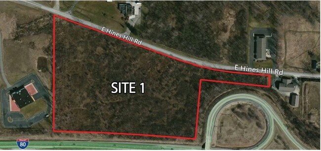

Property Detail
418 E Hines Hill Rd
Akron, OH
ALNOLA FARMS SUBDIVISION PT LOTS 26 30 58-64 ALL OF LOTS 15- 25 27-29 PB 30 PG 41-43 PT VAC STREETS 17.7313 AC
13-00975
Summit
Officebuilding
Ohio
B and X Area of moderate flood hazard, usually the area between the limits of the 100-year and 500-year floods.
30
2023
17.83 AC
2025
Akron
532600
Cleveland
44,697 SF
NEARBY LISTINGS FOR SALE OR LEASE
DEMOGRAPHICS near 418 E Hines Hill Rd
1 mile
3 mile
5 mile
2025 Total Population
821
15,789
50,814
2030 Population
818
15,775
50,620
Pop Growth 2025-2030
(0.37%)
(0.09%)
(0.38%)
Average Age
43
43
43
2025 Total Households
292
5,830
19,634
HH Growth 2025-2030
(0.34%)
+ 0.02%
(0.34%)
Median Household Inc
$162,931
$152,546
$126,613
Avg Household Size
2.80
2.70
2.50
2025 Avg HH Vehicles
3.00
2.00
2.00
Median Home Value
$490,677
$414,899
$360,842
Median Year Built
1986
1993
1984
Nearby Places
Map Layers
Map Styles
 Street
 Aerial
Transit
 Traffic
 Biking
Places
Listings with unknown addresses are not visible on the map
- Restaurants
- Banks
- Shops
- Fitness
- Groceries
PUBLIC TRANSPORTATION
COMMUTER RAIL
Boston Mill (National Park Scenic Railway - Cuyahoga Valley Scenic Railroad)
Drive
Walk
Distance
Boston Mill (National Park Scenic Railway - Cuyahoga Valley Scenic Railroad)
8 min
4.0 mi
Peninsula Depot (Lock 29) (National Park Scenic Railway - Cuyahoga Valley Scenic Railroad)
Drive
Walk
Distance
Peninsula Depot (Lock 29) (National Park Scenic Railway - Cuyahoga Valley Scenic Railroad)
10 min
5.9 mi
AIRPORT
Akron-Canton Regional
Drive
Walk
Distance
Akron-Canton Regional
36 min
27.2 mi
Cleveland-Hopkins International
Drive
Walk
Distance
Cleveland-Hopkins International
40 min
29.1 mi
Freight Ports
Port of Toledo
Drive
Walk
Distance
Port of Toledo
144 min
123.6 mi
Nearby Properties
Address
Land Use
TOTAL SIZE
Lot Size
Zoning
Address
Land Use
TOTAL SIZE
Lot Size
Zoning
Address
Land Use
TOTAL SIZE
Lot Size
Zoning
439,460 SF
146.63 AC
Address
Land Use
TOTAL SIZE
Lot Size
Zoning
1,020,250 SF
63.69 AC
Address
Land Use
TOTAL SIZE
Lot Size
Zoning
Address
Land Use
TOTAL SIZE
Lot Size
Zoning
230,501 SF
39.59 AC
Address
Land Use
TOTAL SIZE
Lot Size
Zoning
110,681 SF
6.85 AC
Address
Land Use
TOTAL SIZE
Lot Size
Zoning
69,972 SF
15 AC
Address
Land Use
TOTAL SIZE
Lot Size
Zoning
178.21 AC
Address
Land Use
TOTAL SIZE
Lot Size
Zoning
258,840 SF
25.62 AC
Address
Land Use
TOTAL SIZE
Lot Size
Zoning
136,800 SF
7.86 AC
Address
Land Use
TOTAL SIZE
Lot Size
Zoning
107,836 SF
9.08 AC
Address
Land Use
TOTAL SIZE
Lot Size
Zoning
Address
Land Use
TOTAL SIZE
Lot Size
Zoning
41,480 SF
7.09 AC
Address
Land Use
TOTAL SIZE
Lot Size
Zoning
111,766 SF
32.18 AC
Address
Land Use
TOTAL SIZE
Lot Size
Zoning
14,247 SF
262 AC
Address
Land Use
TOTAL SIZE
Lot Size
Zoning
179,862 SF
15.81 AC
Address
Land Use
TOTAL SIZE
Lot Size
Zoning
99,702 SF
10.86 AC
Address
Land Use
TOTAL SIZE
Lot Size
Zoning
41,774 SF
31.40 AC
Address
Land Use
TOTAL SIZE
Lot Size
Zoning
Address
Land Use
TOTAL SIZE
Lot Size
Zoning
Address
Land Use
TOTAL SIZE
Lot Size
Zoning
254,000 SF
20 AC
Address
Land Use
TOTAL SIZE
Lot Size
Zoning
147,780 SF
15.31 AC
Address
Land Use
TOTAL SIZE
Lot Size
Zoning
171,464 SF
20.64 AC
Address
Land Use
TOTAL SIZE
Lot Size
Zoning
148,800 SF
13.63 AC
Address
Land Use
TOTAL SIZE
Lot Size
Zoning
156,357 SF
11.55 AC
Address
Land Use
TOTAL SIZE
Lot Size
Zoning
146,666 SF
13.52 AC
Address
Land Use
TOTAL SIZE
Lot Size
Zoning
42,040 SF
7.45 AC
Address
Land Use
TOTAL SIZE
Lot Size
Zoning
174,000 SF
20.02 AC
Address
Land Use
TOTAL SIZE
Lot Size
Zoning
266,952 SF
13.15 AC
The World's #1 Commercial Real Estate Marketplace
Connect with us
© 2026 CoStar Group
The information above has been obtained from sources believed reliable. While we do not doubt its accuracy we have not verified it and make no guarantee, warranty or representation about it. It is your responsibility to independently confirm its accuracy and completeness. Any projections, opinions, assumptions, or estimates used are for example only and do not represent the current or future performance of the property. The value of this transaction to you depends on tax and other factors which should be evaluated by your tax, financial, and legal advisors. You and your advisors should conduct a careful, independent investigation of the property to determine to your satisfaction the suitability of the property for your needs.