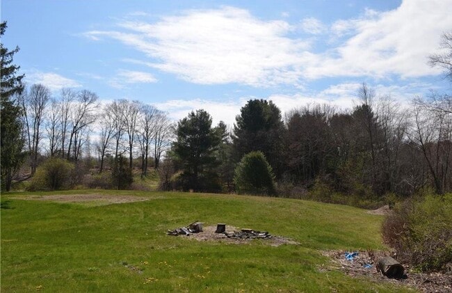
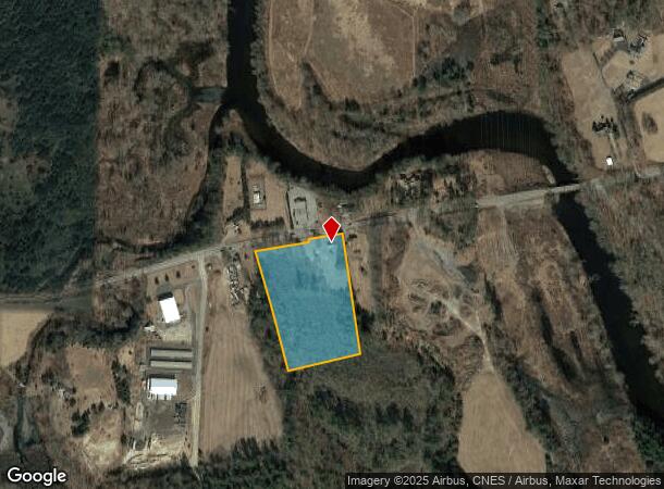
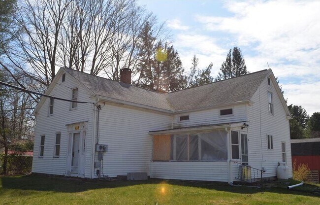
Property Record
418 Killingly Rd, Pomfret Center, CT 06259
NEARBY LISTINGS FOR SALE OR LEASE
Property Detail
418 Killingly Rd
POMF-000036-F000000-000004
Windham
Sfr
Connecticut
AE
4.00
09015C0231F
6.49 AC
2025
Windham County
2025
Hartford
902500
Willimantic, CT
1,574 SF
DEMOGRAPHICS near 418 Killingly Rd
1 mile
3 mile
5 mile
2024 Total Population
526
6,412
26,416
2029 Population
521
6,337
26,382
Pop Growth 2024-2029
(0.95%)
(1.17%)
(0.13%)
Average Age
42
42
42
2024 Total Households
205
2,543
10,598
HH Growth 2024-2029
(0.98%)
(1.14%)
(0.10%)
Median Household Inc
$80,637
$77,451
$73,713
Avg Household Size
2.50
2.40
2.30
2024 Avg HH Vehicles
2.00
2.00
2.00
Median Home Value
$338,983
$276,908
$247,350
Median Year Built
1971
1972
1967
Nearby Places
Map Layers
Map Styles
 Street
 Aerial
Transit
 Traffic
 Biking
Places
Listings with unknown addresses are not visible on the map
- Restaurants
- Banks
- Shops
- Fitness
- Groceries
PUBLIC TRANSPORTATION
AIRPORT
Rhode Island Tf Green International
Drive
Walk
Distance
Rhode Island Tf Green International
50 min
33.3 mi
Worcester Regional
Drive
Walk
Distance
Worcester Regional
50 min
35.8 mi
Freight Ports
Port of Davisville, RI
Drive
Walk
Distance
Port of Davisville, RI
61 min
42.6 mi
SALE & LEASE HISTORY
LISTING DATE
SALE/LEASE

Jun 01, 2020
For Sale
Jan 08, 2019
For Sale
Nearby Properties
Address
Land Use
TOTAL SIZE
Lot Size
Zoning
Address
Land Use
TOTAL SIZE
Lot Size
Zoning
141.59 AC
RD
Address
Land Use
TOTAL SIZE
Lot Size
Zoning
86 AC
LD
Address
Land Use
TOTAL SIZE
Lot Size
Zoning
203,150 SF
21 AC
LD
Address
Land Use
TOTAL SIZE
Lot Size
Zoning
Address
Land Use
TOTAL SIZE
Lot Size
Zoning
62 AC
LD
Address
Land Use
TOTAL SIZE
Lot Size
Zoning
47 AC
MUI
Address
Land Use
TOTAL SIZE
Lot Size
Zoning
447,300 SF
32.08 AC
I
Address
Land Use
TOTAL SIZE
Lot Size
Zoning
139,010 SF
16.75 AC
MUI
Address
Land Use
TOTAL SIZE
Lot Size
Zoning
307,858 SF
52 AC
I
Address
Land Use
TOTAL SIZE
Lot Size
Zoning
227 AC
LD
Address
Land Use
TOTAL SIZE
Lot Size
Zoning
29.78 AC
I
Address
Land Use
TOTAL SIZE
Lot Size
Zoning
169.79 AC
ALZ.L
Address
Land Use
TOTAL SIZE
Lot Size
Zoning
126,601 SF
13.40 AC
MUI
Address
Land Use
TOTAL SIZE
Lot Size
Zoning
210,670 SF
20.74 AC
I
Address
Land Use
TOTAL SIZE
Lot Size
Zoning
864 SF
50 AC
VC/LD
Address
Land Use
TOTAL SIZE
Lot Size
Zoning
6.61 AC
MUI
Address
Land Use
TOTAL SIZE
Lot Size
Zoning
65,888 SF
9.40 AC
RR
Address
Land Use
TOTAL SIZE
Lot Size
Zoning
20,644 SF
80.30 AC
AG-2
Address
Land Use
TOTAL SIZE
Lot Size
Zoning
7.07 AC
GC
Address
Land Use
TOTAL SIZE
Lot Size
Zoning
9.09 AC
I
Address
Land Use
TOTAL SIZE
Lot Size
Zoning
27.10 AC
BV/CB
Address
Land Use
TOTAL SIZE
Lot Size
Zoning
10.50 AC
GC
Address
Land Use
TOTAL SIZE
Lot Size
Zoning
40,240 SF
1.84 AC
GC
Address
Land Use
TOTAL SIZE
Lot Size
Zoning
85,301 SF
47.97 AC
I
Address
Land Use
TOTAL SIZE
Lot Size
Zoning
12,982 SF
1.54 AC
GC
Address
Land Use
TOTAL SIZE
Lot Size
Zoning
48,032 SF
9.40 AC
LD
Address
Land Use
TOTAL SIZE
Lot Size
Zoning
15 AC
I
Address
Land Use
TOTAL SIZE
Lot Size
Zoning
74,072 SF
8 AC
I
Address
Land Use
TOTAL SIZE
Lot Size
Zoning
45,960 SF
1.40 AC
MD
Address
Land Use
TOTAL SIZE
Lot Size
Zoning
7,808 SF
6.90 AC
I
The World's #1 Commercial Real Estate Marketplace
Connect with us
© 2026 CoStar Group
The information above has been obtained from sources believed reliable. While we do not doubt its accuracy we have not verified it and make no guarantee, warranty or representation about it. It is your responsibility to independently confirm its accuracy and completeness. Any projections, opinions, assumptions, or estimates used are for example only and do not represent the current or future performance of the property. The value of this transaction to you depends on tax and other factors which should be evaluated by your tax, financial, and legal advisors. You and your advisors should conduct a careful, independent investigation of the property to determine to your satisfaction the suitability of the property for your needs.