Property Record
418 Starratt Rd, Jacksonville, FL 32218


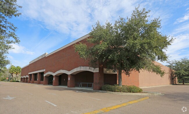

Property Detail
418 Starratt Rd
106636-0010
1-7 37-1N-27E 5.903 JOHN BROWARD GRANT PT NE1/4 SEC 10,PT SE1/4 SEC 7 RECD O/R 10164-1252 (EX PT RW REC O/R 14275-98 BEING PARCEL 101)
Regionalshoppingcenterormallwithanchorstore
Duval
PUD
Florida
AE The base floodplain where base flood elevations are provided. AE Zones are now used on new format FIRMs instead of A1-A30 Zones.
5.91 AC
2025
Northeast Jacksonville
2026
Jacksonville (Florida)
010204
Jacksonville, FL
42,919 SF
NEARBY LISTINGS FOR SALE OR LEASE
DEMOGRAPHICS near 418 Starratt Rd
1 mile
3 mile
5 mile
2025 Total Population
7,490
35,251
72,131
2030 Population
8,057
37,766
77,003
Pop Growth 2025-2030
+ 7.57%
+ 7.13%
+ 6.75%
Average Age
37
38
38
2025 Total Households
2,757
13,487
26,899
HH Growth 2025-2030
+ 7.94%
+ 7.65%
+ 7.16%
Median Household Inc
$75,681
$82,743
$78,625
Avg Household Size
2.70
2.60
2.60
2025 Avg HH Vehicles
2.00
2.00
2.00
Median Home Value
$277,474
$316,030
$324,959
Median Year Built
2004
2004
2002
Nearby Places
Map Layers
Map Styles
 Street
 Aerial
Layers
 Traffic
 Biking
Places
Listings with unknown addresses are not visible on the map
- Restaurants
- Banks
- Shops
- Fitness
- Groceries
PUBLIC TRANSPORTATION
AIRPORT
Jacksonville International
Drive
Walk
Distance
Jacksonville International
13 min
5.3 mi
SALE & LEASE HISTORY
LISTING DATE
SALE/LEASE

Sep 26, 2016
For Lease
Mar 30, 2017
For Lease
Dec 05, 2017
For Lease
Nearby Properties
Address
Land Use
TOTAL SIZE
Lot Size
Zoning
Address
Land Use
TOTAL SIZE
Lot Size
Zoning
344,800 SF
35.11 AC
PUD
Address
Land Use
TOTAL SIZE
Lot Size
Zoning
608,297 SF
49.09 AC
IBP
Address
Land Use
TOTAL SIZE
Lot Size
Zoning
371,466 SF
42.67 AC
PUD
Address
Land Use
TOTAL SIZE
Lot Size
Zoning
226,421 SF
1.89 AC
PUD
Address
Land Use
TOTAL SIZE
Lot Size
Zoning
846,897 SF
47.02 AC
PUD
Address
Land Use
TOTAL SIZE
Lot Size
Zoning
403,103 SF
31.05 AC
PUD
Address
Land Use
TOTAL SIZE
Lot Size
Zoning
201,630 SF
21.59 AC
PUD
Address
Land Use
TOTAL SIZE
Lot Size
Zoning
307,351 SF
34.25 AC
PUD
Address
Land Use
TOTAL SIZE
Lot Size
Zoning
328,039 SF
18.88 AC
PUD
Address
Land Use
TOTAL SIZE
Lot Size
Zoning
240,988 SF
18.11 AC
PUD
Address
Land Use
TOTAL SIZE
Lot Size
Zoning
556,862 SF
27.25 AC
IL
Address
Land Use
TOTAL SIZE
Lot Size
Zoning
210,341 SF
8.84 AC
PUD
Address
Land Use
TOTAL SIZE
Lot Size
Zoning
237,807 SF
13.52 AC
CRO
Address
Land Use
TOTAL SIZE
Lot Size
Zoning
640,660 SF
28.30 AC
PUD
Address
Land Use
TOTAL SIZE
Lot Size
Zoning
317,695 SF
15.88 AC
PUD
Address
Land Use
TOTAL SIZE
Lot Size
Zoning
317,815 SF
17.56 AC
PUD
Address
Land Use
TOTAL SIZE
Lot Size
Zoning
163,276 SF
8.39 AC
PUD
Address
Land Use
TOTAL SIZE
Lot Size
Zoning
408,384 SF
23.77 AC
IL
Address
Land Use
TOTAL SIZE
Lot Size
Zoning
226,572 SF
9.24 AC
PUD
Address
Land Use
TOTAL SIZE
Lot Size
Zoning
324,922 SF
19.11 AC
PUD
Address
Land Use
TOTAL SIZE
Lot Size
Zoning
336,566 SF
25.63 AC
PUD
Address
Land Use
TOTAL SIZE
Lot Size
Zoning
170,638 SF
10.77 AC
PUD
Address
Land Use
TOTAL SIZE
Lot Size
Zoning
303,200 SF
17.47 AC
IL
Address
Land Use
TOTAL SIZE
Lot Size
Zoning
320,372 SF
18.41 AC
PUD
Address
Land Use
TOTAL SIZE
Lot Size
Zoning
264,117 SF
22.48 AC
PUD
Address
Land Use
TOTAL SIZE
Lot Size
Zoning
321,852 SF
14.82 AC
IL
Address
Land Use
TOTAL SIZE
Lot Size
Zoning
104,353 SF
6.57 AC
CRO
Address
Land Use
TOTAL SIZE
Lot Size
Zoning
171,509 SF
8.81 AC
IL
Address
Land Use
TOTAL SIZE
Lot Size
Zoning
117,647 SF
10.17 AC
PUD
Address
Land Use
TOTAL SIZE
Lot Size
Zoning
201,300 SF
15.83 AC
PUD
The World's #1 Commercial Real Estate Marketplace
Connect with us
© 2026 CoStar Group
The information above has been obtained from sources believed reliable. While we do not doubt its accuracy we have not verified it and make no guarantee, warranty or representation about it. It is your responsibility to independently confirm its accuracy and completeness. Any projections, opinions, assumptions, or estimates used are for example only and do not represent the current or future performance of the property. The value of this transaction to you depends on tax and other factors which should be evaluated by your tax, financial, and legal advisors. You and your advisors should conduct a careful, independent investigation of the property to determine to your satisfaction the suitability of the property for your needs.