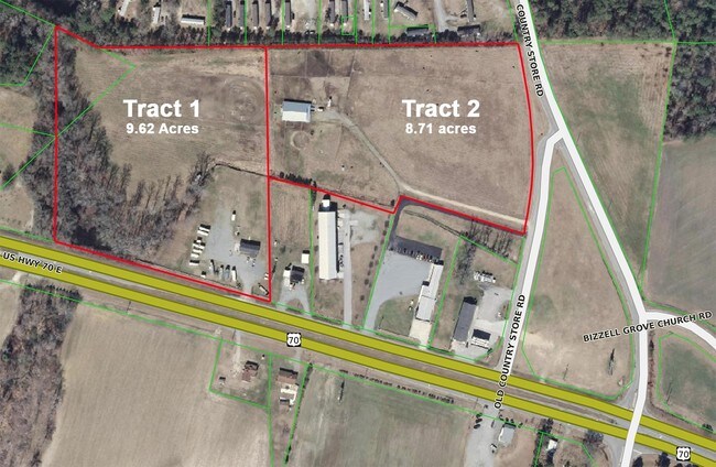
Property Record
4303 Us Highway 70 E, Selma, NC 27576

NEARBY LISTINGS FOR SALE OR LEASE
Property Detail
4303 Us Highway 70 E
12N11018
PEEDIN 262300-11
Realpropertynec
Johnston
X
North Carolina
3720262200K
8.72 AC
2025
Johnston County
2025
Raleigh/Durham
040301
Raleigh-Cary, NC
DEMOGRAPHICS near 4303 Us Highway 70 E
1 mile
3 mile
5 mile
2024 Total Population
735
6,714
19,382
2029 Population
889
8,113
23,491
Pop Growth 2024-2029
+ 20.95%
+ 20.84%
+ 21.20%
Average Age
38
39
39
2024 Total Households
281
2,553
7,449
HH Growth 2024-2029
+ 21.35%
+ 21.03%
+ 21.32%
Median Household Inc
$58,888
$68,133
$52,532
Avg Household Size
2.60
2.60
2.60
2024 Avg HH Vehicles
2.00
3.00
2.00
Median Home Value
$141,911
$163,930
$163,580
Median Year Built
1989
1990
1985
Nearby Places
Map Layers
Map Styles
 Street
 Aerial
Transit
 Traffic
 Biking
Places
Listings with unknown addresses are not visible on the map
- Restaurants
- Banks
- Shops
- Fitness
- Groceries
PUBLIC TRANSPORTATION
COMMUTER RAIL
Selma (Carolinian - Amtrak, Palmetto - Amtrak)
Drive
Walk
Distance
Selma (Carolinian - Amtrak, Palmetto - Amtrak)
9 min
5.0 mi
Freight Ports
Port of Wilmington
Drive
Walk
Distance
Port of Wilmington
136 min
107.9 mi
SALE & LEASE HISTORY
LISTING DATE
SALE/LEASE

Apr 05, 2017
For Sale
Nearby Properties
Address
Land Use
TOTAL SIZE
Lot Size
Zoning
Address
Land Use
TOTAL SIZE
Lot Size
Zoning
134,742 SF
8.20 AC
IND
Address
Land Use
TOTAL SIZE
Lot Size
Zoning
54,009 SF
2.08 AC
COM
Address
Land Use
TOTAL SIZE
Lot Size
Zoning
41.27 AC
IND
Address
Land Use
TOTAL SIZE
Lot Size
Zoning
20,602 SF
4.52 AC
COM
Address
Land Use
TOTAL SIZE
Lot Size
Zoning
19,854 SF
7.86 AC
COM
Address
Land Use
TOTAL SIZE
Lot Size
Zoning
34.19 AC
IND
Address
Land Use
TOTAL SIZE
Lot Size
Zoning
20,730 SF
7.77 AC
COM
Address
Land Use
TOTAL SIZE
Lot Size
Zoning
1,176 SF
87.07 AC
IND
Address
Land Use
TOTAL SIZE
Lot Size
Zoning
9,462 SF
17.64 AC
COM
Address
Land Use
TOTAL SIZE
Lot Size
Zoning
840 SF
22.74 AC
MHP
Address
Land Use
TOTAL SIZE
Lot Size
Zoning
10,640 SF
1.86 AC
RES
Address
Land Use
TOTAL SIZE
Lot Size
Zoning
46,830 SF
22.60 AC
IND
Address
Land Use
TOTAL SIZE
Lot Size
Zoning
1,402 SF
264.41 AC
MHP
Address
Land Use
TOTAL SIZE
Lot Size
Zoning
37,320 SF
6.32 AC
IND
Address
Land Use
TOTAL SIZE
Lot Size
Zoning
2,800 SF
13.40 AC
COM
Address
Land Use
TOTAL SIZE
Lot Size
Zoning
2,200 SF
17.33 AC
MHP
Address
Land Use
TOTAL SIZE
Lot Size
Zoning
27.63 AC
IND
Address
Land Use
TOTAL SIZE
Lot Size
Zoning
2,994 SF
33.62 AC
RAG
Address
Land Use
TOTAL SIZE
Lot Size
Zoning
15.76 AC
IND
Address
Land Use
TOTAL SIZE
Lot Size
Zoning
40,940 SF
3.54 AC
IND
Address
Land Use
TOTAL SIZE
Lot Size
Zoning
26,000 SF
2.82 AC
COM
Address
Land Use
TOTAL SIZE
Lot Size
Zoning
32,374 SF
26.45 AC
COW
Address
Land Use
TOTAL SIZE
Lot Size
Zoning
14,848 SF
3.17 AC
RAG
Address
Land Use
TOTAL SIZE
Lot Size
Zoning
12,151 SF
1.46 AC
RES
Address
Land Use
TOTAL SIZE
Lot Size
Zoning
1,551 SF
2.50 AC
RES
Address
Land Use
TOTAL SIZE
Lot Size
Zoning
8,925 SF
7.64 AC
RAG
Address
Land Use
TOTAL SIZE
Lot Size
Zoning
5,688 SF
77.86 AC
COM
Address
Land Use
TOTAL SIZE
Lot Size
Zoning
6,216 SF
12.83 AC
RAG
Address
Land Use
TOTAL SIZE
Lot Size
Zoning
1,826 SF
112.98 AC
COM
Address
Land Use
TOTAL SIZE
Lot Size
Zoning
1,512 SF
1.16 AC
COM
The World's #1 Commercial Real Estate Marketplace
Connect with us
© 2026 CoStar Group
The information above has been obtained from sources believed reliable. While we do not doubt its accuracy we have not verified it and make no guarantee, warranty or representation about it. It is your responsibility to independently confirm its accuracy and completeness. Any projections, opinions, assumptions, or estimates used are for example only and do not represent the current or future performance of the property. The value of this transaction to you depends on tax and other factors which should be evaluated by your tax, financial, and legal advisors. You and your advisors should conduct a careful, independent investigation of the property to determine to your satisfaction the suitability of the property for your needs.