Property Record
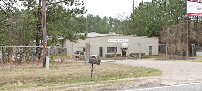
4188 Belair Frontage Rd, Augusta, GA 30909


Property Detail
4188 Belair Frontage Rd
080-006C
TRACT A & B 5.00 ACS; CREATIVE MARBLE
Officebuilding
Columbia
B and X Area of moderate flood hazard, usually the area between the limits of the 100-year and 500-year floods.
Georgia
2025
5 AC
2025
Outlying Columbia County
030505
Augusta/Richmond County
7,350 SF
Augusta-Richmond County, GA-SC
NEARBY LISTINGS FOR SALE OR LEASE
DEMOGRAPHICS near 4188 Belair Frontage Rd
1 mile
3 mile
5 mile
2025 Total Population
5,330
55,280
137,118
2030 Population
5,439
56,471
140,384
Pop Growth 2025-2030
+ 2.05%
+ 2.15%
+ 2.38%
Average Age
39
40
40
2025 Total Households
2,414
23,360
54,716
HH Growth 2025-2030
+ 1.91%
+ 2.03%
+ 2.16%
Median Household Inc
$69,037
$70,413
$74,670
Avg Household Size
2.10
2.30
2.40
2025 Avg HH Vehicles
2.00
2.00
2.00
Median Home Value
$234,594
$240,505
$274,670
Median Year Built
1996
1989
1988
Nearby Places
Map Layers
Map Styles
 Street
 Aerial
Layers
 Traffic
 Biking
Places
Listings with unknown addresses are not visible on the map
- Restaurants
- Banks
- Shops
- Fitness
- Groceries
Nearby Properties
Address
Land Use
TOTAL SIZE
Lot Size
Zoning
Address
Land Use
TOTAL SIZE
Lot Size
Zoning
371,617 SF
13.26 AC
B-2
Address
Land Use
TOTAL SIZE
Lot Size
Zoning
4,357 SF
34 AC
R-3B
Address
Land Use
TOTAL SIZE
Lot Size
Zoning
7,216 SF
53.27 AC
B-1 SPEX
Address
Land Use
TOTAL SIZE
Lot Size
Zoning
292,232 SF
39.73 AC
B-2
Address
Land Use
TOTAL SIZE
Lot Size
Zoning
5,541 SF
14.81 AC
B-2
Address
Land Use
TOTAL SIZE
Lot Size
Zoning
4,077 SF
20.88 AC
C-2;GEN CO
Address
Land Use
TOTAL SIZE
Lot Size
Zoning
5,480 SF
19.05 AC
R-3B
Address
Land Use
TOTAL SIZE
Lot Size
Zoning
984 SF
16.18 AC
R-3C
Address
Land Use
TOTAL SIZE
Lot Size
Zoning
3,680 SF
13.42 AC
B-2
Address
Land Use
TOTAL SIZE
Lot Size
Zoning
92,482 SF
14.77 AC
Address
Land Use
TOTAL SIZE
Lot Size
Zoning
3,498 SF
12.61 AC
B-2
Address
Land Use
TOTAL SIZE
Lot Size
Zoning
2,665 SF
11.80 AC
B-2
Address
Land Use
TOTAL SIZE
Lot Size
Zoning
36,755 SF
12.09 AC
B-2
Address
Land Use
TOTAL SIZE
Lot Size
Zoning
61,236 SF
8.09 AC
R-3B
Address
Land Use
TOTAL SIZE
Lot Size
Zoning
952 SF
29 AC
A
Address
Land Use
TOTAL SIZE
Lot Size
Zoning
3,829 SF
35.30 AC
R-3B
Address
Land Use
TOTAL SIZE
Lot Size
Zoning
2,508 SF
14.61 AC
A-R;APARTM
Address
Land Use
TOTAL SIZE
Lot Size
Zoning
997 SF
19.16 AC
Address
Land Use
TOTAL SIZE
Lot Size
Zoning
4,108 SF
14.12 AC
B-2
Address
Land Use
TOTAL SIZE
Lot Size
Zoning
640 SF
12.17 AC
B-1
Address
Land Use
TOTAL SIZE
Lot Size
Zoning
8,640 SF
13.15 AC
R-3B
Address
Land Use
TOTAL SIZE
Lot Size
Zoning
150,263 SF
18.75 AC
PUD
Address
Land Use
TOTAL SIZE
Lot Size
Zoning
112,947 SF
14.91 AC
Address
Land Use
TOTAL SIZE
Lot Size
Zoning
72,381 SF
0.95 AC
Address
Land Use
TOTAL SIZE
Lot Size
Zoning
42,617 SF
40.26 AC
R-1_B-1
Address
Land Use
TOTAL SIZE
Lot Size
Zoning
2,757 SF
19.55 AC
B-2_R-1
Address
Land Use
TOTAL SIZE
Lot Size
Zoning
68,600 SF
20.94 AC
R-3A
Address
Land Use
TOTAL SIZE
Lot Size
Zoning
62,440 SF
5.70 AC
B-2
Address
Land Use
TOTAL SIZE
Lot Size
Zoning
125,466 SF
15.98 AC
B-2
Address
Land Use
TOTAL SIZE
Lot Size
Zoning
11,584 SF
10.34 AC
R-3B
The World's #1 Commercial Real Estate Marketplace
Connect with us
© 2026 CoStar Group
The information above has been obtained from sources believed reliable. While we do not doubt its accuracy we have not verified it and make no guarantee, warranty or representation about it. It is your responsibility to independently confirm its accuracy and completeness. Any projections, opinions, assumptions, or estimates used are for example only and do not represent the current or future performance of the property. The value of this transaction to you depends on tax and other factors which should be evaluated by your tax, financial, and legal advisors. You and your advisors should conduct a careful, independent investigation of the property to determine to your satisfaction the suitability of the property for your needs.