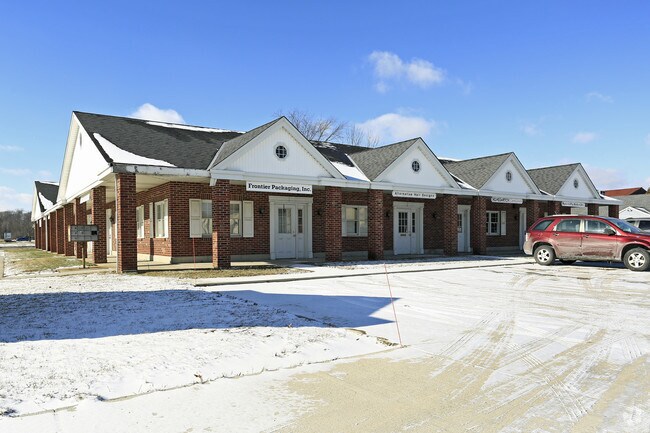
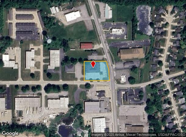
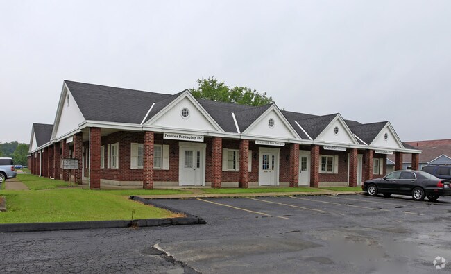
Property Record
419 N Main St, Grafton, OH 44044
Current Lease Availabilities
NEARBY LISTINGS FOR SALE OR LEASE
-
-
View all Grafton listings for lease on LoopNet.com
Property Detail
419 N Main St
11-00-099-000-423
Lorain
Officebuilding
Ohio
X
99
39093C0237D
1 AC
2024
Lorain County
2024
Cleveland
095100
Cleveland-Elyria, OH
7,532 SF
DEMOGRAPHICS near 419 N Main St
1 Mile
3 Mile
5 Mile
2024 Total Population
3,117
9,581
36,185
2029 Population
3,238
9,874
37,518
Pop Growth 2024-2029
+ 3.88%
+ 3.06%
+ 3.68%
Average Age
44
45
43
2024 Total Households
1,073
3,154
13,377
HH Growth 2024-2029
+ 4.29%
+ 3.52%
+ 3.91%
Median Household Inc
$69,865
$74,503
$68,632
Avg Household Size
2.50
2.50
2.40
2024 Avg HH Vehicles
2.00
2.00
2.00
Median Home Value
$224,864
$204,388
$191,768
Median Year Built
1988
1972
1979
Nearby Places
- Restaurants
- Banks
- Shops
- Fitness
- Groceries
PUBLIC TRANSPORTATION
COMMUTER RAIL
Elyria Amtrak (Capitol Limited - Amtrak, Lake Shore Limited - Amtrak)
DRIVE
WALK
Distance
Elyria Amtrak (Capitol Limited - Amtrak, Lake Shore Limited - Amtrak)
10 min
6.9 mi
AIRPORT
Cleveland-Hopkins International
DRIVE
WALK
Distance
Cleveland-Hopkins International
26 min
18.1 mi
Freight Ports
Port of Toledo
DRIVE
WALK
Distance
Port of Toledo
117 min
97.2 mi
Nearby Properties
Address
Land Use
TOTAL SIZE
Lot Size
Zoning
Address
Land Use
TOTAL SIZE
Lot Size
Zoning
347,284 SF
34.50 AC
Address
Land Use
TOTAL SIZE
Lot Size
Zoning
79,531 SF
51.20 AC
Address
Land Use
TOTAL SIZE
Lot Size
Zoning
155,964 SF
15.06 AC
Address
Land Use
TOTAL SIZE
Lot Size
Zoning
6,031 SF
92.10 AC
Address
Land Use
TOTAL SIZE
Lot Size
Zoning
66,690 SF
14 AC
Address
Land Use
TOTAL SIZE
Lot Size
Zoning
72,170 SF
27.60 AC
Address
Land Use
TOTAL SIZE
Lot Size
Zoning
39,212 SF
25 AC
Address
Land Use
TOTAL SIZE
Lot Size
Zoning
16,960 SF
137.91 AC
Address
Land Use
TOTAL SIZE
Lot Size
Zoning
14,696 SF
25 AC
Address
Land Use
TOTAL SIZE
Lot Size
Zoning
12,005 SF
5.66 AC
Address
Land Use
TOTAL SIZE
Lot Size
Zoning
10,126 SF
7.47 AC
Address
Land Use
TOTAL SIZE
Lot Size
Zoning
14,760 SF
3.14 AC
Address
Land Use
TOTAL SIZE
Lot Size
Zoning
15,822 SF
20.01 AC
Address
Land Use
TOTAL SIZE
Lot Size
Zoning
14,804 SF
1.97 AC
Address
Land Use
TOTAL SIZE
Lot Size
Zoning
25,022 SF
5.39 AC
Address
Land Use
TOTAL SIZE
Lot Size
Zoning
11,972 SF
53.87 AC
Address
Land Use
TOTAL SIZE
Lot Size
Zoning
42,140 SF
33.21 AC
Address
Land Use
TOTAL SIZE
Lot Size
Zoning
10,400 SF
0.25 AC
Address
Land Use
TOTAL SIZE
Lot Size
Zoning
13,858 SF
0.11 AC
Address
Land Use
TOTAL SIZE
Lot Size
Zoning
9,180 SF
7.66 AC
Address
Land Use
TOTAL SIZE
Lot Size
Zoning
149.50 AC
Address
Land Use
TOTAL SIZE
Lot Size
Zoning
73.93 AC
Address
Land Use
TOTAL SIZE
Lot Size
Zoning
2,644 SF
145.84 AC
Address
Land Use
TOTAL SIZE
Lot Size
Zoning
1,600 SF
64.44 AC
Address
Land Use
TOTAL SIZE
Lot Size
Zoning
9,363 SF
0.20 AC
Address
Land Use
TOTAL SIZE
Lot Size
Zoning
42,473 SF
4.55 AC
Address
Land Use
TOTAL SIZE
Lot Size
Zoning
0.87 AC
Address
Land Use
TOTAL SIZE
Lot Size
Zoning
5,176 SF
0.31 AC
Address
Land Use
TOTAL SIZE
Lot Size
Zoning
4,124 SF
0.25 AC
Address
Land Use
TOTAL SIZE
Lot Size
Zoning
17,828 SF
1.55 AC
The World's #1 Commercial Real Estate Marketplace
Connect with us
© 2025 CoStar Group
The information above has been obtained from sources believed reliable. While we do not doubt its accuracy we have not verified it and make no guarantee, warranty or representation about it. It is your responsibility to independently confirm its accuracy and completeness. Any projections, opinions, assumptions, or estimates used are for example only and do not represent the current or future performance of the property. The value of this transaction to you depends on tax and other factors which should be evaluated by your tax, financial, and legal advisors. You and your advisors should conduct a careful, independent investigation of the property to determine to your satisfaction the suitability of the property for your needs.