Property Record
419 Main St, Villa Rica, GA 30180

Current Lease Availabilities
NEARBY LISTINGS FOR SALE OR LEASE
Property Detail
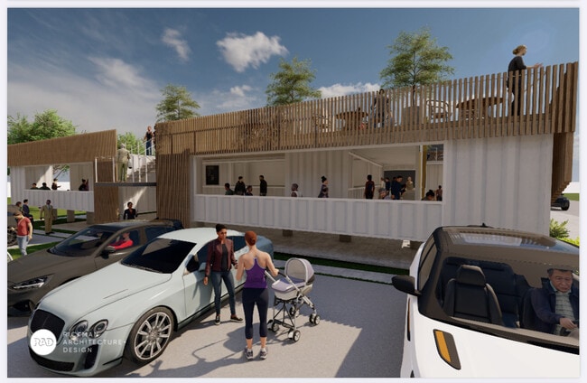
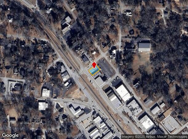
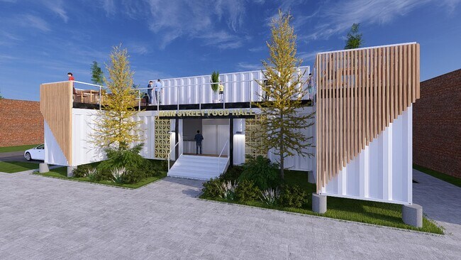
419 Main St
V01-0010003
COMM BLDG/LT/MAIN ST/CHEEVES ST V26
Commercialnec
Carroll
X
Georgia
13097C0106C
0.15 AC
2025
Villa Rica/West Outlying
2025
Atlanta
910101
Atlanta-Sandy Springs-Roswell, GA
3,132 SF
DEMOGRAPHICS near 419 Main St
1 Mile
3 Mile
5 Mile
2024 Total Population
4,308
25,043
40,912
2029 Population
4,846
27,357
44,831
Pop Growth 2024-2029
+ 12.49%
+ 9.24%
+ 9.58%
Average Age
35
37
37
2024 Total Households
1,598
8,967
14,390
HH Growth 2024-2029
+ 12.58%
+ 9.48%
+ 9.73%
Median Household Inc
$56,932
$66,371
$72,164
Avg Household Size
2.60
2.70
2.80
2024 Avg HH Vehicles
2.00
2.00
2.00
Median Home Value
$228,840
$214,967
$215,285
Median Year Built
1997
2002
2001
Nearby Places
- Restaurants
- Banks
- Shops
- Fitness
- Groceries
PUBLIC TRANSPORTATION
AIRPORT
Hartsfield - Jackson Atlanta International
DRIVE
WALK
Distance
Hartsfield - Jackson Atlanta International
54 min
41.3 mi
Nearby Properties
Address
Land Use
TOTAL SIZE
Lot Size
Zoning
Address
Land Use
TOTAL SIZE
Lot Size
Zoning
143,620 SF
12.14 AC
GC
Address
Land Use
TOTAL SIZE
Lot Size
Zoning
54,539 SF
9.68 AC
R14
Address
Land Use
TOTAL SIZE
Lot Size
Zoning
41,677 SF
16.13 AC
A
Address
Land Use
TOTAL SIZE
Lot Size
Zoning
69,664 SF
24.09 AC
R14
Address
Land Use
TOTAL SIZE
Lot Size
Zoning
26.74 AC
GI
Address
Land Use
TOTAL SIZE
Lot Size
Zoning
422,128 SF
36.83 AC
PUD
Address
Land Use
TOTAL SIZE
Lot Size
Zoning
397,150 SF
32.04 AC
PUD
Address
Land Use
TOTAL SIZE
Lot Size
Zoning
583,480 SF
46.54 AC
GI
Address
Land Use
TOTAL SIZE
Lot Size
Zoning
10,990 SF
20.40 AC
R14
Address
Land Use
TOTAL SIZE
Lot Size
Zoning
161,070 SF
12.72 AC
002
Address
Land Use
TOTAL SIZE
Lot Size
Zoning
98,391 SF
6.66 AC
GC
Address
Land Use
TOTAL SIZE
Lot Size
Zoning
211,500 SF
32.04 AC
PUD
Address
Land Use
TOTAL SIZE
Lot Size
Zoning
317,240 SF
30.08 AC
GI
Address
Land Use
TOTAL SIZE
Lot Size
Zoning
28,304 SF
13.83 AC
GC
Address
Land Use
TOTAL SIZE
Lot Size
Zoning
218,660 SF
39.19 AC
GI
Address
Land Use
TOTAL SIZE
Lot Size
Zoning
15,949 SF
9.01 AC
R14
Address
Land Use
TOTAL SIZE
Lot Size
Zoning
164,061 SF
16.96 AC
GC
Address
Land Use
TOTAL SIZE
Lot Size
Zoning
111,860 SF
12.29 AC
Address
Land Use
TOTAL SIZE
Lot Size
Zoning
266,135 SF
25.58 AC
GI
Address
Land Use
TOTAL SIZE
Lot Size
Zoning
266,422 SF
16.35 AC
GI
Address
Land Use
TOTAL SIZE
Lot Size
Zoning
241,500 SF
21.13 AC
GI
Address
Land Use
TOTAL SIZE
Lot Size
Zoning
92,704 SF
40.02 AC
RD
Address
Land Use
TOTAL SIZE
Lot Size
Zoning
30,951 SF
28 AC
R20
Address
Land Use
TOTAL SIZE
Lot Size
Zoning
77,285 SF
11.22 AC
C-
Address
Land Use
TOTAL SIZE
Lot Size
Zoning
11,454 SF
1.77 AC
GC
Address
Land Use
TOTAL SIZE
Lot Size
Zoning
103,129 SF
19.50 AC
GC
Address
Land Use
TOTAL SIZE
Lot Size
Zoning
28,751 SF
6.40 AC
R14
Address
Land Use
TOTAL SIZE
Lot Size
Zoning
7,630 SF
14.27 AC
R14
Address
Land Use
TOTAL SIZE
Lot Size
Zoning
500 SF
5.89 AC
GI
Address
Land Use
TOTAL SIZE
Lot Size
Zoning
47,291 SF
19.48 AC
GC
The World's #1 Commercial Real Estate Marketplace
Connect with us
© 2025 CoStar Group
The information above has been obtained from sources believed reliable. While we do not doubt its accuracy we have not verified it and make no guarantee, warranty or representation about it. It is your responsibility to independently confirm its accuracy and completeness. Any projections, opinions, assumptions, or estimates used are for example only and do not represent the current or future performance of the property. The value of this transaction to you depends on tax and other factors which should be evaluated by your tax, financial, and legal advisors. You and your advisors should conduct a careful, independent investigation of the property to determine to your satisfaction the suitability of the property for your needs.