Property Record
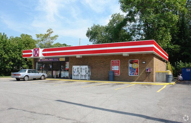
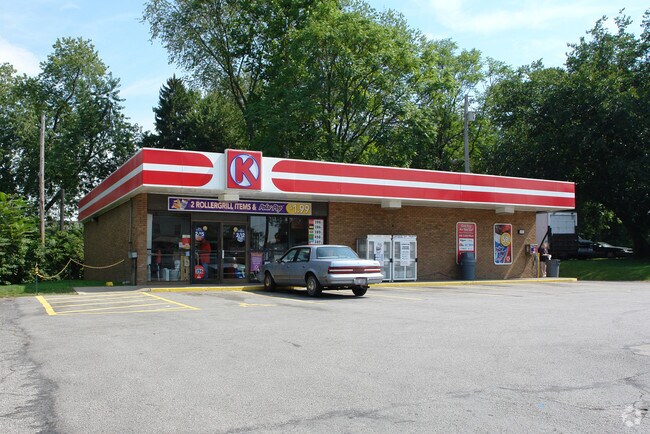
419 S Main St, Niles, OH 44446

Property Detail
419 S Main St
Youngstown-Warren, OH
9 75.00F .2410A PER SURVEY S MAIN ST NILES CITY
25-135721
Trumbull
Servicestationmarket
Ohio
B and X Area of moderate flood hazard, usually the area between the limits of the 100-year and 500-year floods.
190
2025
0.24 AC
2025
Niles
932802
Youngstown/Warren/Boardman
2,562 SF
NEARBY LISTINGS FOR SALE OR LEASE
DEMOGRAPHICS near 419 S Main St
1 mile
3 mile
5 mile
2025 Total Population
5,497
31,614
71,474
2030 Population
5,449
31,353
71,184
Pop Growth 2025-2030
(0.87%)
(0.83%)
(0.41%)
Average Age
40
43
43
2025 Total Households
2,392
14,150
31,515
HH Growth 2025-2030
(1.00%)
(0.86%)
(0.49%)
Median Household Inc
$43,284
$49,409
$48,213
Avg Household Size
2.20
2.20
2.20
2025 Avg HH Vehicles
2.00
2.00
2.00
Median Home Value
$75,383
$127,324
$128,670
Median Year Built
1947
1965
1961
Nearby Places
Map Layers
Map Styles
 Street
 Aerial
Layers
 Traffic
 Biking
Places
Listings with unknown addresses are not visible on the map
- Restaurants
- Banks
- Shops
- Fitness
- Groceries
SALE & LEASE HISTORY
LISTING DATE
SALE/LEASE

Sep 24, 2016
For Sale
Nearby Properties
Address
Land Use
TOTAL SIZE
Lot Size
Zoning
Address
Land Use
TOTAL SIZE
Lot Size
Zoning
676,583 SF
74.92 AC
Address
Land Use
TOTAL SIZE
Lot Size
Zoning
1,582.88 AC
Address
Land Use
TOTAL SIZE
Lot Size
Zoning
19,726 SF
96.24 AC
Address
Land Use
TOTAL SIZE
Lot Size
Zoning
8,642 SF
16.50 AC
Address
Land Use
TOTAL SIZE
Lot Size
Zoning
10.30 AC
Address
Land Use
TOTAL SIZE
Lot Size
Zoning
77,500 SF
15.96 AC
Address
Land Use
TOTAL SIZE
Lot Size
Zoning
69,132 SF
10 AC
Address
Land Use
TOTAL SIZE
Lot Size
Zoning
159,850 SF
11.29 AC
Address
Land Use
TOTAL SIZE
Lot Size
Zoning
14.92 AC
Address
Land Use
TOTAL SIZE
Lot Size
Zoning
97,754 SF
68.10 AC
Address
Land Use
TOTAL SIZE
Lot Size
Zoning
54,854 SF
9.03 AC
Address
Land Use
TOTAL SIZE
Lot Size
Zoning
145,800 SF
23.19 AC
Address
Land Use
TOTAL SIZE
Lot Size
Zoning
98,609 SF
11.01 AC
Address
Land Use
TOTAL SIZE
Lot Size
Zoning
103,556 SF
14.12 AC
Address
Land Use
TOTAL SIZE
Lot Size
Zoning
164,473 SF
14.34 AC
Address
Land Use
TOTAL SIZE
Lot Size
Zoning
13,464 SF
21.34 AC
Address
Land Use
TOTAL SIZE
Lot Size
Zoning
58,282 SF
24.96 AC
Address
Land Use
TOTAL SIZE
Lot Size
Zoning
128,670 SF
7.87 AC
Address
Land Use
TOTAL SIZE
Lot Size
Zoning
1,129 SF
100.32 AC
Address
Land Use
TOTAL SIZE
Lot Size
Zoning
71,678 SF
7.78 AC
Address
Land Use
TOTAL SIZE
Lot Size
Zoning
62,764 SF
9.16 AC
Address
Land Use
TOTAL SIZE
Lot Size
Zoning
79,349 SF
2.82 AC
Address
Land Use
TOTAL SIZE
Lot Size
Zoning
5,616 SF
23.43 AC
Address
Land Use
TOTAL SIZE
Lot Size
Zoning
2,080 SF
13.83 AC
Address
Land Use
TOTAL SIZE
Lot Size
Zoning
54,969 SF
6.17 AC
Address
Land Use
TOTAL SIZE
Lot Size
Zoning
153,848 SF
16.95 AC
Address
Land Use
TOTAL SIZE
Lot Size
Zoning
7,648 SF
17.10 AC
Address
Land Use
TOTAL SIZE
Lot Size
Zoning
11,316 SF
8.86 AC
Address
Land Use
TOTAL SIZE
Lot Size
Zoning
Address
Land Use
TOTAL SIZE
Lot Size
Zoning
28,454 SF
6.18 AC
The World's #1 Commercial Real Estate Marketplace
Connect with us
© 2026 CoStar Group
The information above has been obtained from sources believed reliable. While we do not doubt its accuracy we have not verified it and make no guarantee, warranty or representation about it. It is your responsibility to independently confirm its accuracy and completeness. Any projections, opinions, assumptions, or estimates used are for example only and do not represent the current or future performance of the property. The value of this transaction to you depends on tax and other factors which should be evaluated by your tax, financial, and legal advisors. You and your advisors should conduct a careful, independent investigation of the property to determine to your satisfaction the suitability of the property for your needs.