Property Record
419 W Main St, Trinidad, CO 81082


NEARBY LISTINGS FOR SALE OR LEASE
-
-
View all Trinidad listings for sale on LoopNet.com
Property Detail
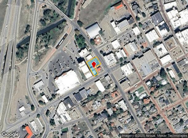
419 W Main St
14288500
Ots
Recreationalentertainmentgeneral
O T S BLK-111- PT LTS-1-2- 35FT ON MAIN 75FT DEEP W OF 77FT OF LTS. O T S BLK-111- THAT PART OF LTS-1-2- TERRYS WEST BLK-7- AND THAT PART OF-
X
Las Animas
08071C1767C
Colorado
2024
o
2025
0.28 AC
000400
Colorado East Area
4,032 SF
Other Market Areas
DEMOGRAPHICS near 419 W Main St
1 Mile
3 Mile
5 Mile
2024 Total Population
5,870
9,548
10,108
2029 Population
5,872
9,547
10,113
Pop Growth 2024-2029
+ 0.03%
(0.01%)
+ 0.05%
Average Age
44
44
44
2024 Total Households
2,712
4,334
4,576
HH Growth 2024-2029
(0.15%)
(0.23%)
(0.17%)
Median Household Inc
$41,492
$41,825
$43,921
Avg Household Size
2.10
2.10
2.10
2024 Avg HH Vehicles
2.00
2.00
2.00
Median Home Value
$164,425
$179,634
$184,687
Median Year Built
1954
1959
1963
Nearby Places
Map Layers
Map Styles
 Street
 Aerial
- Restaurants
- Banks
- Shops
- Fitness
- Groceries
PUBLIC TRANSPORTATION
COMMUTER RAIL
Trinidad Amtrak (Southwest Chief - Amtrak)
DRIVE
WALK
Distance
Trinidad Amtrak (Southwest Chief - Amtrak)
1 min
9 min
0.5 mi
Freight Ports
Tulsa Port Of Catoosa
DRIVE
WALK
Distance
Tulsa Port Of Catoosa
647 min
553.8 mi
SALE & LEASE HISTORY
LISTING DATE
SALE/LEASE

Sep 23, 2016
For Sale
Nearby Properties
Address
Land Use
TOTAL SIZE
Lot Size
Zoning
Address
Land Use
TOTAL SIZE
Lot Size
Zoning
1.74 AC
Address
Land Use
TOTAL SIZE
Lot Size
Zoning
22.44 AC
Address
Land Use
TOTAL SIZE
Lot Size
Zoning
49.55 AC
Address
Land Use
TOTAL SIZE
Lot Size
Zoning
0.52 AC
Address
Land Use
TOTAL SIZE
Lot Size
Zoning
3.27 AC
Address
Land Use
TOTAL SIZE
Lot Size
Zoning
153,025 SF
20.82 AC
Address
Land Use
TOTAL SIZE
Lot Size
Zoning
22.68 AC
Address
Land Use
TOTAL SIZE
Lot Size
Zoning
57,000 SF
4.34 AC
Address
Land Use
TOTAL SIZE
Lot Size
Zoning
Address
Land Use
TOTAL SIZE
Lot Size
Zoning
44,348 SF
0.18 AC
Address
Land Use
TOTAL SIZE
Lot Size
Zoning
6.39 AC
Address
Land Use
TOTAL SIZE
Lot Size
Zoning
2,020 SF
7.26 AC
Address
Land Use
TOTAL SIZE
Lot Size
Zoning
2,160 SF
0.35 AC
Address
Land Use
TOTAL SIZE
Lot Size
Zoning
5.57 AC
Address
Land Use
TOTAL SIZE
Lot Size
Zoning
Address
Land Use
TOTAL SIZE
Lot Size
Zoning
0.11 AC
Address
Land Use
TOTAL SIZE
Lot Size
Zoning
43,600 SF
4.50 AC
Address
Land Use
TOTAL SIZE
Lot Size
Zoning
2,990 SF
0.10 AC
Address
Land Use
TOTAL SIZE
Lot Size
Zoning
37,250 SF
4.60 AC
Address
Land Use
TOTAL SIZE
Lot Size
Zoning
Address
Land Use
TOTAL SIZE
Lot Size
Zoning
18,552 SF
0.38 AC
Address
Land Use
TOTAL SIZE
Lot Size
Zoning
14,768 SF
1.29 AC
Address
Land Use
TOTAL SIZE
Lot Size
Zoning
Address
Land Use
TOTAL SIZE
Lot Size
Zoning
Address
Land Use
TOTAL SIZE
Lot Size
Zoning
Address
Land Use
TOTAL SIZE
Lot Size
Zoning
3.51 AC
Address
Land Use
TOTAL SIZE
Lot Size
Zoning
36,500 SF
0.68 AC
Address
Land Use
TOTAL SIZE
Lot Size
Zoning
70,720 SF
6 AC
Address
Land Use
TOTAL SIZE
Lot Size
Zoning
33.50 AC
Address
Land Use
TOTAL SIZE
Lot Size
Zoning
60,014 SF
6.57 AC
The World's #1 Commercial Real Estate Marketplace
Connect with us
© 2026 CoStar Group
The information above has been obtained from sources believed reliable. While we do not doubt its accuracy we have not verified it and make no guarantee, warranty or representation about it. It is your responsibility to independently confirm its accuracy and completeness. Any projections, opinions, assumptions, or estimates used are for example only and do not represent the current or future performance of the property. The value of this transaction to you depends on tax and other factors which should be evaluated by your tax, financial, and legal advisors. You and your advisors should conduct a careful, independent investigation of the property to determine to your satisfaction the suitability of the property for your needs.