Property Record
4195 S Fort Apache Rd, Las Vegas, NV 89147


NEARBY LISTINGS FOR SALE OR LEASE
Property Detail
4195 S Fort Apache Rd
Las Vegas-Henderson-North Las Vegas, NV
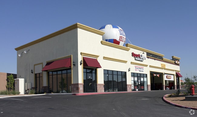
Apache Plaza
163-19-510-007
APACHE PLAZA PLAT BOOK 103 PAGE 71 PT LOT 1
Commercialnec
Clark
X
Nevada
32003C2535F
1
2026
10.18 AC
2026
Southwest Las Vegas
005849
Las Vegas
106,992 SF
DEMOGRAPHICS near 4195 S Fort Apache Rd
1 mile
3 mile
5 mile
2024 Total Population
24,264
167,816
343,126
2029 Population
26,125
180,471
369,128
Pop Growth 2024-2029
+ 7.67%
+ 7.54%
+ 7.58%
Average Age
40
41
41
2024 Total Households
10,118
68,192
138,519
HH Growth 2024-2029
+ 7.74%
+ 7.52%
+ 7.54%
Median Household Inc
$62,703
$72,749
$68,756
Avg Household Size
2.40
2.40
2.40
2024 Avg HH Vehicles
2.00
2.00
2.00
Median Home Value
$391,636
$423,289
$402,328
Median Year Built
1999
1999
1997
Nearby Places
Map Layers
Map Styles
 Street
 Aerial
Transit
 Traffic
 Biking
Places
Listings with unknown addresses are not visible on the map
- Restaurants
- Banks
- Shops
- Fitness
- Groceries
PUBLIC TRANSPORTATION
AIRPORT
Harry Reid International
Drive
Walk
Distance
Harry Reid International
19 min
13.3 mi
Boulder City Municipal
Drive
Walk
Distance
Boulder City Municipal
44 min
33.0 mi
Nearby Properties
Address
Land Use
TOTAL SIZE
Lot Size
Zoning
Address
Land Use
TOTAL SIZE
Lot Size
Zoning
205,752 SF
36.24 AC
C1
Address
Land Use
TOTAL SIZE
Lot Size
Zoning
174,108 SF
52.16 AC
RU
Address
Land Use
TOTAL SIZE
Lot Size
Zoning
40 AC
PF
Address
Land Use
TOTAL SIZE
Lot Size
Zoning
466,224 SF
11.85 AC
C:C-2
Address
Land Use
TOTAL SIZE
Lot Size
Zoning
13,250 SF
3.68 AC
Address
Land Use
TOTAL SIZE
Lot Size
Zoning
Address
Land Use
TOTAL SIZE
Lot Size
Zoning
38.56 AC
PF
Address
Land Use
TOTAL SIZE
Lot Size
Zoning
Address
Land Use
TOTAL SIZE
Lot Size
Zoning
9,279 SF
24.36 AC
Address
Land Use
TOTAL SIZE
Lot Size
Zoning
7,736 SF
16.26 AC
RE
Address
Land Use
TOTAL SIZE
Lot Size
Zoning
504,632 SF
6.25 AC
Address
Land Use
TOTAL SIZE
Lot Size
Zoning
401,023 SF
17.61 AC
R-3
Address
Land Use
TOTAL SIZE
Lot Size
Zoning
4,542 SF
18.72 AC
Address
Land Use
TOTAL SIZE
Lot Size
Zoning
Address
Land Use
TOTAL SIZE
Lot Size
Zoning
Address
Land Use
TOTAL SIZE
Lot Size
Zoning
33.24 AC
C1
Address
Land Use
TOTAL SIZE
Lot Size
Zoning
6,825 SF
9.11 AC
Address
Land Use
TOTAL SIZE
Lot Size
Zoning
3,520 SF
28.42 AC
R3
Address
Land Use
TOTAL SIZE
Lot Size
Zoning
5,374 SF
12.36 AC
Address
Land Use
TOTAL SIZE
Lot Size
Zoning
43,264 SF
3.56 AC
Address
Land Use
TOTAL SIZE
Lot Size
Zoning
322,127 SF
9.32 AC
Address
Land Use
TOTAL SIZE
Lot Size
Zoning
4,382 SF
13.65 AC
C2
Address
Land Use
TOTAL SIZE
Lot Size
Zoning
4,446 SF
16.17 AC
Address
Land Use
TOTAL SIZE
Lot Size
Zoning
485,241 SF
13.77 AC
R3
Address
Land Use
TOTAL SIZE
Lot Size
Zoning
11,942 SF
17.01 AC
R3
Address
Land Use
TOTAL SIZE
Lot Size
Zoning
21.17 AC
PF
Address
Land Use
TOTAL SIZE
Lot Size
Zoning
310,672 SF
8.84 AC
Address
Land Use
TOTAL SIZE
Lot Size
Zoning
2,754 SF
17.17 AC
RPD20
Address
Land Use
TOTAL SIZE
Lot Size
Zoning
220,053 SF
3.04 AC
The World's #1 Commercial Real Estate Marketplace
Connect with us
© 2026 CoStar Group
The information above has been obtained from sources believed reliable. While we do not doubt its accuracy we have not verified it and make no guarantee, warranty or representation about it. It is your responsibility to independently confirm its accuracy and completeness. Any projections, opinions, assumptions, or estimates used are for example only and do not represent the current or future performance of the property. The value of this transaction to you depends on tax and other factors which should be evaluated by your tax, financial, and legal advisors. You and your advisors should conduct a careful, independent investigation of the property to determine to your satisfaction the suitability of the property for your needs.