Property Record
41965 Us Highway 50, Gunnison, CO 81230

Save to a Folder
{{folder.Name}}
{{folder.ListingIds.length}} Properties
{{folder.ListingIds.length}} Property
Create a New Folder
Property Detail
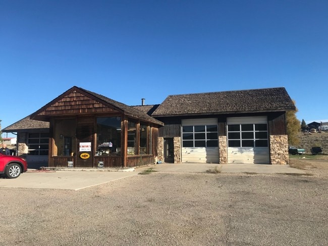
41965 Us Highway 50
M006356
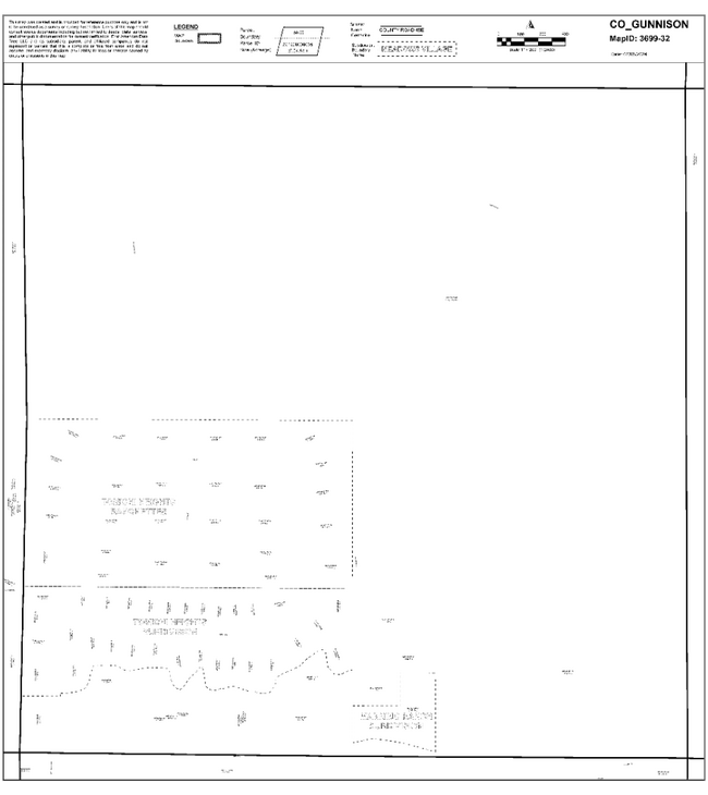
1.47 ACRES IN SECTION 32, TOWNSHIP 50N, RANGE 1E
Servicestation
Gunnison
2024
Colorado
2024
1.47 AC
963602
Colorado Southwest Area
4,054 SF
Other Market Areas
NEARBY LISTINGS FOR SALE OR LEASE
DEMOGRAPHICS near 41965 Us Highway 50
1 mile
3 mile
5 mile
2025 Total Population
116
5,789
8,304
2030 Population
119
5,551
8,015
Pop Growth 2025-2030
+ 2.59%
(4.11%)
(3.48%)
Average Age
40
34
36
2025 Total Households
46
2,182
3,265
HH Growth 2025-2030
+ 2.17%
(5.13%)
(4.07%)
Median Household Inc
$83,928
$62,554
$73,715
Avg Household Size
2.30
2.20
2.20
2025 Avg HH Vehicles
3.00
2.00
2.00
Median Home Value
$589,286
$479,123
$543,544
Median Year Built
1986
1985
1984
Nearby Places
Map Layers
Map Styles
 Street
 Aerial
Layers
 Traffic
 Biking
Places
Listings with unknown addresses are not visible on the map
- Restaurants
- Banks
- Shops
- Fitness
- Groceries
PUBLIC TRANSPORTATION
AIRPORT
Gunnison-Crested Butte Regional
Drive
Walk
Distance
Gunnison-Crested Butte Regional
18 min
5.9 mi
Freight Ports
Tulsa Port Of Catoosa
Drive
Walk
Distance
Tulsa Port Of Catoosa
932 min
759.9 mi
SALE & LEASE HISTORY
LISTING DATE
SALE/LEASE

Sep 30, 2018
For Sale
Feb 22, 2019
For Sale
Nearby Properties
Address
Land Use
TOTAL SIZE
Lot Size
Zoning
Address
Land Use
TOTAL SIZE
Lot Size
Zoning
38,866 SF
7.50 AC
Address
Land Use
TOTAL SIZE
Lot Size
Zoning
38,866 SF
7.50 AC
Address
Land Use
TOTAL SIZE
Lot Size
Zoning
67,817 SF
5.11 AC
Address
Land Use
TOTAL SIZE
Lot Size
Zoning
24.45 AC
Address
Land Use
TOTAL SIZE
Lot Size
Zoning
49,153 SF
3.92 AC
Address
Land Use
TOTAL SIZE
Lot Size
Zoning
10,802 SF
3.04 AC
Address
Land Use
TOTAL SIZE
Lot Size
Zoning
6,282 SF
0.25 AC
Address
Land Use
TOTAL SIZE
Lot Size
Zoning
48,839 SF
4.56 AC
Address
Land Use
TOTAL SIZE
Lot Size
Zoning
30,330 SF
1.64 AC
Address
Land Use
TOTAL SIZE
Lot Size
Zoning
12,690 SF
3.80 AC
Address
Land Use
TOTAL SIZE
Lot Size
Zoning
43,938 SF
4.81 AC
Address
Land Use
TOTAL SIZE
Lot Size
Zoning
9,600 SF
5.13 AC
Address
Land Use
TOTAL SIZE
Lot Size
Zoning
30,496 SF
0.86 AC
Address
Land Use
TOTAL SIZE
Lot Size
Zoning
11,637 SF
1.31 AC
Address
Land Use
TOTAL SIZE
Lot Size
Zoning
Address
Land Use
TOTAL SIZE
Lot Size
Zoning
15,948 SF
3.69 AC
Address
Land Use
TOTAL SIZE
Lot Size
Zoning
22,080 SF
2.46 AC
Address
Land Use
TOTAL SIZE
Lot Size
Zoning
Address
Land Use
TOTAL SIZE
Lot Size
Zoning
Address
Land Use
TOTAL SIZE
Lot Size
Zoning
36,468 SF
1.86 AC
Address
Land Use
TOTAL SIZE
Lot Size
Zoning
12,235 SF
0.70 AC
Address
Land Use
TOTAL SIZE
Lot Size
Zoning
29,860 SF
1.72 AC
Address
Land Use
TOTAL SIZE
Lot Size
Zoning
19,446 SF
1.29 AC
Address
Land Use
TOTAL SIZE
Lot Size
Zoning
1.07 AC
Address
Land Use
TOTAL SIZE
Lot Size
Zoning
9,900 SF
3.22 AC
Address
Land Use
TOTAL SIZE
Lot Size
Zoning
Address
Land Use
TOTAL SIZE
Lot Size
Zoning
21,987 SF
1.72 AC
Address
Land Use
TOTAL SIZE
Lot Size
Zoning
22,538 SF
1.52 AC
Address
Land Use
TOTAL SIZE
Lot Size
Zoning
12,173 SF
1.72 AC
Address
Land Use
TOTAL SIZE
Lot Size
Zoning
26,238 SF
2.41 AC
The World's #1 Commercial Real Estate Marketplace
Connect with us
© 2026 CoStar Group
The information above has been obtained from sources believed reliable. While we do not doubt its accuracy we have not verified it and make no guarantee, warranty or representation about it. It is your responsibility to independently confirm its accuracy and completeness. Any projections, opinions, assumptions, or estimates used are for example only and do not represent the current or future performance of the property. The value of this transaction to you depends on tax and other factors which should be evaluated by your tax, financial, and legal advisors. You and your advisors should conduct a careful, independent investigation of the property to determine to your satisfaction the suitability of the property for your needs.