Property Record
41991 Highway 195, Haleyville, AL 35565


NEARBY LISTINGS FOR SALE OR LEASE
Property Detail
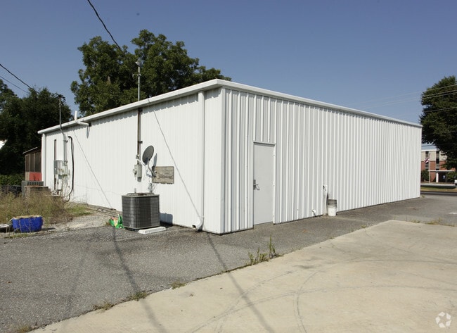
41991 Highway 195
Storebuilding
COM NE COR SW-SE S28 T9 R10 TH SWLY 1415 S TO POB SE 300.02 SW 120 NW 300 NE 120 TO POB ANNEXED INTO CITY LIMTS ORD 2010-04 C
X
Winston
01133C0180D
Alabama
2025
0.80 AC
2024
Other Market Areas
965800
05-08-28-0-200-032.001
2,700 SF
DEMOGRAPHICS near 41991 Highway 195
1 Mile
3 Mile
5 Mile
2024 Total Population
990
5,953
8,884
2029 Population
993
5,935
8,818
Pop Growth 2024-2029
+ 0.30%
(0.30%)
(0.74%)
Average Age
41
42
42
2024 Total Households
446
2,480
3,695
HH Growth 2024-2029
+ 0.45%
(0.28%)
(0.73%)
Median Household Inc
$38,958
$48,084
$45,750
Avg Household Size
2.20
2.30
2.30
2024 Avg HH Vehicles
2.00
2.00
2.00
Median Home Value
$98,449
$116,858
$107,601
Median Year Built
1983
1976
1978
Nearby Places
Map Layers
Map Styles
 Street
 Aerial
- Restaurants
- Banks
- Shops
- Fitness
- Groceries
Nearby Properties
Address
Land Use
TOTAL SIZE
Lot Size
Zoning
Address
Land Use
TOTAL SIZE
Lot Size
Zoning
47,666 SF
6.10 AC
Address
Land Use
TOTAL SIZE
Lot Size
Zoning
30,451 SF
1.70 AC
Address
Land Use
TOTAL SIZE
Lot Size
Zoning
44,800 SF
36 AC
Address
Land Use
TOTAL SIZE
Lot Size
Zoning
24,985 SF
3.50 AC
Address
Land Use
TOTAL SIZE
Lot Size
Zoning
24,069 SF
1.90 AC
Address
Land Use
TOTAL SIZE
Lot Size
Zoning
24,500 SF
1.88 AC
Address
Land Use
TOTAL SIZE
Lot Size
Zoning
18,400 SF
1.20 AC
Address
Land Use
TOTAL SIZE
Lot Size
Zoning
7,383 SF
1.01 AC
Address
Land Use
TOTAL SIZE
Lot Size
Zoning
2,476 SF
0.90 AC
Address
Land Use
TOTAL SIZE
Lot Size
Zoning
9,500 SF
1.10 AC
Address
Land Use
TOTAL SIZE
Lot Size
Zoning
9,224 SF
4.20 AC
Address
Land Use
TOTAL SIZE
Lot Size
Zoning
15,252 SF
5 AC
Address
Land Use
TOTAL SIZE
Lot Size
Zoning
19,500 SF
1.05 AC
Address
Land Use
TOTAL SIZE
Lot Size
Zoning
3,702 SF
0.28 AC
Address
Land Use
TOTAL SIZE
Lot Size
Zoning
6,000 SF
5 AC
Address
Land Use
TOTAL SIZE
Lot Size
Zoning
6,400 SF
3 AC
The World's #1 Commercial Real Estate Marketplace
Connect with us
© 2026 CoStar Group
The information above has been obtained from sources believed reliable. While we do not doubt its accuracy we have not verified it and make no guarantee, warranty or representation about it. It is your responsibility to independently confirm its accuracy and completeness. Any projections, opinions, assumptions, or estimates used are for example only and do not represent the current or future performance of the property. The value of this transaction to you depends on tax and other factors which should be evaluated by your tax, financial, and legal advisors. You and your advisors should conduct a careful, independent investigation of the property to determine to your satisfaction the suitability of the property for your needs.