Property Record
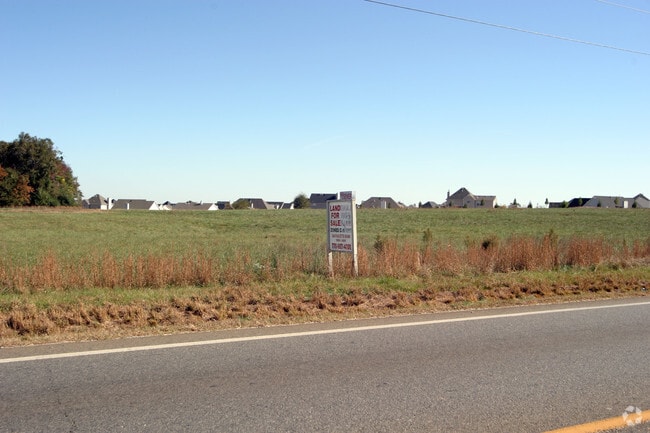
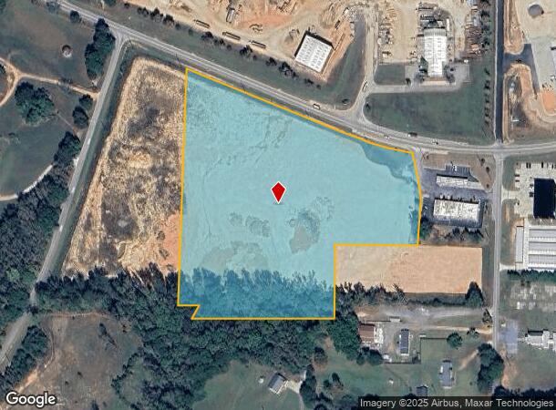
42 Canup Rd, Locust Grove, GA 30248
NEARBY LISTINGS FOR SALE OR LEASE
-
-
View all Locust Grove listings for sale on LoopNet.com
Property Detail
42 Canup Rd
Atlanta-Sandy Springs-Roswell, GA
Surv Prepared Philip Corbin
0162-01-004-001
LAND LOT: 130 /LAND DISTRICT: 2; COMMERCIAL
Industrialacreage
Henry
X
Georgia
13255C0125E
130
2025
12.21 AC
2025
South Clayton/Henry Cnty
070411
Atlanta
DEMOGRAPHICS near 42 Canup Rd
1 Mile
3 Mile
5 Mile
2024 Total Population
778
11,464
25,844
2029 Population
849
12,759
28,533
Pop Growth 2024-2029
+ 9.13%
+ 11.30%
+ 10.40%
Average Age
39
36
37
2024 Total Households
272
3,831
8,181
HH Growth 2024-2029
+ 9.93%
+ 11.51%
+ 10.88%
Median Household Inc
$45,208
$67,206
$64,285
Avg Household Size
2.80
2.90
2.90
2024 Avg HH Vehicles
3.00
2.00
2.00
Median Home Value
$229,091
$183,539
$189,001
Median Year Built
1997
1998
2000
Nearby Places
Map Layers
Map Styles
 Street
 Aerial
- Restaurants
- Banks
- Shops
- Fitness
- Groceries
PUBLIC TRANSPORTATION
AIRPORT
Hartsfield - Jackson Atlanta International
DRIVE
WALK
Distance
Hartsfield - Jackson Atlanta International
44 min
34.1 mi
Nearby Properties
Address
Land Use
TOTAL SIZE
Lot Size
Zoning
Address
Land Use
TOTAL SIZE
Lot Size
Zoning
298,806 SF
100.73 AC
RA
Address
Land Use
TOTAL SIZE
Lot Size
Zoning
90,990 SF
30.28 AC
AR
Address
Land Use
TOTAL SIZE
Lot Size
Zoning
68,540 SF
5.90 AC
C3
Address
Land Use
TOTAL SIZE
Lot Size
Zoning
350 SF
84.78 AC
PD
Address
Land Use
TOTAL SIZE
Lot Size
Zoning
102,612 SF
15.60 AC
Address
Land Use
TOTAL SIZE
Lot Size
Zoning
983 SF
14.21 AC
RA
Address
Land Use
TOTAL SIZE
Lot Size
Zoning
213.34 AC
RA
Address
Land Use
TOTAL SIZE
Lot Size
Zoning
116,644 SF
8 AC
M2
Address
Land Use
TOTAL SIZE
Lot Size
Zoning
194.42 AC
PD
Address
Land Use
TOTAL SIZE
Lot Size
Zoning
66,855 SF
41.88 AC
M-1
Address
Land Use
TOTAL SIZE
Lot Size
Zoning
3,000 SF
3.43 AC
HB
Address
Land Use
TOTAL SIZE
Lot Size
Zoning
1,200 SF
30.89 AC
PD
Address
Land Use
TOTAL SIZE
Lot Size
Zoning
6,580 SF
14.22 AC
HB
Address
Land Use
TOTAL SIZE
Lot Size
Zoning
2,700 SF
101.91 AC
M-2
Address
Land Use
TOTAL SIZE
Lot Size
Zoning
24,211 SF
31.42 AC
RA
Address
Land Use
TOTAL SIZE
Lot Size
Zoning
29,086 SF
4.44 AC
M2
Address
Land Use
TOTAL SIZE
Lot Size
Zoning
11,250 SF
21.15 AC
Address
Land Use
TOTAL SIZE
Lot Size
Zoning
14,850 SF
2.72 AC
C1
Address
Land Use
TOTAL SIZE
Lot Size
Zoning
17,160 SF
1.78 AC
C2
Address
Land Use
TOTAL SIZE
Lot Size
Zoning
740 SF
106.22 AC
RA
Address
Land Use
TOTAL SIZE
Lot Size
Zoning
16,401 SF
5.08 AC
AR
Address
Land Use
TOTAL SIZE
Lot Size
Zoning
9,268 SF
6.32 AC
M2
Address
Land Use
TOTAL SIZE
Lot Size
Zoning
15,520 SF
14 AC
Address
Land Use
TOTAL SIZE
Lot Size
Zoning
379 AC
M-2
Address
Land Use
TOTAL SIZE
Lot Size
Zoning
10,130 SF
2.19 AC
C1
Address
Land Use
TOTAL SIZE
Lot Size
Zoning
15,288 SF
0.85 AC
C1
Address
Land Use
TOTAL SIZE
Lot Size
Zoning
308.80 AC
AR
Address
Land Use
TOTAL SIZE
Lot Size
Zoning
8,543 SF
2 AC
C
Address
Land Use
TOTAL SIZE
Lot Size
Zoning
8,818 SF
10.28 AC
M2
Address
Land Use
TOTAL SIZE
Lot Size
Zoning
7,000 SF
25.48 AC
M-1
The World's #1 Commercial Real Estate Marketplace
Connect with us
© 2025 CoStar Group
The information above has been obtained from sources believed reliable. While we do not doubt its accuracy we have not verified it and make no guarantee, warranty or representation about it. It is your responsibility to independently confirm its accuracy and completeness. Any projections, opinions, assumptions, or estimates used are for example only and do not represent the current or future performance of the property. The value of this transaction to you depends on tax and other factors which should be evaluated by your tax, financial, and legal advisors. You and your advisors should conduct a careful, independent investigation of the property to determine to your satisfaction the suitability of the property for your needs.