Property Record
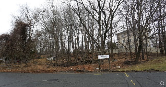
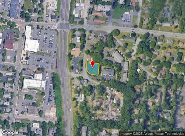
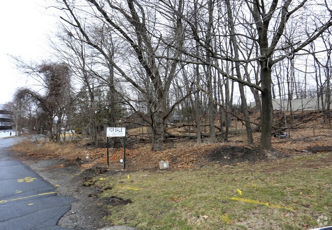
42 Demarest Ave, New City, NY 10956
NEARBY LISTINGS FOR SALE OR LEASE
Property Detail
42 Demarest Ave
New York-Jersey City-White Plains, NY-NJ
57-M-14
392089-043-019-0003-006-000-0000
Rockland
Commercialacreage
New York
X
6.0
36087C0113G
0.30 AC
2023
Clarkstown
2024
Northern New Jersey
010804
DEMOGRAPHICS near 42 Demarest Ave
1 Mile
3 Mile
5 Mile
2024 Total Population
11,287
71,980
222,975
2029 Population
11,345
71,642
221,360
Pop Growth 2024-2029
+ 0.51%
(0.47%)
(0.72%)
Average Age
42
39
36
2024 Total Households
3,828
21,823
65,182
HH Growth 2024-2029
+ 0.63%
(0.47%)
(0.74%)
Median Household Inc
$115,798
$121,827
$95,550
Avg Household Size
2.80
3.10
3.20
2024 Avg HH Vehicles
2.00
2.00
2.00
Median Home Value
$521,908
$566,090
$501,032
Median Year Built
1967
1971
1971
Nearby Places
- Restaurants
- Banks
- Shops
- Fitness
- Groceries
PUBLIC TRANSPORTATION
COMMUTER RAIL
Nanuet (Pascack Valley Line - NJ Transit Commuter Rail (NJ Transit))
DRIVE
WALK
Distance
Nanuet (Pascack Valley Line - NJ Transit Commuter Rail (NJ Transit))
10 min
5.1 mi
Spring Valley (Pascack Valley Line - NJ Transit Commuter Rail (NJ Transit))
DRIVE
WALK
Distance
Spring Valley (Pascack Valley Line - NJ Transit Commuter Rail (NJ Transit))
11 min
6.6 mi
AIRPORT
Westchester County
DRIVE
WALK
Distance
Westchester County
38 min
26.1 mi
LaGuardia
DRIVE
WALK
Distance
LaGuardia
54 min
34.2 mi
New York Stewart International
DRIVE
WALK
Distance
New York Stewart International
52 min
35.3 mi
Freight Ports
NY - Red Hook Container Terminal
DRIVE
WALK
Distance
NY - Red Hook Container Terminal
64 min
42.0 mi
Nearby Properties
Address
Land Use
TOTAL SIZE
Lot Size
Zoning
Address
Land Use
TOTAL SIZE
Lot Size
Zoning
146,101 SF
55 AC
Address
Land Use
TOTAL SIZE
Lot Size
Zoning
298,975 SF
63.32 AC
03 - MULTI
Address
Land Use
TOTAL SIZE
Lot Size
Zoning
316,644 SF
65.70 AC
Address
Land Use
TOTAL SIZE
Lot Size
Zoning
104,303 SF
71.26 AC
RR-50
Address
Land Use
TOTAL SIZE
Lot Size
Zoning
247,711 SF
37.26 AC
Address
Land Use
TOTAL SIZE
Lot Size
Zoning
1,887 SF
245.60 AC
02 - SINGL
Address
Land Use
TOTAL SIZE
Lot Size
Zoning
Address
Land Use
TOTAL SIZE
Lot Size
Zoning
68,910 SF
27 AC
Address
Land Use
TOTAL SIZE
Lot Size
Zoning
129,957 SF
21.90 AC
Address
Land Use
TOTAL SIZE
Lot Size
Zoning
68,910 SF
6.90 AC
02 - SINGL
Address
Land Use
TOTAL SIZE
Lot Size
Zoning
2,140 SF
1.91 AC
Address
Land Use
TOTAL SIZE
Lot Size
Zoning
133,039 SF
14.80 AC
CS
Address
Land Use
TOTAL SIZE
Lot Size
Zoning
60,423 SF
2.90 AC
Address
Land Use
TOTAL SIZE
Lot Size
Zoning
72,930 SF
18.10 AC
02 - SINGL
Address
Land Use
TOTAL SIZE
Lot Size
Zoning
Address
Land Use
TOTAL SIZE
Lot Size
Zoning
129,218 SF
11.56 AC
Address
Land Use
TOTAL SIZE
Lot Size
Zoning
130,930 SF
11 AC
Address
Land Use
TOTAL SIZE
Lot Size
Zoning
175,948 SF
11.13 AC
Address
Land Use
TOTAL SIZE
Lot Size
Zoning
248,709 SF
15.30 AC
Address
Land Use
TOTAL SIZE
Lot Size
Zoning
73,000 SF
5.10 AC
05
Address
Land Use
TOTAL SIZE
Lot Size
Zoning
38,624 SF
5.90 AC
Address
Land Use
TOTAL SIZE
Lot Size
Zoning
60,803 SF
6.70 AC
02 - SINGL
Address
Land Use
TOTAL SIZE
Lot Size
Zoning
106,960 SF
8.04 AC
CS
Address
Land Use
TOTAL SIZE
Lot Size
Zoning
1,656 SF
20 AC
02 - SINGL
Address
Land Use
TOTAL SIZE
Lot Size
Zoning
99,725 SF
17.78 AC
03 - MULTI
Address
Land Use
TOTAL SIZE
Lot Size
Zoning
96,393 SF
8.70 AC
R1
Address
Land Use
TOTAL SIZE
Lot Size
Zoning
57,392 SF
3.40 AC
Address
Land Use
TOTAL SIZE
Lot Size
Zoning
46,107 SF
8.49 AC
02 - SINGL
Address
Land Use
TOTAL SIZE
Lot Size
Zoning
13,983 SF
5.53 AC
Address
Land Use
TOTAL SIZE
Lot Size
Zoning
40,194 SF
14 AC
The World's #1 Commercial Real Estate Marketplace
Connect with us
© 2025 CoStar Group
The information above has been obtained from sources believed reliable. While we do not doubt its accuracy we have not verified it and make no guarantee, warranty or representation about it. It is your responsibility to independently confirm its accuracy and completeness. Any projections, opinions, assumptions, or estimates used are for example only and do not represent the current or future performance of the property. The value of this transaction to you depends on tax and other factors which should be evaluated by your tax, financial, and legal advisors. You and your advisors should conduct a careful, independent investigation of the property to determine to your satisfaction the suitability of the property for your needs.