Property Record
42 E 2Nd St, Freeport, NY 11520
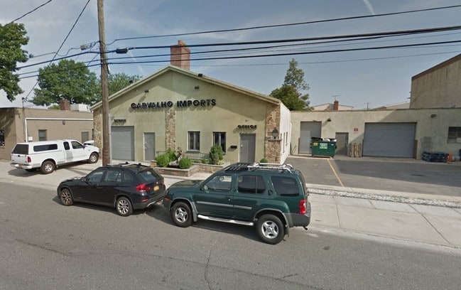


Property Detail
42 E 2Nd St
09-303-00-0031
Nassau
Lightindustrial
New York
B and X Area of moderate flood hazard, usually the area between the limits of the 100-year and 500-year floods.
0.23 AC
2025
Central Nassau
2025
Long Island (New York)
303700
Nassau County-Suffolk County, NY
6,613 SF
NEARBY LISTINGS FOR SALE OR LEASE
DEMOGRAPHICS near 42 E 2Nd St
1 mile
3 mile
5 mile
2025 Total Population
24,683
178,547
491,060
2030 Population
24,803
178,791
489,460
Pop Growth 2025-2030
+ 0.49%
+ 0.14%
(0.33%)
Average Age
42
41
42
2025 Total Households
9,835
57,998
153,329
HH Growth 2025-2030
+ 0.59%
+ 0.20%
(0.37%)
Median Household Inc
$142,247
$136,701
$137,428
Avg Household Size
2.50
2.90
3.00
2025 Avg HH Vehicles
2.00
2.00
2.00
Median Home Value
$747,569
$787,288
$746,536
Median Year Built
1953
1953
1953
Nearby Places
Map Layers
Map Styles
 Street
 Aerial
Layers
 Traffic
 Biking
Places
Listings with unknown addresses are not visible on the map
- Restaurants
- Banks
- Shops
- Fitness
- Groceries
PUBLIC TRANSPORTATION
COMMUTER RAIL
Freeport Station (Babylon Branch - Long Island Rail Road)
Drive
Walk
Distance
Freeport Station (Babylon Branch - Long Island Rail Road)
3 min
1.5 mi
Merrick Station (Babylon Branch - Long Island Rail Road)
Drive
Walk
Distance
Merrick Station (Babylon Branch - Long Island Rail Road)
6 min
3.2 mi
AIRPORT
John F Kennedy International
Drive
Walk
Distance
John F Kennedy International
23 min
14.7 mi
LaGuardia
Drive
Walk
Distance
LaGuardia
34 min
21.7 mi
Long Island MacArthur
Drive
Walk
Distance
Long Island MacArthur
43 min
31.0 mi
Freight Ports
NY - Red Hook Container Terminal
Drive
Walk
Distance
NY - Red Hook Container Terminal
44 min
26.1 mi
SALE & LEASE HISTORY
LISTING DATE
SALE/LEASE

Sep 25, 2017
For Lease
Mar 06, 2018
For Lease
Jul 01, 2020
For Lease
Feb 19, 2019
For Lease
Nearby Properties
Address
Land Use
TOTAL SIZE
Lot Size
Zoning
Address
Land Use
TOTAL SIZE
Lot Size
Zoning
986.74 AC
Address
Land Use
TOTAL SIZE
Lot Size
Zoning
457.91 AC
Address
Land Use
TOTAL SIZE
Lot Size
Zoning
169.25 AC
Address
Land Use
TOTAL SIZE
Lot Size
Zoning
336,450 SF
139.91 AC
Address
Land Use
TOTAL SIZE
Lot Size
Zoning
173.70 AC
Address
Land Use
TOTAL SIZE
Lot Size
Zoning
57,874 SF
21 AC
Address
Land Use
TOTAL SIZE
Lot Size
Zoning
65,235 SF
15.48 AC
Address
Land Use
TOTAL SIZE
Lot Size
Zoning
94,204 SF
35.42 AC
Address
Land Use
TOTAL SIZE
Lot Size
Zoning
116.80 AC
Address
Land Use
TOTAL SIZE
Lot Size
Zoning
145,209 SF
20.01 AC
Address
Land Use
TOTAL SIZE
Lot Size
Zoning
106.66 AC
Address
Land Use
TOTAL SIZE
Lot Size
Zoning
140,000 SF
50.78 AC
Address
Land Use
TOTAL SIZE
Lot Size
Zoning
101.55 AC
Address
Land Use
TOTAL SIZE
Lot Size
Zoning
67,408 SF
66.13 AC
Address
Land Use
TOTAL SIZE
Lot Size
Zoning
80,895 SF
26.22 AC
Address
Land Use
TOTAL SIZE
Lot Size
Zoning
86.38 AC
Address
Land Use
TOTAL SIZE
Lot Size
Zoning
357,868 SF
24.92 AC
Address
Land Use
TOTAL SIZE
Lot Size
Zoning
377,041 SF
14.43 AC
Address
Land Use
TOTAL SIZE
Lot Size
Zoning
81 AC
Address
Land Use
TOTAL SIZE
Lot Size
Zoning
253,201 SF
16.01 AC
Address
Land Use
TOTAL SIZE
Lot Size
Zoning
168,070 SF
11.29 AC
Address
Land Use
TOTAL SIZE
Lot Size
Zoning
82,698 SF
12.03 AC
Address
Land Use
TOTAL SIZE
Lot Size
Zoning
61.38 AC
Address
Land Use
TOTAL SIZE
Lot Size
Zoning
65,102 SF
27.67 AC
Address
Land Use
TOTAL SIZE
Lot Size
Zoning
290,400 SF
246.92 AC
Address
Land Use
TOTAL SIZE
Lot Size
Zoning
278,714 SF
3.04 AC
Address
Land Use
TOTAL SIZE
Lot Size
Zoning
193,285 SF
9.64 AC
Address
Land Use
TOTAL SIZE
Lot Size
Zoning
16,122 SF
160.92 AC
Address
Land Use
TOTAL SIZE
Lot Size
Zoning
99,386 SF
15.13 AC
Address
Land Use
TOTAL SIZE
Lot Size
Zoning
43.23 AC
The World's #1 Commercial Real Estate Marketplace
Connect with us
© 2026 CoStar Group
The information above has been obtained from sources believed reliable. While we do not doubt its accuracy we have not verified it and make no guarantee, warranty or representation about it. It is your responsibility to independently confirm its accuracy and completeness. Any projections, opinions, assumptions, or estimates used are for example only and do not represent the current or future performance of the property. The value of this transaction to you depends on tax and other factors which should be evaluated by your tax, financial, and legal advisors. You and your advisors should conduct a careful, independent investigation of the property to determine to your satisfaction the suitability of the property for your needs.