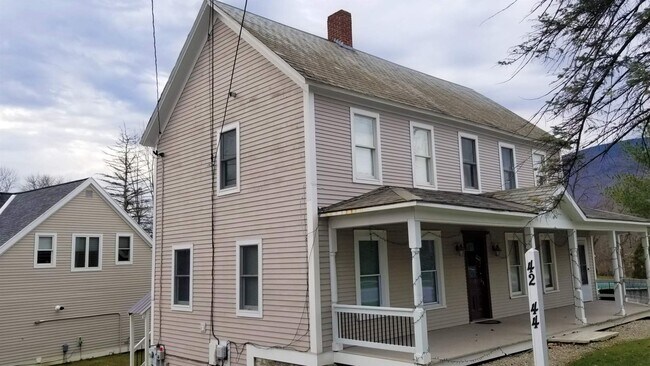
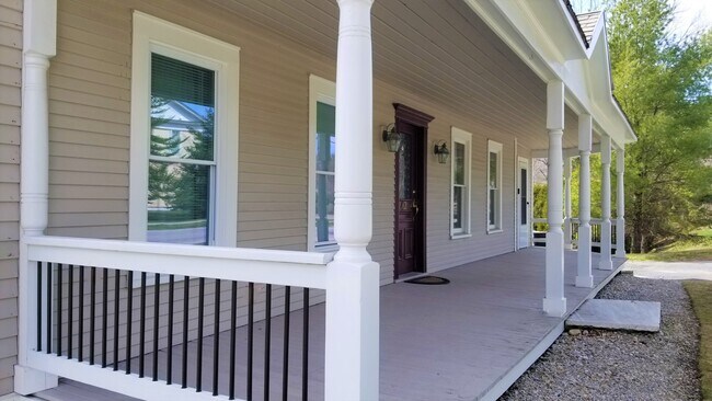
Property Record
42 E Manchester Rd, Manchester Center, VT 05255
NEARBY LISTINGS FOR SALE OR LEASE
-
-
View all Manchester Center listings for sale on LoopNet.com
Property Detail
42 E Manchester Rd
(116)1211
HSE/OFF/APT & LAND
Multifamilydwelling
Bennington
AE
Vermont
50003C0191D
2.25 AC
2024
Vermont South Area
2024
Other Market Areas
970401
Bennington, VT
DEMOGRAPHICS near 42 E Manchester Rd
1 Mile
3 Mile
5 Mile
2024 Total Population
1,880
3,843
5,175
2029 Population
1,840
3,764
5,092
Pop Growth 2024-2029
(2.13%)
(2.06%)
(1.60%)
Average Age
47
47
47
2024 Total Households
836
1,682
2,247
HH Growth 2024-2029
(2.03%)
(2.08%)
(1.69%)
Median Household Inc
$82,738
$90,426
$88,794
Avg Household Size
2.10
2.20
2.20
2024 Avg HH Vehicles
2.00
2.00
2.00
Median Home Value
$412,903
$425,257
$418,206
Median Year Built
1978
1975
1975
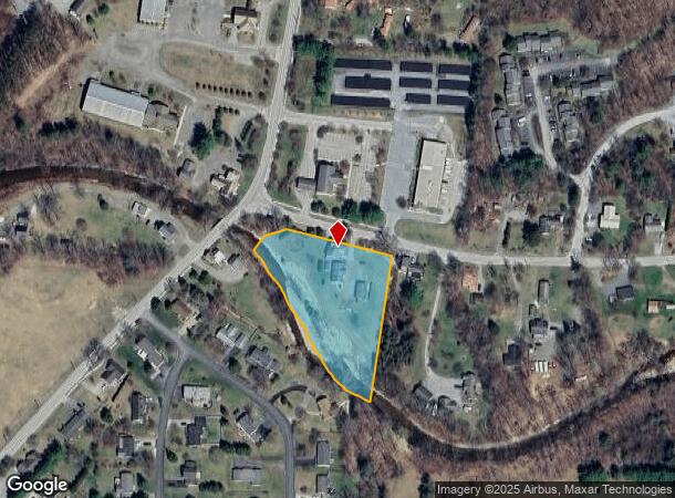
Nearby Places
Map Layers
Map Styles
 Street
 Aerial
- Restaurants
- Banks
- Shops
- Fitness
- Groceries
SALE & LEASE HISTORY
LISTING DATE
SALE/LEASE

Dec 30, 2020
For Sale
Nearby Properties
Address
Land Use
TOTAL SIZE
Lot Size
Zoning
Address
Land Use
TOTAL SIZE
Lot Size
Zoning
16.62 AC
Address
Land Use
TOTAL SIZE
Lot Size
Zoning
4.18 AC
Address
Land Use
TOTAL SIZE
Lot Size
Zoning
4.32 AC
Address
Land Use
TOTAL SIZE
Lot Size
Zoning
25,000 SF
Address
Land Use
TOTAL SIZE
Lot Size
Zoning
29.90 AC
Address
Land Use
TOTAL SIZE
Lot Size
Zoning
61,934 SF
2.63 AC
Address
Land Use
TOTAL SIZE
Lot Size
Zoning
100,058 SF
12.24 AC
Address
Land Use
TOTAL SIZE
Lot Size
Zoning
210.50 AC
Address
Land Use
TOTAL SIZE
Lot Size
Zoning
126.95 AC
Address
Land Use
TOTAL SIZE
Lot Size
Zoning
12.80 AC
Address
Land Use
TOTAL SIZE
Lot Size
Zoning
Address
Land Use
TOTAL SIZE
Lot Size
Zoning
52,292 SF
14.26 AC
Address
Land Use
TOTAL SIZE
Lot Size
Zoning
Address
Land Use
TOTAL SIZE
Lot Size
Zoning
57,350 SF
9.26 AC
Address
Land Use
TOTAL SIZE
Lot Size
Zoning
34,402 SF
8.36 AC
Address
Land Use
TOTAL SIZE
Lot Size
Zoning
61,656 SF
7.61 AC
Address
Land Use
TOTAL SIZE
Lot Size
Zoning
Address
Land Use
TOTAL SIZE
Lot Size
Zoning
152,736 SF
34.70 AC
Address
Land Use
TOTAL SIZE
Lot Size
Zoning
145.60 AC
Address
Land Use
TOTAL SIZE
Lot Size
Zoning
281.89 AC
Address
Land Use
TOTAL SIZE
Lot Size
Zoning
15.54 AC
Address
Land Use
TOTAL SIZE
Lot Size
Zoning
20,430 SF
22.45 AC
Address
Land Use
TOTAL SIZE
Lot Size
Zoning
3.77 AC
Address
Land Use
TOTAL SIZE
Lot Size
Zoning
9,397 SF
Address
Land Use
TOTAL SIZE
Lot Size
Zoning
1.86 AC
Address
Land Use
TOTAL SIZE
Lot Size
Zoning
Address
Land Use
TOTAL SIZE
Lot Size
Zoning
Address
Land Use
TOTAL SIZE
Lot Size
Zoning
18.92 AC
Address
Land Use
TOTAL SIZE
Lot Size
Zoning
42.50 AC
Address
Land Use
TOTAL SIZE
Lot Size
Zoning
5,971 SF
13.50 AC
The World's #1 Commercial Real Estate Marketplace
Connect with us
© 2025 CoStar Group
The information above has been obtained from sources believed reliable. While we do not doubt its accuracy we have not verified it and make no guarantee, warranty or representation about it. It is your responsibility to independently confirm its accuracy and completeness. Any projections, opinions, assumptions, or estimates used are for example only and do not represent the current or future performance of the property. The value of this transaction to you depends on tax and other factors which should be evaluated by your tax, financial, and legal advisors. You and your advisors should conduct a careful, independent investigation of the property to determine to your satisfaction the suitability of the property for your needs.