Property Record
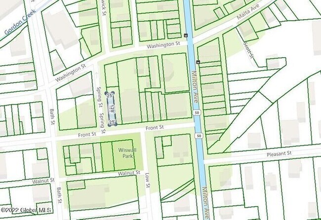
42 Front St, Ballston Spa, NY 12020


Property Detail
42 Front St
414201-216-032-0001-034-000-0000
Saratoga
Commercialofficeresidentialmixeduse
New York
CBD
34.000
2025
0.07 AC
2025
Saratoga County
061800
Albany/Schenectady/Troy
3,360 SF
Albany-Schenectady-Troy, NY
NEARBY LISTINGS FOR SALE OR LEASE
DEMOGRAPHICS near 42 Front St
1 mile
3 mile
5 mile
2025 Total Population
4,807
19,831
44,381
2030 Population
4,801
20,171
45,236
Pop Growth 2025-2030
(0.12%)
+ 1.71%
+ 1.93%
Average Age
44
43
43
2025 Total Households
2,156
8,499
18,858
HH Growth 2025-2030
0.00%
+ 1.88%
+ 2.03%
Median Household Inc
$77,872
$96,553
$100,827
Avg Household Size
2.10
2.30
2.30
2025 Avg HH Vehicles
2.00
2.00
2.00
Median Home Value
$290,922
$342,999
$338,924
Median Year Built
1950
1985
1990
Nearby Places
Map Layers
Map Styles
 Street
 Aerial
Layers
 Traffic
 Biking
Places
Listings with unknown addresses are not visible on the map
- Restaurants
- Banks
- Shops
- Fitness
- Groceries
PUBLIC TRANSPORTATION
COMMUTER RAIL
Drive
Walk
Distance
14 min
6.7 mi
AIRPORT
Albany International
Drive
Walk
Distance
Albany International
32 min
22.0 mi
Freight Ports
Albany, NY Port
Drive
Walk
Distance
Albany, NY Port
47 min
32.4 mi
SALE & LEASE HISTORY
LISTING DATE
SALE/LEASE

Nov 27, 2022
For Lease
Nearby Properties
Address
Land Use
TOTAL SIZE
Lot Size
Zoning
Address
Land Use
TOTAL SIZE
Lot Size
Zoning
131,567 SF
47.50 AC
Address
Land Use
TOTAL SIZE
Lot Size
Zoning
48,314 SF
117.07 AC
R2
Address
Land Use
TOTAL SIZE
Lot Size
Zoning
141,175 SF
71.20 AC
R1
Address
Land Use
TOTAL SIZE
Lot Size
Zoning
7,300 SF
524.89 AC
A
Address
Land Use
TOTAL SIZE
Lot Size
Zoning
12,053 SF
28.28 AC
MU
Address
Land Use
TOTAL SIZE
Lot Size
Zoning
12,854 SF
25.44 AC
MU
Address
Land Use
TOTAL SIZE
Lot Size
Zoning
11,044 SF
29.68 AC
MU
Address
Land Use
TOTAL SIZE
Lot Size
Zoning
65,454 SF
12.27 AC
R1
Address
Land Use
TOTAL SIZE
Lot Size
Zoning
12,271 SF
21.12 AC
MU
Address
Land Use
TOTAL SIZE
Lot Size
Zoning
2,160 SF
14.67 AC
R1
Address
Land Use
TOTAL SIZE
Lot Size
Zoning
9,692 SF
18.13 AC
MU
Address
Land Use
TOTAL SIZE
Lot Size
Zoning
12,768 SF
22.12 AC
Address
Land Use
TOTAL SIZE
Lot Size
Zoning
97,640 SF
6.28 AC
Address
Land Use
TOTAL SIZE
Lot Size
Zoning
600 SF
50.28 AC
R3
Address
Land Use
TOTAL SIZE
Lot Size
Zoning
16,648 SF
7.17 AC
Address
Land Use
TOTAL SIZE
Lot Size
Zoning
34,091 SF
15.20 AC
Address
Land Use
TOTAL SIZE
Lot Size
Zoning
34,352 SF
15.83 AC
Address
Land Use
TOTAL SIZE
Lot Size
Zoning
71,473 SF
4 AC
Address
Land Use
TOTAL SIZE
Lot Size
Zoning
46,800 SF
5.63 AC
Address
Land Use
TOTAL SIZE
Lot Size
Zoning
211,150 SF
23 AC
0
Address
Land Use
TOTAL SIZE
Lot Size
Zoning
33,000 SF
2.84 AC
Address
Land Use
TOTAL SIZE
Lot Size
Zoning
83,518 SF
4.61 AC
Address
Land Use
TOTAL SIZE
Lot Size
Zoning
19,200 SF
29.36 AC
R1
Address
Land Use
TOTAL SIZE
Lot Size
Zoning
6,888 SF
10.36 AC
R-2S
Address
Land Use
TOTAL SIZE
Lot Size
Zoning
8,974 SF
5.08 AC
Address
Land Use
TOTAL SIZE
Lot Size
Zoning
5,032 SF
0.66 AC
CBD
Address
Land Use
TOTAL SIZE
Lot Size
Zoning
32,698 SF
9.80 AC
2
Address
Land Use
TOTAL SIZE
Lot Size
Zoning
38,793 SF
10.66 AC
Address
Land Use
TOTAL SIZE
Lot Size
Zoning
31,840 SF
1.72 AC
Address
Land Use
TOTAL SIZE
Lot Size
Zoning
50,428 SF
7.41 AC
R-1
The World's #1 Commercial Real Estate Marketplace
Connect with us
© 2026 CoStar Group
The information above has been obtained from sources believed reliable. While we do not doubt its accuracy we have not verified it and make no guarantee, warranty or representation about it. It is your responsibility to independently confirm its accuracy and completeness. Any projections, opinions, assumptions, or estimates used are for example only and do not represent the current or future performance of the property. The value of this transaction to you depends on tax and other factors which should be evaluated by your tax, financial, and legal advisors. You and your advisors should conduct a careful, independent investigation of the property to determine to your satisfaction the suitability of the property for your needs.