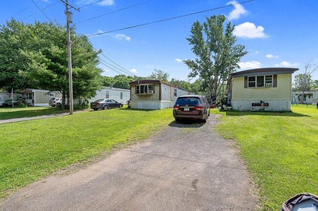
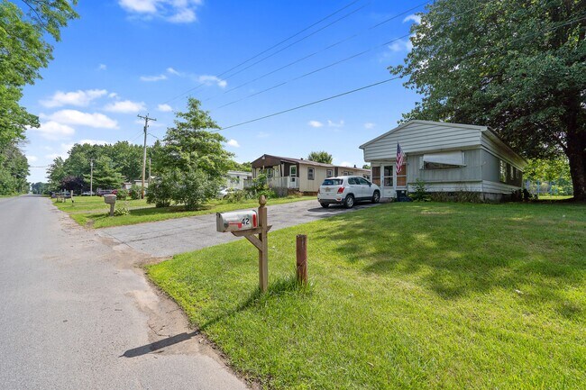
Property Record
42 Island Rd, Phoenix, NY 13135

Property Detail
42 Island Rd
Syracuse, NY
LOT 43 301-075-000 10 MH, 10 PADS
354400-239-000-0003-021-002-0000
OSWEGO
Mobilehomepark
New York
01 - NOT Z
21.200
A Areas with a 1% annual chance of flooding and a 26% chance of flooding over the life of a 30-year mortgage.
32.23 AC
2025
Oswego County
2025
Syracuse
020800
NEARBY LISTINGS FOR SALE OR LEASE
-
-
View all Phoenix listings for sale on LoopNet.com
DEMOGRAPHICS near 42 Island Rd
1 mile
3 mile
5 mile
2025 Total Population
212
2,785
7,239
2030 Population
213
2,798
7,234
Pop Growth 2025-2030
+ 0.47%
+ 0.47%
(0.07%)
Average Age
42
42
43
2025 Total Households
84
1,102
2,847
HH Growth 2025-2030
0.00%
+ 0.64%
+ 0.04%
Median Household Inc
$67,500
$68,648
$73,841
Avg Household Size
2.60
2.50
2.50
2025 Avg HH Vehicles
2.00
2.00
2.00
Median Home Value
$144,827
$152,452
$166,456
Median Year Built
1976
1978
1981
Nearby Places
Map Layers
Map Styles
 Street
 Aerial
Layers
 Traffic
 Biking
Places
Listings with unknown addresses are not visible on the map
- Restaurants
- Banks
- Shops
- Fitness
- Groceries
PUBLIC TRANSPORTATION
AIRPORT
Syracuse Hancock International
Drive
Walk
Distance
Syracuse Hancock International
32 min
22.4 mi
Freight Ports
Albany, NY Port
Drive
Walk
Distance
Albany, NY Port
196 min
163.4 mi
SALE & LEASE HISTORY
LISTING DATE
SALE/LEASE

Jul 09, 2024
For Sale
Nearby Properties
Address
Land Use
TOTAL SIZE
Lot Size
Zoning
Address
Land Use
TOTAL SIZE
Lot Size
Zoning
1,224 SF
31.55 AC
RMH-2
Address
Land Use
TOTAL SIZE
Lot Size
Zoning
550 SF
30.17 AC
RMH-2
Address
Land Use
TOTAL SIZE
Lot Size
Zoning
13,480 SF
5.20 AC
C-2
Address
Land Use
TOTAL SIZE
Lot Size
Zoning
1,140 SF
109.96 AC
R-3
Address
Land Use
TOTAL SIZE
Lot Size
Zoning
2,423 SF
85.03 AC
01 - NOT Z
Address
Land Use
TOTAL SIZE
Lot Size
Zoning
14.25 AC
01 - NOT Z
Address
Land Use
TOTAL SIZE
Lot Size
Zoning
649.96 AC
01 - NOT Z
Address
Land Use
TOTAL SIZE
Lot Size
Zoning
4,768 SF
3 AC
R-3
Address
Land Use
TOTAL SIZE
Lot Size
Zoning
1,764 SF
17.21 AC
R1
Address
Land Use
TOTAL SIZE
Lot Size
Zoning
1 AC
01 - NOT Z
Address
Land Use
TOTAL SIZE
Lot Size
Zoning
459.75 AC
R-1
Address
Land Use
TOTAL SIZE
Lot Size
Zoning
99.61 AC
01 - NOT Z
Address
Land Use
TOTAL SIZE
Lot Size
Zoning
6,000 SF
2 AC
R-3
Address
Land Use
TOTAL SIZE
Lot Size
Zoning
6,000 SF
22.90 AC
01 - NOT Z
Address
Land Use
TOTAL SIZE
Lot Size
Zoning
360 SF
0.23 AC
01 - NOT Z
Address
Land Use
TOTAL SIZE
Lot Size
Zoning
2,940 SF
92.69 AC
01 - NOT Z
Address
Land Use
TOTAL SIZE
Lot Size
Zoning
38.93 AC
01 - NOT Z
Address
Land Use
TOTAL SIZE
Lot Size
Zoning
1,424 SF
60 AC
R-3
Address
Land Use
TOTAL SIZE
Lot Size
Zoning
1,568 SF
1.17 AC
C-2
Address
Land Use
TOTAL SIZE
Lot Size
Zoning
1,536 SF
25.67 AC
01 - NOT Z
Address
Land Use
TOTAL SIZE
Lot Size
Zoning
2.25 AC
R-3
Address
Land Use
TOTAL SIZE
Lot Size
Zoning
3,385 SF
11.80 AC
R-3
Address
Land Use
TOTAL SIZE
Lot Size
Zoning
1,496 SF
2.56 AC
01 - NOT Z
Address
Land Use
TOTAL SIZE
Lot Size
Zoning
6,240 SF
1 AC
01 - NOT Z
Address
Land Use
TOTAL SIZE
Lot Size
Zoning
113.83 AC
Address
Land Use
TOTAL SIZE
Lot Size
Zoning
2,204 SF
44.35 AC
01 - NOT Z
Address
Land Use
TOTAL SIZE
Lot Size
Zoning
2,600 SF
2.27 AC
01 - NOT Z
Address
Land Use
TOTAL SIZE
Lot Size
Zoning
2.71 AC
01 - NOT Z
Address
Land Use
TOTAL SIZE
Lot Size
Zoning
57.70 AC
R-3
The World's #1 Commercial Real Estate Marketplace
Connect with us
© 2026 CoStar Group
The information above has been obtained from sources believed reliable. While we do not doubt its accuracy we have not verified it and make no guarantee, warranty or representation about it. It is your responsibility to independently confirm its accuracy and completeness. Any projections, opinions, assumptions, or estimates used are for example only and do not represent the current or future performance of the property. The value of this transaction to you depends on tax and other factors which should be evaluated by your tax, financial, and legal advisors. You and your advisors should conduct a careful, independent investigation of the property to determine to your satisfaction the suitability of the property for your needs.