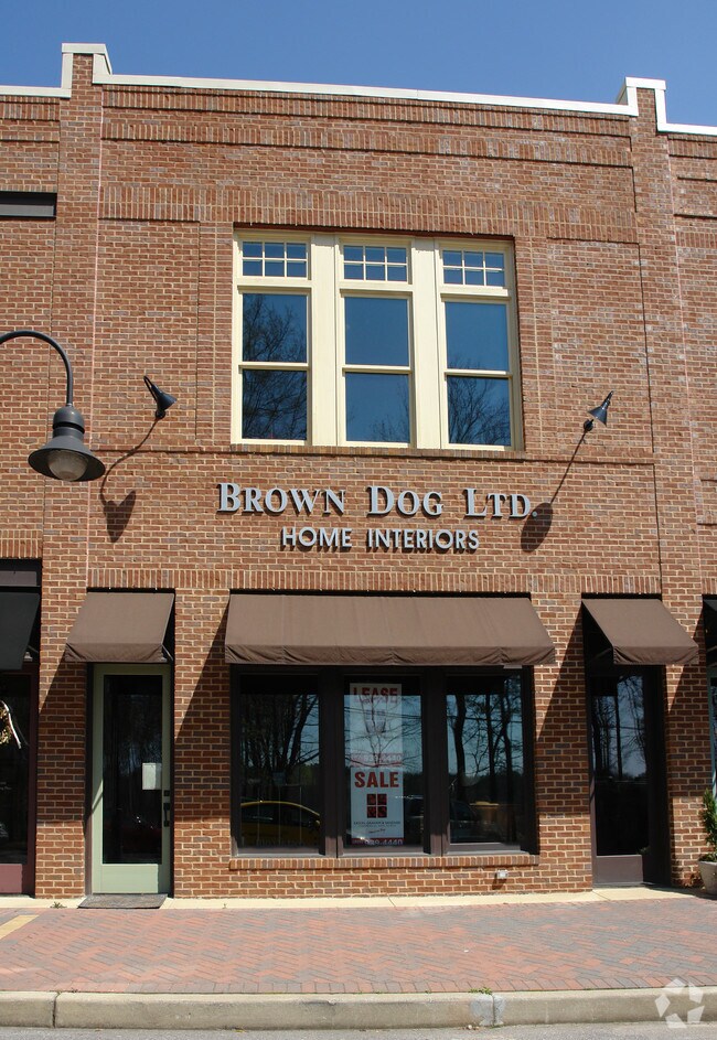
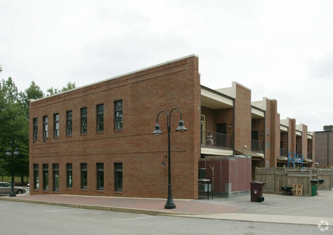
Property Record
42 Manning Pl, Birmingham, AL 35242
NEARBY LISTINGS FOR SALE OR LEASE
Property Detail
42 Manning Pl
Birmingham-Hoover, AL
Mt Laurel Ph 1-C
09-2-03-4-002-026-000
SEC/TWNSHP/RAN 3 19S 01W NBRHD: 01 MT LAUREL COMMERCIAL R-2
Storesoffices
Shelby
X
Alabama
01117C0092E
3-04
2024
0.05 AC
2024
Chelsea/Harpersville
030211
Birmingham
2,436 SF
DEMOGRAPHICS near 42 Manning Pl
1 Mile
3 Mile
5 Mile
2024 Total Population
4,222
21,796
49,326
2029 Population
4,608
23,615
53,243
Pop Growth 2024-2029
+ 9.14%
+ 8.35%
+ 7.94%
Average Age
45
44
42
2024 Total Households
1,618
8,488
20,137
HH Growth 2024-2029
+ 9.21%
+ 8.47%
+ 8.00%
Median Household Inc
$138,444
$124,436
$104,453
Avg Household Size
2.60
2.50
2.40
2024 Avg HH Vehicles
2.00
2.00
2.00
Median Home Value
$478,926
$457,615
$386,106
Median Year Built
2003
1999
1997
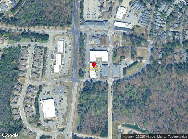
Nearby Places
Map Layers
Map Styles
 Street
 Aerial
- Restaurants
- Banks
- Shops
- Fitness
- Groceries
PUBLIC TRANSPORTATION
AIRPORT
Birmingham-Shuttlesworth International
DRIVE
WALK
Distance
Birmingham-Shuttlesworth International
35 min
20.2 mi
Nearby Properties
Address
Land Use
TOTAL SIZE
Lot Size
Zoning
Address
Land Use
TOTAL SIZE
Lot Size
Zoning
37,950 SF
26.50 AC
Address
Land Use
TOTAL SIZE
Lot Size
Zoning
4,335 SF
26.43 AC
Address
Land Use
TOTAL SIZE
Lot Size
Zoning
64,375 SF
8.99 AC
Address
Land Use
TOTAL SIZE
Lot Size
Zoning
11,058 SF
24.33 AC
Address
Land Use
TOTAL SIZE
Lot Size
Zoning
111,045 SF
25.72 AC
Address
Land Use
TOTAL SIZE
Lot Size
Zoning
127,710 SF
31.82 AC
Address
Land Use
TOTAL SIZE
Lot Size
Zoning
144,210 SF
9.37 AC
Address
Land Use
TOTAL SIZE
Lot Size
Zoning
4,259 SF
24.94 AC
Address
Land Use
TOTAL SIZE
Lot Size
Zoning
60,656 SF
20.32 AC
Address
Land Use
TOTAL SIZE
Lot Size
Zoning
220,128 SF
24.49 AC
Address
Land Use
TOTAL SIZE
Lot Size
Zoning
16,243 SF
10.74 AC
Address
Land Use
TOTAL SIZE
Lot Size
Zoning
2,220 SF
12.20 AC
Address
Land Use
TOTAL SIZE
Lot Size
Zoning
27,504 SF
14.05 AC
Address
Land Use
TOTAL SIZE
Lot Size
Zoning
19,954 SF
19.48 AC
Address
Land Use
TOTAL SIZE
Lot Size
Zoning
66,174 SF
28 AC
Address
Land Use
TOTAL SIZE
Lot Size
Zoning
1,436 SF
19.64 AC
Address
Land Use
TOTAL SIZE
Lot Size
Zoning
55,068 SF
23.03 AC
Address
Land Use
TOTAL SIZE
Lot Size
Zoning
99,535 SF
9.61 AC
Address
Land Use
TOTAL SIZE
Lot Size
Zoning
102,800 SF
12.38 AC
Address
Land Use
TOTAL SIZE
Lot Size
Zoning
126,923 SF
7.19 AC
Address
Land Use
TOTAL SIZE
Lot Size
Zoning
52,068 SF
7.29 AC
Address
Land Use
TOTAL SIZE
Lot Size
Zoning
103,320 SF
18.47 AC
Address
Land Use
TOTAL SIZE
Lot Size
Zoning
102,387 SF
8.92 AC
Address
Land Use
TOTAL SIZE
Lot Size
Zoning
86,499 SF
14.55 AC
Address
Land Use
TOTAL SIZE
Lot Size
Zoning
11,058 SF
6.37 AC
Address
Land Use
TOTAL SIZE
Lot Size
Zoning
61,114 SF
2.54 AC
Address
Land Use
TOTAL SIZE
Lot Size
Zoning
97,899 SF
1.71 AC
The World's #1 Commercial Real Estate Marketplace
Connect with us
© 2025 CoStar Group
The information above has been obtained from sources believed reliable. While we do not doubt its accuracy we have not verified it and make no guarantee, warranty or representation about it. It is your responsibility to independently confirm its accuracy and completeness. Any projections, opinions, assumptions, or estimates used are for example only and do not represent the current or future performance of the property. The value of this transaction to you depends on tax and other factors which should be evaluated by your tax, financial, and legal advisors. You and your advisors should conduct a careful, independent investigation of the property to determine to your satisfaction the suitability of the property for your needs.