Property Record
42 Maple St, Potsdam, NY 13676


Property Detail
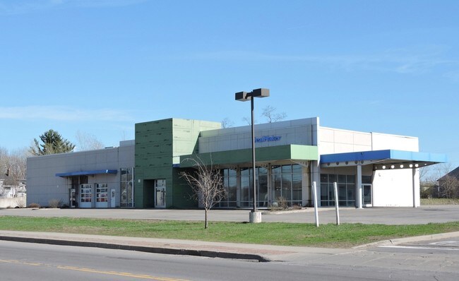
42 Maple St
407403 64.066-4-3.11
Saint Lawrence
Vehiclerentalsvehiclesales
New York
01 - NOT Z
3.011
0
2.95 AC
2025
Central New York Area/Thousand Island
491100
Other Market Areas
16,080 SF
Massena-Ogdensburg, NY
NEARBY LISTINGS FOR SALE OR LEASE
DEMOGRAPHICS near 42 Maple St
1 mile
3 mile
5 mile
2025 Total Population
5,820
9,834
12,505
2030 Population
5,837
9,807
12,394
Pop Growth 2025-2030
+ 0.29%
(0.27%)
(0.89%)
Average Age
31
33
35
2025 Total Households
1,641
2,962
4,095
HH Growth 2025-2030
+ 0.12%
(0.81%)
(1.54%)
Median Household Inc
$35,494
$37,321
$46,750
Avg Household Size
2.00
2.10
2.10
2025 Avg HH Vehicles
1.00
1.00
2.00
Median Home Value
$147,106
$156,633
$159,504
Median Year Built
1951
1957
1961
Nearby Places
Map Layers
Map Styles
 Street
 Aerial
Layers
 Traffic
 Biking
Places
Listings with unknown addresses are not visible on the map
- Restaurants
- Banks
- Shops
- Fitness
- Groceries
SALE & LEASE HISTORY
LISTING DATE
SALE/LEASE

Oct 04, 2018
For Sale
May 02, 2017
For Sale
Nearby Properties
Address
Land Use
TOTAL SIZE
Lot Size
Zoning
Address
Land Use
TOTAL SIZE
Lot Size
Zoning
179,334 SF
9.48 AC
01 - NOT Z
Address
Land Use
TOTAL SIZE
Lot Size
Zoning
97,017 SF
0.01 AC
Address
Land Use
TOTAL SIZE
Lot Size
Zoning
231,516 SF
0.01 AC
Address
Land Use
TOTAL SIZE
Lot Size
Zoning
36,981 SF
0.01 AC
Address
Land Use
TOTAL SIZE
Lot Size
Zoning
103,528 SF
10.01 AC
01 - NOT Z
Address
Land Use
TOTAL SIZE
Lot Size
Zoning
163,741 SF
0.01 AC
Address
Land Use
TOTAL SIZE
Lot Size
Zoning
74,110 SF
0.01 AC
01 - NOT Z
Address
Land Use
TOTAL SIZE
Lot Size
Zoning
166,700 SF
0.01 AC
Address
Land Use
TOTAL SIZE
Lot Size
Zoning
197,320 SF
1.52 AC
Address
Land Use
TOTAL SIZE
Lot Size
Zoning
200,492 SF
0.01 AC
Address
Land Use
TOTAL SIZE
Lot Size
Zoning
198,687 SF
42.15 AC
01 - NOT Z
Address
Land Use
TOTAL SIZE
Lot Size
Zoning
6,336 SF
0.01 AC
01 - NOT Z
Address
Land Use
TOTAL SIZE
Lot Size
Zoning
2,816 SF
18.50 AC
Address
Land Use
TOTAL SIZE
Lot Size
Zoning
5,888 SF
0.01 AC
Address
Land Use
TOTAL SIZE
Lot Size
Zoning
3,188 SF
12.98 AC
Address
Land Use
TOTAL SIZE
Lot Size
Zoning
148,348 SF
0.01 AC
Address
Land Use
TOTAL SIZE
Lot Size
Zoning
143,609 SF
79.47 AC
Address
Land Use
TOTAL SIZE
Lot Size
Zoning
54,701 SF
0.01 AC
Address
Land Use
TOTAL SIZE
Lot Size
Zoning
72,187 SF
0.01 AC
Address
Land Use
TOTAL SIZE
Lot Size
Zoning
57,096 SF
0.01 AC
Address
Land Use
TOTAL SIZE
Lot Size
Zoning
7,254 SF
0.01 AC
Address
Land Use
TOTAL SIZE
Lot Size
Zoning
119,431 SF
0.01 AC
Address
Land Use
TOTAL SIZE
Lot Size
Zoning
46,940 SF
10.74 AC
Address
Land Use
TOTAL SIZE
Lot Size
Zoning
112,557 SF
15.32 AC
01 - NOT Z
Address
Land Use
TOTAL SIZE
Lot Size
Zoning
101,341 SF
0.01 AC
Address
Land Use
TOTAL SIZE
Lot Size
Zoning
4,860 SF
10.41 AC
01 - NOT Z
Address
Land Use
TOTAL SIZE
Lot Size
Zoning
104,342 SF
3.26 AC
Address
Land Use
TOTAL SIZE
Lot Size
Zoning
24,588 SF
24.80 AC
01 - NOT Z
Address
Land Use
TOTAL SIZE
Lot Size
Zoning
105,680 SF
0.01 AC
Address
Land Use
TOTAL SIZE
Lot Size
Zoning
127,758 SF
0.01 AC
The World's #1 Commercial Real Estate Marketplace
Connect with us
© 2026 CoStar Group
The information above has been obtained from sources believed reliable. While we do not doubt its accuracy we have not verified it and make no guarantee, warranty or representation about it. It is your responsibility to independently confirm its accuracy and completeness. Any projections, opinions, assumptions, or estimates used are for example only and do not represent the current or future performance of the property. The value of this transaction to you depends on tax and other factors which should be evaluated by your tax, financial, and legal advisors. You and your advisors should conduct a careful, independent investigation of the property to determine to your satisfaction the suitability of the property for your needs.