Property Record
42 Mcmurray Rd, Flat Rock, NC 28731


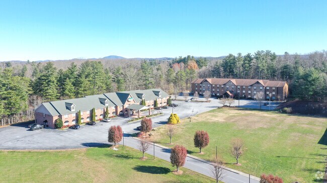
Property Detail
42 Mcmurray Rd
1011085
NBHD:UPWARD RD/I-26 TO CREST
Drycleanerlaundryservice
Henderson
1011085~C-
North Carolina
B and X Area of moderate flood hazard, usually the area between the limits of the 100-year and 500-year floods.
7087
2025
2.86 AC
2025
North Carolina West/Cherokee Area
930302
Asheville
45,665 SF
Asheville, NC
NEARBY LISTINGS FOR SALE OR LEASE
-
-
View all Flat Rock listings for sale on LoopNet.com
DEMOGRAPHICS near 42 Mcmurray Rd
1 mile
3 mile
5 mile
2025 Total Population
2,885
19,898
48,939
2030 Population
3,028
20,665
50,778
Pop Growth 2025-2030
+ 4.96%
+ 3.85%
+ 3.76%
Average Age
43
44
46
2025 Total Households
1,120
8,084
21,143
HH Growth 2025-2030
+ 5.18%
+ 3.98%
+ 3.89%
Median Household Inc
$52,344
$53,594
$55,729
Avg Household Size
2.50
2.40
2.20
2025 Avg HH Vehicles
2.00
2.00
2.00
Median Home Value
$282,228
$292,448
$335,039
Median Year Built
1992
1987
1985
Nearby Places
Map Layers
Map Styles
 Street
 Aerial
Transit
 Traffic
 Biking
Places
Listings with unknown addresses are not visible on the map
- Restaurants
- Banks
- Shops
- Fitness
- Groceries
PUBLIC TRANSPORTATION
AIRPORT
Asheville Regional
Drive
Walk
Distance
Asheville Regional
17 min
13.4 mi
Freight Ports
North Charleston Terminal
Drive
Walk
Distance
North Charleston Terminal
259 min
232.0 mi
Nearby Properties
Address
Land Use
TOTAL SIZE
Lot Size
Zoning
Address
Land Use
TOTAL SIZE
Lot Size
Zoning
5,625 SF
15.53 AC
10007593~P
Address
Land Use
TOTAL SIZE
Lot Size
Zoning
29,233 SF
83.09 AC
10005104~O
Address
Land Use
TOTAL SIZE
Lot Size
Zoning
88,500 SF
50.24 AC
9906531~R-
Address
Land Use
TOTAL SIZE
Lot Size
Zoning
12,309 SF
6.52 AC
10005105~O
Address
Land Use
TOTAL SIZE
Lot Size
Zoning
44,485 SF
38.89 AC
9906409~OI
Address
Land Use
TOTAL SIZE
Lot Size
Zoning
18.65 AC
10006780~I
Address
Land Use
TOTAL SIZE
Lot Size
Zoning
90,000 SF
19.59 AC
1004354~R2
Address
Land Use
TOTAL SIZE
Lot Size
Zoning
70,145 SF
31.16 AC
201578~CC
Address
Land Use
TOTAL SIZE
Lot Size
Zoning
70,136 SF
3.33 AC
10000154~O
Address
Land Use
TOTAL SIZE
Lot Size
Zoning
88,754 SF
4 AC
1003459~OI
Address
Land Use
TOTAL SIZE
Lot Size
Zoning
97,368 SF
6.66 AC
1000569~PI
Address
Land Use
TOTAL SIZE
Lot Size
Zoning
516,587 SF
116.84 AC
9928729~I
Address
Land Use
TOTAL SIZE
Lot Size
Zoning
73,500 SF
16.40 AC
10010073~I
Address
Land Use
TOTAL SIZE
Lot Size
Zoning
51,166 SF
5.43 AC
9962201~R1
Address
Land Use
TOTAL SIZE
Lot Size
Zoning
72,560 SF
7.23 AC
10000067~P
Address
Land Use
TOTAL SIZE
Lot Size
Zoning
11.77 AC
10009504~I
Address
Land Use
TOTAL SIZE
Lot Size
Zoning
9.06 AC
10009502~I
Address
Land Use
TOTAL SIZE
Lot Size
Zoning
228,704 SF
10.68 AC
9949735~RC
Address
Land Use
TOTAL SIZE
Lot Size
Zoning
90,495 SF
15.65 AC
10005991~P
Address
Land Use
TOTAL SIZE
Lot Size
Zoning
53,319 SF
1.93 AC
10004263~C
Address
Land Use
TOTAL SIZE
Lot Size
Zoning
46,712 SF
2.12 AC
1016840~PC
Address
Land Use
TOTAL SIZE
Lot Size
Zoning
10,548 SF
7.98 AC
10003171~P
Address
Land Use
TOTAL SIZE
Lot Size
Zoning
62,091 SF
12.15 AC
9967364~RC
Address
Land Use
TOTAL SIZE
Lot Size
Zoning
80,361 SF
3.49 AC
10012676~P
Address
Land Use
TOTAL SIZE
Lot Size
Zoning
49,870 SF
9.84 AC
OI
Address
Land Use
TOTAL SIZE
Lot Size
Zoning
25,750 SF
22.64 AC
200817~CC
Address
Land Use
TOTAL SIZE
Lot Size
Zoning
38,576 SF
5.28 AC
9969932~R2
Address
Land Use
TOTAL SIZE
Lot Size
Zoning
169,200 SF
9.95 AC
9957916~I-
Address
Land Use
TOTAL SIZE
Lot Size
Zoning
11,398 SF
23.75 AC
10010923~R
The World's #1 Commercial Real Estate Marketplace
Connect with us
© 2026 CoStar Group
The information above has been obtained from sources believed reliable. While we do not doubt its accuracy we have not verified it and make no guarantee, warranty or representation about it. It is your responsibility to independently confirm its accuracy and completeness. Any projections, opinions, assumptions, or estimates used are for example only and do not represent the current or future performance of the property. The value of this transaction to you depends on tax and other factors which should be evaluated by your tax, financial, and legal advisors. You and your advisors should conduct a careful, independent investigation of the property to determine to your satisfaction the suitability of the property for your needs.